88.87.230.132 - IP Lookup: Free IP Address Lookup, Postal Code Lookup, IP Location Lookup, IP ASN, Public IP
Country:
Region:
City:
Location:
Time Zone:
Postal Code:
ISP:
ASN:
language:
User-Agent:
Proxy IP:
Blacklist:
IP information under different IP Channel
ip-api
Country
Region
City
ASN
Time Zone
ISP
Blacklist
Proxy
Latitude
Longitude
Postal
Route
db-ip
Country
Region
City
ASN
Time Zone
ISP
Blacklist
Proxy
Latitude
Longitude
Postal
Route
IPinfo
Country
Region
City
ASN
Time Zone
ISP
Blacklist
Proxy
Latitude
Longitude
Postal
Route
IP2Location
88.87.230.132Country
Region
komarom-esztergom
City
acs
Time Zone
Europe/Budapest
ISP
Language
User-Agent
Latitude
Longitude
Postal
ipdata
Country
Region
City
ASN
Time Zone
ISP
Blacklist
Proxy
Latitude
Longitude
Postal
Route
Popular places and events near this IP address

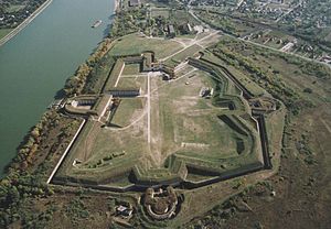
Fort Monostor
Fort near Komárom, Hungary
Distance: Approx. 7655 meters
Latitude and longitude: 47.75111111,18.09569444
Fort Monostor (Hungarian: Monostori Erőd) (also referred to as Fort Sandberg) is a fort is situated close to the city of Komárom, Hungary. It was built between 1850 and 1871 like part of the fortification system of Komárom. After World War II the Soviets built the biggest ammunition storage in the Fortress of Monostor.
Zlatná na Ostrove
Municipality in Slovakia
Distance: Approx. 7128 meters
Latitude and longitude: 47.77,17.97
Zlatná na Ostrove (Hungarian: Csallóközaranyos, pronounced [ˈtʃɒlːoːkøzɒrɒɲoʃ]) is a village and municipality in the Komárno District in the Nitra Region of south-west Slovakia.
Ács
Town in Komárom-Esztergom, Hungary
Distance: Approx. 435 meters
Latitude and longitude: 47.71,18.016
Ács (German: Atsch) is a town in Komárom-Esztergom county, northern Hungary.
Csém
Place in Komárom-Esztergom, Hungary
Distance: Approx. 6638 meters
Latitude and longitude: 47.6812,18.0869
Csém is a village in Komárom-Esztergom County, Hungary.

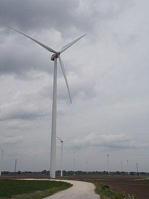
Kisigmánd Wind Farm
Distance: Approx. 6131 meters
Latitude and longitude: 47.67472222,18.07111111
The Kisigmánd Wind Farm is a wind power project in Komárom-Esztergom County, Hungary. It is owned and operated by Iberdrola Renovables, and has an output of up to 50 MW of power, which made it Hungary's largest wind farm by power generation when it was built. It was Iberdrola's first wind farm in Hungary when it began operation in early 2009.

Europe Gate
Distance: Approx. 7742 meters
Latitude and longitude: 47.74895,18.09917
The Europe Gate is a sculpture made out of LiTraCon, or Light Transmitting Concrete. It is a wall 3.5 meters squared and commemorates Hungary joining the European Union. It was built in 2004 in Fort Monostor in the town of Komárom by Áron Losonczi and Orsolya Vadász.
Battle of Bolia
Battle between Romans and Germanics (468)
Distance: Approx. 4336 meters
Latitude and longitude: 47.68333333,18.05
The Battle of Bolia took place in 468 between the Ostrogoths (Amal dynasty) and a coalition of Germanic tribes in the Roman province of Pannonia. It was fought on the south side of the Danube near its confluence with the river Bolia, in present-day Hungary. The Ostrogoths won, achieving supremacy in Pannonia, but soon migrated south towards richer lands.

First Battle of Komárom (1849)
Battle of the Hungarian War of Independence
Distance: Approx. 7517 meters
Latitude and longitude: 47.73558333,18.10552778
The First battle of Komárom was one of the most important battles of the Hungarian War of Independence, fought on 26 April 1849, between the Hungarian and the Austrian Imperial main armies, which some consider ended as a Hungarian victory, while others say that actually it was undecided. This battle was part of the Hungarian Spring Campaign. After the revolutionary army attacked and broke the Austrian siege of the fortress, the Imperials, having received reinforcements which made them numerically very superior to their enemies, successfully counterattacked, but after stabilising their situation, they retreated towards Győr, leaving the trenches and much of their siege artillery in Hungarian hands.

Second Battle of Komárom (1849)
Battle of the Hungarian War of Independence
Distance: Approx. 7517 meters
Latitude and longitude: 47.73558333,18.10552778
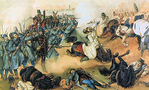
The Second Battle of Komárom, also known as the Battle of Ács, took place on 2 July 1849 between the Hungarian Revolutionary Army (led by General Artúr Görgei) and the Imperial Austrian Army of the Austrian Empire (led by Supreme Commander Field Marshal Julius von Haynau); a contingent of almost 12,000 Russian Empire troops was led by Lieutenant General Fyodor Sergeyevich Panyutyin. The Austrian army outnumbered the Hungarian troops two to one, and had a multitude of infantry (landwehr, grenadiers, seressaner, and kaiserjägers), light infantry (uhlans, dragoons, cossacks, and chevau-léger), heavy cavalry (cuirassiers), and better weapons. The Hungarians, except for the Landwehr (Hungarian: Honvéd) and the hussars, had few types of military units.

Third Battle of Komárom (1849)
Distance: Approx. 7517 meters
Latitude and longitude: 47.73558333,18.10552778
The main aim of the third Battle of Komárom was to push back the Austrian army, easing the task of the Hungarian army to retreat towards South-East. The Hungarian Government agreed on a Hungarian attack against the Austrian troops led by Julius Jacob von Haynau, which was stationing to East and South-East from the fortress of Komárom. On 11 July the Hungarian army started to attack the Austrians.

Fourth Battle of Komárom
Distance: Approx. 7517 meters
Latitude and longitude: 47.73558333,18.10552778
The Fourth Battle of Komárom was fought in 30 July and 3 August 1849 between the Hungarian garrison of the fortress of Komárom led by General György Klapka and the besieging Austrian army led by Lieutenant field marshal Anton Freiherr Csorich von Monte Creto. Thanks to the capturing, by a Hungarian detachment of Hussars, of a statement containing the number of the besieging Austrian II. corps, Klapka understood, that he actually has numerical superiority over the besiegers. So in two sorties made on 30 July and 3 August he managed to crush their siege on the northern, then also on the southern section of the fortress, chasing them towards West, and causing them heavy losses.

Veľký Lél Island
River island in Slovakia
Distance: Approx. 7510 meters
Latitude and longitude: 47.752831,17.931111
Island Veľký Lél (Slovakian: Veľkolélsky ostrov, Hungarian: Nagy-Léli sziget) is a river island. It is located on the Danube near the settlement of Veľký Lél, which is today a local part of the village of Zlatná na Ostrove in the district of Komárno. There are meadows, alluvial forests and tall solitary trees.
Weather in this IP's area
clear sky
2 Celsius
1 Celsius
2 Celsius
2 Celsius
1019 hPa
72 %
1019 hPa
1003 hPa
10000 meters
1.43 m/s
1.85 m/s
180 degree
9 %
