88.83.124.72 - IP Lookup: Free IP Address Lookup, Postal Code Lookup, IP Location Lookup, IP ASN, Public IP
Country:
Region:
City:
Location:
Time Zone:
Postal Code:
IP information under different IP Channel
ip-api
Country
Region
City
ASN
Time Zone
ISP
Blacklist
Proxy
Latitude
Longitude
Postal
Route
Luminati
Country
Region
eng
City
birmingham
ASN
Time Zone
Europe/London
ISP
Cityfibre Limited
Latitude
Longitude
Postal
IPinfo
Country
Region
City
ASN
Time Zone
ISP
Blacklist
Proxy
Latitude
Longitude
Postal
Route
IP2Location
88.83.124.72Country
Region
england
City
eastleigh
Time Zone
Europe/London
ISP
Language
User-Agent
Latitude
Longitude
Postal
db-ip
Country
Region
City
ASN
Time Zone
ISP
Blacklist
Proxy
Latitude
Longitude
Postal
Route
ipdata
Country
Region
City
ASN
Time Zone
ISP
Blacklist
Proxy
Latitude
Longitude
Postal
Route
Popular places and events near this IP address
Eastleigh
Town in Hampshire, England
Distance: Approx. 4 meters
Latitude and longitude: 50.966667,-1.35
Eastleigh is a town in Hampshire, England, between Southampton and Winchester. It is the largest town and the administrative seat of the Borough of Eastleigh, with a population of 24,011 at the 2011 census. The town lies on the River Itchen, one of England's premier chalk streams for fly fishing, and a designated site of Special Scientific Interest.

Eastleigh Works
Distance: Approx. 634 meters
Latitude and longitude: 50.96124,-1.34742
Eastleigh Works is a locomotive, carriage and wagon building and repair facility in the town of Eastleigh, in the county of Hampshire in England.
Eastleigh railway station
Railway station in Hampshire, England
Distance: Approx. 308 meters
Latitude and longitude: 50.96944444,-1.34944444
Eastleigh railway station serves the town of Eastleigh in the English county of Hampshire. It is located on the South West Main Line and is the junction station for two other routes, the Eastleigh-Fareham Line and the Eastleigh-Romsey Line. It is 73 miles 35 chains (118.2 km) from London Waterloo.

St Mary's Church, Bishopstoke
Distance: Approx. 1456 meters
Latitude and longitude: 50.97602,-1.33542
The Church of St Mary's is an Anglican Church in Bishopstoke, Hampshire. St Mary's was designed by Edward Prioleau Warren and built during 1890/91 by Wheeler Bros. of Reading, Berkshire at a cost of £4,200.

Eastleigh College
Distance: Approx. 820 meters
Latitude and longitude: 50.962,-1.359
Eastleigh College in Eastleigh, Hampshire is a further education college providing technical and professional training and apprenticeships to school leavers, in addition to part-time professional courses and part-time leisure courses for adults. With over 9,000 apprentices in learning, the college was ranked the best in Hampshire for learner achievement (and within the top 10 FE and Sixth Form colleges nationally), and named the third largest college provider of adult apprenticeships in England. In 2018 the college was criticised for sub-contracting much of its provision.
Barton Peveril Sixth Form College
Sixth form college in Eastleigh, Hampshire, England
Distance: Approx. 1219 meters
Latitude and longitude: 50.962,-1.3657
Barton Peveril Sixth Form College is an Ofsted 'Outstanding' sixth form college located in Eastleigh, Hampshire, UK with approximately 5,000 students, aged 16–18. It is part of the Wessex Group of Sixth Form Colleges.

Lakeside Country Park
Railway park in the United Kingdom
Distance: Approx. 1459 meters
Latitude and longitude: 50.957,-1.364
Lakeside Country Park is a country park just south of the town of Eastleigh in Hampshire. The park covers 60 acres and is home to the Eastleigh Lakeside Steam Railway. The park is on the site of old gravel workings, with lakes formed from gravel pits.
Quilley School
Community school in Eastleigh, Hampshire, England
Distance: Approx. 962 meters
Latitude and longitude: 50.96173,-1.36122
Quilley School, originally called Alderman Quilley, was a secondary school in Eastleigh, Hampshire, England. The enrollment in 2016 was 570 pupils. The school was founded by Edward John Quilley in 1963, opened in 1964 as a comprehensive mixed secondary school for 11- to 16-year-olds.
The Point, Eastleigh
Municipal building in Eastleigh, Hampshire, England
Distance: Approx. 525 meters
Latitude and longitude: 50.969837,-1.355588
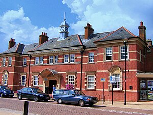
The Point is a theatre and dance studio for contemporary performance and contemporary dance at Eastleigh in Hampshire, England, operating under the auspices of Eastleigh Borough Council. It was previously the local council offices and then the local town hall for Eastleigh before being converted into a theatre in 1997.
Crestwood Community School
Community school in Boyatt Wood, Eastleigh, Hampshire, England
Distance: Approx. 1559 meters
Latitude and longitude: 50.9788,-1.3612
Crestwood Community School (known as Crestwood College prior to its name change in August 2017) is a coeducational secondary school, located in Eastleigh in the English county of Hampshire. Crestwood is a split-site school, operating two campuses on Shakespeare Road and Cherbourg Road. It is a community school administered by Hampshire County Council, which coordinates the school's admissions.
Eastleigh Depot
Railway maintenance depot in Eastleigh, Hampshire
Distance: Approx. 848 meters
Latitude and longitude: 50.9591,-1.3491
Eastleigh Depot is a depot location in Eastleigh, Hampshire, England. The depot is situated on the South West Main Line and is near Eastleigh station.
Eastleigh Museum
Former museum in Eastleigh, England
Distance: Approx. 314 meters
Latitude and longitude: 50.9682,-1.3538
Eastleigh Museum was a museum situated in Eastleigh, a town in Hampshire, England, which opened in October 1986. In 2014, ownership of the Eastleigh Museum was transferred to the Hampshire Cultural Trust as part of a larger transfer of museums from Hampshire County Council and Winchester City Council. The town was originally developed as a railway town by the London and South Western Railway from 1884.
Weather in this IP's area
broken clouds
1 Celsius
1 Celsius
1 Celsius
3 Celsius
1037 hPa
97 %
1037 hPa
1031 hPa
10000 meters
1.06 m/s
1.18 m/s
121 degree
67 %


