Country:
Region:
City:
Latitude and Longitude:
Time Zone:
Postal Code:
IP information under different IP Channel
ip-api
Country
Region
City
ASN
Time Zone
ISP
Blacklist
Proxy
Latitude
Longitude
Postal
Route
Luminati
Country
Region
11
City
lisbon
ASN
Time Zone
Europe/Lisbon
ISP
Servicos De Comunicacoes E Multimedia S.A.
Latitude
Longitude
Postal
IPinfo
Country
Region
City
ASN
Time Zone
ISP
Blacklist
Proxy
Latitude
Longitude
Postal
Route
db-ip
Country
Region
City
ASN
Time Zone
ISP
Blacklist
Proxy
Latitude
Longitude
Postal
Route
ipdata
Country
Region
City
ASN
Time Zone
ISP
Blacklist
Proxy
Latitude
Longitude
Postal
Route
Popular places and events near this IP address

Gondomar, Portugal
Municipality in Norte, Portugal
Distance: Approx. 1970 meters
Latitude and longitude: 41.15,-8.53333333
Gondomar (Portuguese pronunciation: [ɡõduˈmaɾ] ) is a municipality located in the east of Portugal's Porto Metropolitan Area and 7 km from central Porto. The population in 2011 was 168,027, in an area of 131.86 km2. Gondomar's mayor is Marco Martins.

Valongo
Municipality in Norte, Portugal
Distance: Approx. 3057 meters
Latitude and longitude: 41.18333333,-8.5
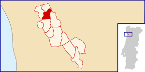
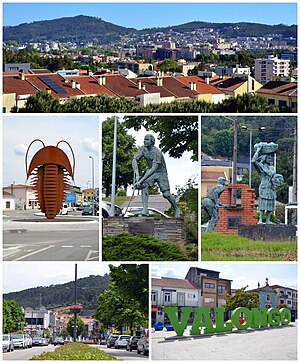
Valongo (Portuguese pronunciation: [vɐˈlõɡu] ) is a Portuguese municipality located in the District of Porto and 10 km from Porto, in the northern region of Portugal. The municipality area consists of 75.12 km² and 93 858 inhabitants (2011), and it is subdivided into four parishes: Alfena, Campo e Sobrado, Ermesinde and Valongo. The municipality is limited to the north by the municipality of Santo Tirso, to the northeast by Paços de Ferreira, to the east by Paredes, to the southwest by Gondomar and to the west by Maia.

Campanhã
Civil parish in Norte, Portugal
Distance: Approx. 4285 meters
Latitude and longitude: 41.157,-8.579
Campanhã (Portuguese pronunciation: [kɐ̃pɐˈɲɐ̃]) is a Portuguese freguesia ("civil parish"), located in the city of Porto. The population in 2011 was 32,659, in an area of 8.04 km². Located there is the Campanhã station, the most important in Porto.
Estádio de São Miguel (Gondomar)
Distance: Approx. 3652 meters
Latitude and longitude: 41.13595556,-8.54175833
Estadio de São Miguel is a multi-use stadium in Gondomar, Portugal. It is currently used mostly for football matches and is the home stadium of fourth-tier Gondomar SC. The stadium is able to hold around 2500 people.

Rio Tinto (Gondomar)
Civil parish in Norte, Portugal
Distance: Approx. 2787 meters
Latitude and longitude: 41.178,-8.56
Rio Tinto (Portuguese pronunciation: [ˈʁiu ˈtĩtu]) is a Portuguese city and parish, located in Gondomar Municipality, in northern Portugal. The population in 2011 was 50,713, in an area of 9.38 km2. Rio Tinto, which in Portuguese means red river, was elevated to city status in 1995, and the city of Rio Tinto includes two parishes (freguesias): Baguim do Monte and Rio Tinto, with a total of 65,000 inhabitants, being the most populous city in Gondomar municipality, and third largest in the Greater Porto agglomeration.

Battle of Ponte Ferreira
Distance: Approx. 3057 meters
Latitude and longitude: 41.18333333,-8.5
The Battle of Ponte Ferreira, fought on 22–23 July 1832, was the first major battle of the Portuguese Civil War between the forces of Dom Pedro, ex-Emperor of Brazil and Regent for his daughter Maria da Glória, and the army of his brother Dom Miguel, who had usurped the throne of Portugal. Though technically a victory for Pedro's forces, it gave him no lasting advantage because the enemy were not pursued and were able to return in full strength, as a result of which he was besieged in Porto for an entire year.

Fânzeres
Civil parish in Norte, Portugal
Distance: Approx. 309 meters
Latitude and longitude: 41.16666667,-8.53333333
Fânzeres is a town and a former civil parish in the municipality of Gondomar, Portugal. In 2013, the parish merged into the new parish Fânzeres e São Pedro da Cova. Its population is around 20,000.
Fountain of the Virtues
Distance: Approx. 2696 meters
Latitude and longitude: 41.14472222,-8.51888889
The Fountain of the Virtues (Portuguese: Chafariz das Virtudes) is a fountain in the civil parish of Cedofeita, Santo Ildefonso, Sé, Miragaia, São Nicolau e Vitória, in the municipality of Porto.

Dragão Arena
Distance: Approx. 4395 meters
Latitude and longitude: 41.162784,-8.581879
The Dragão Arena (formerly named Dragão Caixa for sponsorship reasons) is an indoor arena located in Porto, Portugal, that houses the basketball, handball and roller hockey teams of FC Porto. It was inaugurated on 23 April 2009 and has a capacity of 2,179 spectators. The construction project was done in partnership with Portuguese state-owned bank Caixa Geral de Depósitos, which secured the naming rights for a period of 10 years.
Fânzeres e São Pedro da Cova
Civil parish in Norte, Portugal
Distance: Approx. 289 meters
Latitude and longitude: 41.166,-8.527
Fânzeres e São Pedro da Cova is a civil parish in the municipality of Gondomar, Portugal. It was formed in 2013 by the merger of the former parishes Fânzeres and São Pedro da Cova. The population in 2011 was 39,586, in an area of 21.96 km².
Gondomar (São Cosme), Valbom e Jovim
Civil parish in Norte, Portugal
Distance: Approx. 3178 meters
Latitude and longitude: 41.139,-8.532
Gondomar (São Cosme), Valbom e Jovim is a civil parish in the municipality of Gondomar, Portugal. It was formed in 2013 by the merger of the former parishes Gondomar (São Cosme), Valbom and Jovim. The population in 2011 was 48,600, in an area of 23.32 km2.

Valongo (parish)
Civil parish in Norte, Portugal
Distance: Approx. 3735 meters
Latitude and longitude: 41.191,-8.498
Valongo is a civil parish in the municipality (concelho) of Valongo, in continental Portugal. The population in 2021 was 25882, in an area of 20.24 km2. Valongo is most famous for its mountains and its bread.
Weather in this IP's area
clear sky
16 Celsius
15 Celsius
10 Celsius
16 Celsius
1017 hPa
67 %
1017 hPa
1006 hPa
10000 meters
4.12 m/s
100 degree
07:24:53
17:13:43

