Country:
 Czech Republic
Region:
City:
Latitude and Longitude:
Time Zone:
Postal Code:
IP information under different IP Channel
ip-api
Country
Region
City
ASN
Time Zone
ISP
Blacklist
Proxy
Latitude
Longitude
Postal
Route
IPinfo
Country
Region
City
ASN
Time Zone
ISP
Blacklist
Proxy
Latitude
Longitude
Postal
Route
MaxMind
Country
Region
City
ASN
Time Zone
ISP
Blacklist
Proxy
Latitude
Longitude
Postal
Route
Luminati
Country
CZRegion
63
City
opatov
ASN
Time Zone
Europe/Prague
ISP
O2 Czech Republic, a.s.
Latitude
Longitude
Postal
db-ip
Country
Region
City
ASN
Time Zone
ISP
Blacklist
Proxy
Latitude
Longitude
Postal
Route
ipdata
Country
Region
City
ASN
Time Zone
ISP
Blacklist
Proxy
Latitude
Longitude
Postal
Route
Popular places and events near this IP address
Brtnička
Municipality in Vysočina, Czech Republic
Distance: Approx. 3032 meters
Latitude and longitude: 49.23722222,15.62416667
Brtnička (Czech pronunciation: [ˈbr̩tɲɪtʃka]) is a municipality and village in Jihlava District in the Vysočina Region of the Czech Republic. It has about 90 inhabitants. Brtnička lies approximately 19 kilometres (12 mi) south of Jihlava and 129 km (80 mi) south-east of Prague.
Dlouhá Brtnice
Municipality in Vysočina, Czech Republic
Distance: Approx. 4348 meters
Latitude and longitude: 49.23611111,15.60416667
Dlouhá Brtnice (Czech pronunciation: [ˈdlouhaː ˈbr̩cɲɪtsɛ]; German: Langpirnitz) is a municipality and village in Jihlava District in the Vysočina Region of the Czech Republic. It has about 400 inhabitants. Dlouhá Brtnice lies approximately 18 kilometres (11 mi) south of Jihlava and 127 km (79 mi) south-east of Prague.

Hladov
Municipality in Vysočina, Czech Republic
Distance: Approx. 3833 meters
Latitude and longitude: 49.21472222,15.61138889
Hladov (Czech pronunciation: [ˈɦladof]; German: Hungerleiden) is a municipality and village in Jihlava District in the Vysočina Region of the Czech Republic. It has about 200 inhabitants. Hladov lies approximately 21 kilometres (13 mi) south of Jihlava and 131 km (81 mi) south-east of Prague.

Hrutov
Municipality in Vysočina, Czech Republic
Distance: Approx. 3642 meters
Latitude and longitude: 49.25555556,15.68027778
Hrutov (Czech pronunciation: [ˈɦrutof]) is a municipality and village in Jihlava District in the Vysočina Region of the Czech Republic. It has about 100 inhabitants. The municipality forms an enclave in the territory of Kněžice.

Kněžice (Jihlava District)
Municipality in Vysočina, Czech Republic
Distance: Approx. 5138 meters
Latitude and longitude: 49.27083333,15.67222222
Kněžice (Czech pronunciation: [ˈkɲɛʒɪtsɛ]) is a municipality and village in Jihlava District in the Vysočina Region of the Czech Republic. It has about 1,400 inhabitants.

Sedlatice
Municipality in Vysočina, Czech Republic
Distance: Approx. 5079 meters
Latitude and longitude: 49.19222222,15.61333333
Sedlatice (Czech pronunciation: [ˈsɛdlacɪtsɛ]) is a municipality and village in Jihlava District in the Vysočina Region of the Czech Republic. It has about 60 inhabitants. Sedlatice lies approximately 23 kilometres (14 mi) south of Jihlava and 132 km (82 mi) south-east of Prague.
Heraltice
Market town in Vysočina, Czech Republic
Distance: Approx. 5052 meters
Latitude and longitude: 49.23083333,15.73055556
Heraltice is a market town in Třebíč District in the Vysočina Region of the Czech Republic. It has about 400 inhabitants.
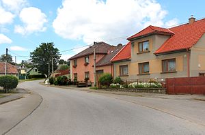
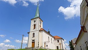
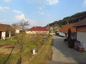
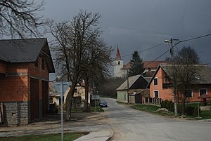
Opatov (Třebíč District)
Market town in Vysočina, Czech Republic
Distance: Approx. 84 meters
Latitude and longitude: 49.22444444,15.66166667
Opatov is a market town in Třebíč District in the Vysočina Region of the Czech Republic. It has about 800 inhabitants.
Pokojovice
Municipality in Vysočina, Czech Republic
Distance: Approx. 5913 meters
Latitude and longitude: 49.21972222,15.7425
Pokojovice is a municipality and village in Třebíč District in the Vysočina Region of the Czech Republic. It has about 100 inhabitants. Pokojovice lies approximately 11 kilometres (7 mi) west of Třebíč, 23 km (14 mi) south-east of Jihlava, and 136 km (85 mi) south-east of Prague.
Předín
Municipality in Vysočina, Czech Republic
Distance: Approx. 3116 meters
Latitude and longitude: 49.19833333,15.67361111
Předín is a municipality and village in Třebíč District in the Vysočina Region of the Czech Republic. It has about 700 inhabitants. Předín lies approximately 15 kilometres (9 mi) west of Třebíč, 23 km (14 mi) south of Jihlava, and 135 km (84 mi) south-east of Prague.

Štěměchy
Municipality in Vysočina, Czech Republic
Distance: Approx. 5245 meters
Latitude and longitude: 49.19333333,15.71472222
Štěměchy is a municipality and village in Třebíč District in the Vysočina Region of the Czech Republic. It has about 300 inhabitants. Štěměchy lies approximately 13 kilometres (8 mi) west of Třebíč, 26 km (16 mi) south of Jihlava, and 137 km (85 mi) south-east of Prague.

Zašovice
Municipality in Vysočina, Czech Republic
Distance: Approx. 5950 meters
Latitude and longitude: 49.25833333,15.72583333
Zašovice is a municipality and village in Třebíč District in the Vysočina Region of the Czech Republic. It has about 100 inhabitants. Zašovice lies approximately 14 kilometres (9 mi) north-west of Třebíč, 17 km (11 mi) south-east of Jihlava, and 130 km (81 mi) south-east of Prague.
Weather in this IP's area
light rain
21 Celsius
21 Celsius
20 Celsius
22 Celsius
1004 hPa
74 %
1004 hPa
938 hPa
10000 meters
0.45 m/s
1.79 m/s
105 degree
100 %
06:25:33
19:24:00