87.254.215.242 - IP Lookup: Free IP Address Lookup, Postal Code Lookup, IP Location Lookup, IP ASN, Public IP
Country:
Region:
City:
Location:
Time Zone:
Postal Code:
ISP:
ASN:
language:
User-Agent:
Proxy IP:
Blacklist:
IP information under different IP Channel
ip-api
Country
Region
City
ASN
Time Zone
ISP
Blacklist
Proxy
Latitude
Longitude
Postal
Route
db-ip
Country
Region
City
ASN
Time Zone
ISP
Blacklist
Proxy
Latitude
Longitude
Postal
Route
IPinfo
Country
Region
City
ASN
Time Zone
ISP
Blacklist
Proxy
Latitude
Longitude
Postal
Route
IP2Location
87.254.215.242Country
Region
pirkanmaa
City
nokia
Time Zone
Europe/Helsinki
ISP
Language
User-Agent
Latitude
Longitude
Postal
ipdata
Country
Region
City
ASN
Time Zone
ISP
Blacklist
Proxy
Latitude
Longitude
Postal
Route
Popular places and events near this IP address

Nokia, Finland
Town in Pirkanmaa, Finland
Distance: Approx. 1164 meters
Latitude and longitude: 61.47666667,23.50527778
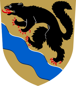
Nokia (Finnish pronunciation: [ˈnokiɑ]) is a town in the Pirkanmaa region of Finland. It lies on the banks of the Nokianvirta, a river of the Kokemäki River watershed, and is situated in the Tampere metropolitan area, about 15 kilometres (9 mi) west of Tampere proper. The population of Nokia is approximately 36,000, while the Tampere metropolitan area has a population of approximately 423,000.

Pirkkala
Municipality in Pirkanmaa, Finland
Distance: Approx. 7966 meters
Latitude and longitude: 61.46666667,23.65
Pirkkala (Finnish: [ˈpirkːɑlɑ]; Swedish: Birkala) is a municipality in Finland, located in the Pirkanmaa region. It lies to the southwest of the regional capital, Tampere. The population of Pirkkala is approximately 21,000, while the metropolitan area has a population of approximately 423,000.

Tampere–Pirkkala Airport
Airport
Distance: Approx. 7364 meters
Latitude and longitude: 61.41527778,23.58777778
Tampere–Pirkkala Airport (IATA: TMP, ICAO: EFTP; Finnish: Tampere-Pirkkalan lentoasema, Swedish: Tammerfors-Birkala flygplats), or simply Tampere Airport, is located in Pirkkala, Finland, 7 nautical miles (13 kilometres; 8.1 miles) south-west of Tampere city centre. The airport is the sixth-busiest airport in Finland, as measured by the total number of passengers (168,328 in 2022), and the third-busiest as measured by the number of international passengers (159,801 in 2022).

Nokia railway station
Railway station in Nokia, Finland
Distance: Approx. 1673 meters
Latitude and longitude: 61.481528,23.500314
The Nokia railway station is located in the town of Nokia, Finland, on the track between Tampere and Pori. The station was completed in 1895, and trains between Tampere and Pori stop there twelve times a day, half of which in each direction. A train trip between Tampere and Nokia takes 14 minutes, according to the VR Group.

Nokianvirta
River in the country of Finland
Distance: Approx. 6217 meters
Latitude and longitude: 61.465,23.38333333
Nokianvirta is a river of Finland. It flows from the lake Pyhäjärvi near Tampere to the lake Kulovesi, which is a part of a lake system from which the Kokemäki River begins its course towards the Gulf of Bothnia. Nokianvirta flows through Nokia, Finland, the town that gave its name to the Nokia Corporation.
Nokian lukio
High school in Finland
Distance: Approx. 2011 meters
Latitude and longitude: 61.4825,23.51777778
Nokian lukio (Nokia Senior High School) is a school located in the town of Nokia, Finland. There are about 415 students and 30 teachers. The principal of the school is Juha Sainio.

Tesoma
District in Tampere, Finland
Distance: Approx. 7264 meters
Latitude and longitude: 61.505724,23.609432
Tesoma is a district in Tampere, Finland, located west of the city centre. It largely comprises Lake Tesoma with its surroundings, including the quarters: Epilänharju, Tohloppi, Haukiluoma, Lamminpää, Myllypuro, Ikuri, Ristimäki and Tesomajärvi. Tesoma features the Tesoma Swimming Hall, an indoor swimming pool; the Tesoma Ice Rink, an ice rink that serves as home to the Tampereen Ilves Naiset; the Tesoma Church; and the Westeri shopping center.

Tesomajärvi
City district in Tampere, Finland
Distance: Approx. 7635 meters
Latitude and longitude: 61.5063,23.6172
Tesomajärvi (sometimes speaking only Tesoma) is a district in the southwestern part of Tampere, Finland, belonging part of Tesoma's planning area. 1,280 people lived on Tesomajärvi in 2015. Although the population of Tampere is growing, the population of Tesomajärvi has clearly decreased from about 1,500 in 1996.

Westeri
Shopping mall in Tampere, Finland
Distance: Approx. 7984 meters
Latitude and longitude: 61.50501596,23.62693663
Westeri is a shopping center completed in the spring of 2018 in the Tesomajärvi district of Tampere, Finland. The anchor tenant is the grocery store K-Supermarket, in connection with which Posti and Matkahuolto points serve. Other stores in the shopping center include Alko, Kotipizza, Linkosuo Café, Pizza Hut, Subway, Tesoma Pharmacy, Instrumentarium, Tokmanni, 24 Pesula laundry and sushi restaurant Asahi Sushi.

Naistenmatka
Village in Pirkkala, Finland
Distance: Approx. 7804 meters
Latitude and longitude: 61.46527778,23.64694444
Naistenmatka is the town and at the same time the administrative center of the municipality of Pirkkala in Pirkanmaa, Finland. Its population was 800 people in 1997, or about 15% of Pirkkala's population.

Tesoma railway station
Railway station in Tampere, Finland
Distance: Approx. 7623 meters
Latitude and longitude: 61.50611111,23.61722222
Tesoma railway station (abbreviated Tso) is a railway station in the Tesoma district in Tampere, Finland. The station opened on August 16 2021, with one track at first. The station is located on the Tampere–Pori railway between the track kilometres 196+080 and 196+370.

Nokia Church
Church in Pirkanmaa, Finland
Distance: Approx. 2239 meters
Latitude and longitude: 61.47972222,23.53194444
The Nokia Church (Finnish: Nokian kirkko) is a 19th-century stone church located in Nokia town in Pirkanmaa, Finland. The Neoclassical church building was designed by C. L. Engel (1778–1840), and it was completed in 1837. The model of the building is considered to be the Pantheon of Rome; the church hall is a full circle and the dome extends over the entire hall.
Weather in this IP's area
light shower snow
-1 Celsius
-5 Celsius
-1 Celsius
-1 Celsius
1020 hPa
86 %
1020 hPa
1005 hPa
10000 meters
3.6 m/s
10 degree
100 %
