Country:
 Switzerland
Region:
City:
Latitude and Longitude:
Time Zone:
Postal Code:
IP information under different IP Channel
ip-api
Country
Region
City
ASN
Time Zone
ISP
Blacklist
Proxy
Latitude
Longitude
Postal
Route
IPinfo
Country
Region
City
ASN
Time Zone
ISP
Blacklist
Proxy
Latitude
Longitude
Postal
Route
MaxMind
Country
Region
City
ASN
Time Zone
ISP
Blacklist
Proxy
Latitude
Longitude
Postal
Route
Luminati
Country
CHRegion
ag
City
kolliken
ASN
Time Zone
Europe/Zurich
ISP
Iway AG
Latitude
Longitude
Postal
db-ip
Country
Region
City
ASN
Time Zone
ISP
Blacklist
Proxy
Latitude
Longitude
Postal
Route
ipdata
Country
Region
City
ASN
Time Zone
ISP
Blacklist
Proxy
Latitude
Longitude
Postal
Route
Popular places and events near this IP address

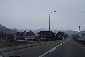
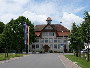
Kölliken
Municipality in Aargau, Switzerland
Distance: Approx. 1463 meters
Latitude and longitude: 47.33333333,8.01666667
Kölliken is a municipality in the district of Zofingen in the canton of Aargau in Switzerland. It was also home to one of the two most toxic hazardous waste landfills in all of Switzerland. The other site is in Bonfol, Canton Jura.

Hirschthal
Municipality in Aargau, Switzerland
Distance: Approx. 3127 meters
Latitude and longitude: 47.31666667,8.05
Hirschthal is a municipality in the district of Aarau of the canton of Aargau in Switzerland.
Muhen
Municipality in Aargau, Switzerland
Distance: Approx. 1684 meters
Latitude and longitude: 47.33333333,8.05
Muhen is a municipality in the district of Aarau of the canton of Aargau in Switzerland.

Oberentfelden
Municipality in Aargau, Switzerland
Distance: Approx. 3100 meters
Latitude and longitude: 47.36666667,8.05
Oberentfelden is a municipality in the district of Aarau of the canton of Aargau in Switzerland.
Unterentfelden
Municipality in Aargau, Switzerland
Distance: Approx. 2772 meters
Latitude and longitude: 47.36666667,8.03333333
Unterentfelden is a municipality in the district of Aarau of the Canton of Aargau in Switzerland.

Holziken
Municipality in Aargau, Switzerland
Distance: Approx. 2801 meters
Latitude and longitude: 47.31666667,8.03333333
Holziken is a municipality in the district of Kulm in the canton of Aargau in Switzerland.

Niedergösgen
Municipality in Solothurn, Switzerland
Distance: Approx. 3648 meters
Latitude and longitude: 47.36666667,8
Niedergösgen is a municipality in the district of Gösgen in the canton of Solothurn in Switzerland.
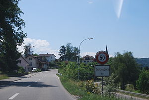
Gretzenbach
Municipality in Solothurn, Switzerland
Distance: Approx. 3648 meters
Latitude and longitude: 47.36666667,8
Gretzenbach is a municipality in the district of Olten in the canton of Solothurn in Switzerland.
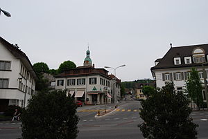
Schönenwerd
Municipality in Solothurn, Switzerland
Distance: Approx. 3648 meters
Latitude and longitude: 47.36666667,8
Schönenwerd is a municipality in the district of Olten in the canton of Solothurn in Switzerland.

Oberentfelden railway station
Railway station in Switzerland
Distance: Approx. 2071 meters
Latitude and longitude: 47.35648056,8.04836944
Oberentfelden railway station (German: Bahnhof Oberentfelden) is a railway station in the municipality of Oberentfelden, in the Swiss canton of Aargau. It is an intermediate stop on the standard gauge Zofingen–Wettingen line of Swiss Federal Railways. The station is located some 180 metres (590 ft) from Oberentfelden Engelplatz on the 1,000 mm (3 ft 3+3⁄8 in) gauge Aarau–Schöftland line of Aargau Verkehr.

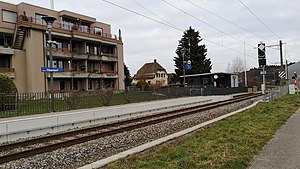
Kölliken railway station
Railway station in Switzerland
Distance: Approx. 631 meters
Latitude and longitude: 47.33728806,8.02644194
Kölliken railway station (German: Bahnhof Kölliken) is a railway station in the municipality of Kölliken, in the Swiss canton of Aargau. It is an intermediate stop on the standard gauge Zofingen–Wettingen line of Swiss Federal Railways.
Kölliken Oberdorf railway station
Railway station in Switzerland
Distance: Approx. 2125 meters
Latitude and longitude: 47.32467,8.01906111
Kölliken Oberdorf railway station (German: Bahnhof Kölliken Oberdorf) is a railway station in the municipality of Kölliken, in the Swiss canton of Aargau. It is an intermediate stop on the standard gauge Zofingen–Wettingen line of Swiss Federal Railways.
Weather in this IP's area
overcast clouds
11 Celsius
11 Celsius
10 Celsius
12 Celsius
1023 hPa
99 %
1023 hPa
972 hPa
10000 meters
1.09 m/s
1 m/s
154 degree
86 %
07:53:43
18:31:11