Country:
 Switzerland
Region:
City:
Latitude and Longitude:
Time Zone:
Postal Code:
IP information under different IP Channel
ip-api
Country
Region
City
ASN
Time Zone
ISP
Blacklist
Proxy
Latitude
Longitude
Postal
Route
IPinfo
Country
Region
City
ASN
Time Zone
ISP
Blacklist
Proxy
Latitude
Longitude
Postal
Route
MaxMind
Country
Region
City
ASN
Time Zone
ISP
Blacklist
Proxy
Latitude
Longitude
Postal
Route
Luminati
Country
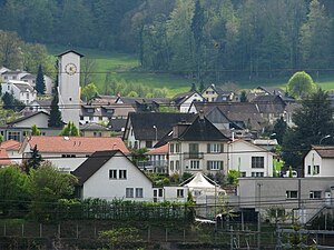
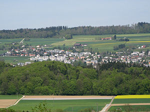
CHRegion
ag
City
oberrohrdorf
ASN
Time Zone
Europe/Zurich
ISP
Iway AG
Latitude
Longitude
Postal
db-ip
Country
Region
City
ASN
Time Zone
ISP
Blacklist
Proxy
Latitude
Longitude
Postal
Route
ipdata
Country
Region
City
ASN
Time Zone
ISP
Blacklist
Proxy
Latitude
Longitude
Postal
Route
Popular places and events near this IP address

Fislisbach
Municipality in Aargau, Switzerland
Distance: Approx. 1364 meters
Latitude and longitude: 47.43333333,8.3
Fislisbach is a municipality in the district of Baden in the canton of Aargau in Switzerland.

Wettingen Abbey
Distance: Approx. 2539 meters
Latitude and longitude: 47.4575,8.31722222
Wettingen Abbey (Kloster Wettingen) was a Cistercian monastery in Wettingen in the Swiss canton of Aargau. It was founded in 1227 and dissolved during the secularisation of 1841, but re-founded at Mehrerau in Austria in 1854. The buildings are listed as a heritage site of national significance.
Killwangen
Municipality in Aargau, Switzerland
Distance: Approx. 2414 meters
Latitude and longitude: 47.43333333,8.35
Killwangen is a municipality in the district of Baden in the canton of Aargau in Switzerland.

Neuenhof, Aargau
Municipality in Aargau, Switzerland
Distance: Approx. 1706 meters
Latitude and longitude: 47.45,8.31666667
Neuenhof is a municipality in the district of Baden in the canton of Aargau in Switzerland, located in the Limmat Valley (German: Limmattal).
Niederrohrdorf
Municipality in Aargau, Switzerland
Distance: Approx. 2010 meters
Latitude and longitude: 47.41666667,8.31666667
Niederrohrdorf is a municipality in the district of Baden in the canton of Aargau in Switzerland.

Oberrohrdorf
Municipality in Aargau, Switzerland
Distance: Approx. 2010 meters
Latitude and longitude: 47.41666667,8.31666667
Oberrohrdorf is a municipality in the district of Baden in the canton of Aargau in Switzerland.

Remetschwil
Municipality in Aargau, Switzerland
Distance: Approx. 2316 meters
Latitude and longitude: 47.41666667,8.33333333
Remetschwil is a municipality in the district of Baden in the canton of Aargau in Switzerland.

Rüsler Pass
Mountain pass in the canton of Aargau in Switzerland
Distance: Approx. 447 meters
Latitude and longitude: 47.438373,8.315597
Rüsler Pass (el. 649 m.) is a mountain pass in the canton of Aargau in Switzerland. It connects Oberrohrdorf and Neuenhof.
Rohrdorf, Switzerland
Former municipality in Aargau, Switzerland
Distance: Approx. 2422 meters
Latitude and longitude: 47.41666667,8.3
Rohrdorf is a former municipality in the district of Baden in the canton of Aargau, Switzerland. It ceased to exist in 1854, when it was split into the three new municipalities Niederrohrdorf, Oberrohrdorf and Remetschwil.
Esp Stadium
Distance: Approx. 2044 meters
Latitude and longitude: 47.4458234,8.2963943
Esp Stadium is a stadium in Fislisbach, Switzerland. It is currently used for football matches and is the home ground of FC Baden. The stadium is situated a few kilometres outside of Baden in Canton Aargau.

Neuenhof railway station
Railway station in Neuenhof, Switzerland
Distance: Approx. 2011 meters
Latitude and longitude: 47.45036667,8.33130556
Neuenhof railway station (German: Bahnhof Neuenhof) is a railway station in the municipality of Neuenhof in the Swiss canton of Aargau. The station is located on the Zürich–Baden railway.
Schräglift Webermühle
Inclined elevator in Wettingen, Aargau, Switzerland
Distance: Approx. 2629 meters
Latitude and longitude: 47.458241,8.315261
Schräglift Webermühle is an inclined lift at Limmat river in Wettingen, Aargau, Switzerland. The lift connects the Webermühle residential area in Neuenhof to the Wettingen railway station above. It has a difference of elevation of 20 m.
Weather in this IP's area
broken clouds
10 Celsius
10 Celsius
9 Celsius
11 Celsius
1023 hPa
94 %
1023 hPa
948 hPa
9000 meters
1.54 m/s
360 degree
75 %
07:52:42
18:29:54