Country:
Region:
City:
Latitude and Longitude:
Time Zone:
Postal Code:
IP information under different IP Channel
ip-api
Country
Region
City
ASN
Time Zone
ISP
Blacklist
Proxy
Latitude
Longitude
Postal
Route
Luminati
Country
ASN
Time Zone
Europe/Madrid
ISP
BTS-USA
Latitude
Longitude
Postal
IPinfo
Country
Region
City
ASN
Time Zone
ISP
Blacklist
Proxy
Latitude
Longitude
Postal
Route
db-ip
Country
Region
City
ASN
Time Zone
ISP
Blacklist
Proxy
Latitude
Longitude
Postal
Route
ipdata
Country
Region
City
ASN
Time Zone
ISP
Blacklist
Proxy
Latitude
Longitude
Postal
Route
Popular places and events near this IP address

Zaragoza
Capital of Aragon, in Spain
Distance: Approx. 438 meters
Latitude and longitude: 41.65,-0.88333333
Zaragoza (Spanish: [θaɾaˈɣoθa] ) also known in English as Saragossa, is the capital city of the province of Zaragoza and of the autonomous community of Aragon, Spain. It lies by the Ebro river and its tributaries, the Huerva and the Gállego, roughly in the centre of both Aragon and the Ebro basin. On 1 January 2021, the population of the municipality of Zaragoza was 675,301, (as of 2023, the fourth or fifth most populous in Spain) on a land area of 973.78 square kilometres (375.98 square miles).
Cathedral of the Savior of Zaragoza
Distance: Approx. 650 meters
Latitude and longitude: 41.65456,-0.87585
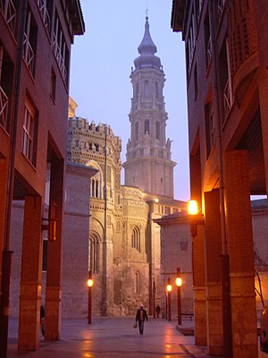
The Cathedral of the Savior (Spanish: Catedral del Salvador) or La Seo de Zaragoza is a Catholic cathedral in Zaragoza (also known as Saragossa), in Aragon, Spain. It is part of the World Heritage Site Mudéjar Architecture of Aragon. The cathedral is located on the Plaza de la Seo and is commonly known as La Seo (Aragonese for "see") to distinguish it from the nearby El Pilar, whose name (pillar) is a reference to an apparition of Mary in Zaragoza.

Calatayud (DO)
Spanish regional wine designation
Distance: Approx. 438 meters
Latitude and longitude: 41.65,-0.88333333
Calatayud is a Spanish Denominación de Origen Protegida (DOP) for wines located in the southwestern corner of the province of Zaragoza (Aragón, Spain) about 90 km from Zaragoza and covers over 5,600 ha, extending over 46 different municipalities, including Calatayud itself. It borders with the Cariñena (DO) in the east and with the province of Soria in the west. It is in the Ebro River valley and is crisscrossed by many of the Ebro's tributaries including the Jalón, Jiloca, Manubles, Mesa (river), Piedra and Ribota.
Church of Santa Engracia de Zaragoza
Distance: Approx. 378 meters
Latitude and longitude: 41.64888889,-0.88277778
The Church of Santa Engracia de Zaragoza is a basilica church in Zaragoza, Spain. It was built on the spot where Saint Engratia and her companions were said to have been martyred in 303 AD. The Basilica of Santa Engracia is located at Plaza de Santa Engracia.

San Miguel de los Navarros
Cultural property in Zaragoza, Spain
Distance: Approx. 159 meters
Latitude and longitude: 41.6496,-0.8765
San Miguel de los Navarros is a church in Zaragoza, Spain. It has a single nave with side chapels, a polygonal apse and a bell tower, located at the northern side. The church and its bell tower are notable examples of Mudéjar architecture.

San Gil Abad (Zaragoza)
Church in Zaragoza, Spain
Distance: Approx. 422 meters
Latitude and longitude: 41.65269444,-0.87938889
San Gil Abad is a church in Zaragoza, Spain.

Franciscan Friary, Zaragoza
Distance: Approx. 462 meters
Latitude and longitude: 41.65226111,-0.88166944
The Franciscan Friary in Zaragoza, Aragon (Spain) (Spanish: Convento de San Francisco de Zaragoza) was established in 1219. Unusually opulent for a Franciscan community, it benefitted greatly from royal patronage, and several members of the Aragonese royal family were buried in its magnificent church.

Abbey of Santa Engracia
Distance: Approx. 388 meters
Latitude and longitude: 41.6489,-0.8829
The Abbey of Santa Engracia (Spanish: Real Monasterio de Santa Engracia) was a monastery in Zaragoza, Aragon, Spain, established to house the relics of Saint Engratia and the many martyrs of Saragossa. The date of 392 was traditionally claimed as a foundation date, which was linked with the travels of Saint Paulinus. The church was believed to have been sited on the spot of the martyrdom of Engratia.

Santa María Magdalena, Zaragoza
Distance: Approx. 532 meters
Latitude and longitude: 41.6525,-0.87388889
Santa María Magdalena is a church in Zaragoza, Spain, built in the 14th century in Mudéjar style.

Paseo de la Constitución
Distance: Approx. 287 meters
Latitude and longitude: 41.6478,-0.8813
El Paseo de la Constitución (Constitution Walk) is located in Zaragoza, Spain.

Museo Goya - Colección Ibercaja - Museo Camón Aznar
Spanish art museum
Distance: Approx. 635 meters
Latitude and longitude: 41.6547,-0.87828
The Museo Goya - Colección Ibercaja - Museo Camón Aznar is a fine arts museum in Zaragoza, Spain. It opened in 1979 under the name Museo Camón Aznar, after the art collector from the city who had contributed the nucleus of its collection. It houses also a collection of paintings and engravings by Francisco Goya.

Zaragoza Museum
Museum in Zaragoza, Spain
Distance: Approx. 95 meters
Latitude and longitude: 41.64819444,-0.87861111
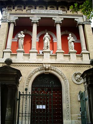
Zaragoza Museum (Spanish - Museo de Zaragoza) is a national museum in the Plaza de los Sitios in the city of Zaragoza in Spain. Its collections range from the Lower Palaeolithic to the modern era and include archaeology, fine arts, ethnology and Iberian ceramics. It is the city's oldest museum and its main building - housing the fine arts and archaeology display - is the Neo-Renaissance structure designed for the Spanish-French Exhibition of 1908 by Ricardo Magdalena and Julio Bravo.
Weather in this IP's area
clear sky
16 Celsius
15 Celsius
15 Celsius
17 Celsius
1018 hPa
61 %
1018 hPa
993 hPa
10000 meters
5.14 m/s
300 degree
07:56:39
17:41:09

