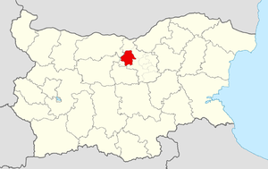
Country:
Region:
City:
Latitude and Longitude:
Time Zone:
Postal Code:
IP information under different IP Channel
ip-api
Country
Region
City
ASN
Time Zone
ISP
Blacklist
Proxy
Latitude
Longitude
Postal
Route
Luminati
Country
Region
04
City
pavlikeni
ASN
Time Zone
Europe/Sofia
ISP
A1 Bulgaria EAD
Latitude
Longitude
Postal
IPinfo
Country
Region
City
ASN
Time Zone
ISP
Blacklist
Proxy
Latitude
Longitude
Postal
Route
db-ip
Country
Region
City
ASN
Time Zone
ISP
Blacklist
Proxy
Latitude
Longitude
Postal
Route
ipdata
Country
Region
City
ASN
Time Zone
ISP
Blacklist
Proxy
Latitude
Longitude
Postal
Route
Popular places and events near this IP address
Pavlikeni
Town in Veliko Tarnovo, Bulgaria
Distance: Approx. 366 meters
Latitude and longitude: 43.24277778,25.32166667
Pavlikeni (Bulgarian: Павликени [pɐvliˈkɛni]) is a town in Veliko Tarnovo Province, Northern Bulgaria, about 41 kilometers from the city of Veliko Tarnovo. It is the administrative centre of the homonymous Pavlikeni Municipality. As of December 2010, the town had a population of 11,604.
Byala Cherkva
Place in Veliko Turnovo, Bulgaria
Distance: Approx. 5404 meters
Latitude and longitude: 43.2,25.3
Byala Cherkva (Bulgarian: Бяла черква) is a town in Pavlikeni Municipality, Veliko Turnovo Province, Central-North Bulgaria. The settlement is located close to the town of Pavlikeni about 28 km away from the city of Veliko Tarnovo. Its name in Bulgarian means white church, a popular placename around the world, equivalent to Bela Crkva, Weisskirchen, Whitechurch, etc.
Danubian Plain (Bulgaria)
Geographic region in northern Bulgaria
Distance: Approx. 875 meters
Latitude and longitude: 43.25,25.33333333
The Danubian Plain (Bulgarian: Дунавска равнина, romanized: Dunavska ravnina) constitutes the northern part of Bulgaria, situated north of the Balkan Mountains and south of the Danube. Its western border is the Timok River, and to the east it borders the Black Sea. The plain has an area of 31,523 square kilometres (12,171 sq mi).

Pavlikeni Municipality
Municipality in Veliko Tarnovo, Bulgaria
Distance: Approx. 2505 meters
Latitude and longitude: 43.26666667,25.31666667
Pavlikeni Municipality (Bulgarian: Община Павликени) is a municipality (obshtina) in Veliko Tarnovo Province, Central-North Bulgaria, located mostly in the Danubian Plain. It is named after its administrative centre - the town of Pavlikeni. The municipality embraces a territory of 622.56 km2 (240.37 sq mi) with a population of 26,342 inhabitants, as of December 2009.

Bacho Kiro High School
School in Pavlikeni, Bulgaria
Distance: Approx. 2061 meters
Latitude and longitude: 43.24305556,25.29972222
Bacho Kiro High School is a secondary comprehensive school in the town of Pavlikeni in Bulgaria. The school provides education to many students in the whole municipality of Pavlikeni.
Vishovgrad
Village in Veliko Tarnovo, Bulgaria
Distance: Approx. 10010 meters
Latitude and longitude: 43.15694444,25.3
Vishovgrad is a village in the Veliko Tarnovo Province of northern Bulgaria.
Mihaltsi
Distance: Approx. 5404 meters
Latitude and longitude: 43.2,25.35
Mihaltsi, or Mihalci, (Bulgarian: Михалци [miˈxaɫt͡si]) is a village in Pavlikeni Municipality, Veliko Tarnovo Province, northern Bulgaria. It is located at a distance of 9 km from the town of Pavlikeni, and 24 km from the city of Veliko Tarnovo.

Daskot
Village in Veliko Tarnovo, Bulgaria
Distance: Approx. 10010 meters
Latitude and longitude: 43.15694444,25.3
Daskot (Bulgarian: Дъскот, pronounced ) is a Bulgarian village in Pavlikeni Municipality, Veliko Tarnovo Province in North Bulgaria.
Samovodene
Village in Veliko Tarnovo, Bulgaria
Distance: Approx. 10010 meters
Latitude and longitude: 43.15694444,25.3
Samovodene (Bulgarian: Самоводене [samoˈvɔdɛnɛ]) is a village in Veliko Tarnovo Municipality, north-central Bulgaria.
Rositsa, Veliko Tarnovo Province
Village in Veliko Tarnovo Province, Bulgaria
Distance: Approx. 10010 meters
Latitude and longitude: 43.15694444,25.3
Rositsa (Bulgarian: Росица) one from the three villages with the name Rositsa in Bulgaria. The village is located in Veliko Tarnovo Province.
Musina, Bulgaria
Village in Veliko Tarnovo, Bulgaria
Distance: Approx. 10010 meters
Latitude and longitude: 43.15694444,25.3
Musina is a village in the Veliko Tarnovo Province of northern Bulgaria.
Prisovo
Village in Veliko Tarnovo, Bulgaria
Distance: Approx. 10010 meters
Latitude and longitude: 43.15694444,25.3
Prisovo is a village in the Veliko Tarnovo province of northern Bulgaria.
Weather in this IP's area
overcast clouds
7 Celsius
5 Celsius
4 Celsius
7 Celsius
1031 hPa
31 %
1031 hPa
1010 hPa
10000 meters
2.14 m/s
3.64 m/s
58 degree
100 %
06:56:27
17:07:59
