87.197.128.2 - IP Lookup: Free IP Address Lookup, Postal Code Lookup, IP Location Lookup, IP ASN, Public IP
Country:
Region:
City:
Location:
Time Zone:
Postal Code:
IP information under different IP Channel
ip-api
Country
Region
City
ASN
Time Zone
ISP
Blacklist
Proxy
Latitude
Longitude
Postal
Route
Luminati
Country
Region
bl
City
senec
ASN
Time Zone
Europe/Bratislava
ISP
Slovak Telekom, a.s.
Latitude
Longitude
Postal
IPinfo
Country
Region
City
ASN
Time Zone
ISP
Blacklist
Proxy
Latitude
Longitude
Postal
Route
IP2Location
87.197.128.2Country
Region
trnavsky kraj
City
senica
Time Zone
Europe/Bratislava
ISP
Language
User-Agent
Latitude
Longitude
Postal
db-ip
Country
Region
City
ASN
Time Zone
ISP
Blacklist
Proxy
Latitude
Longitude
Postal
Route
ipdata
Country
Region
City
ASN
Time Zone
ISP
Blacklist
Proxy
Latitude
Longitude
Postal
Route
Popular places and events near this IP address

Senica District
District in Trnava Region, Slovakia
Distance: Approx. 388 meters
Latitude and longitude: 48.67638889,17.36388889
Senica District (okres Senica) is a district in the Trnava Region of western Slovakia. The district is relatively rich in natural resources oil, gas, lignite. It is an industrial district, in the late period had been established here new industrial facilities.

Senica
Town in Slovakia
Distance: Approx. 153 meters
Latitude and longitude: 48.68055556,17.36666667
Senica (Slovak pronunciation: [ˈseɲitsa]; German: Senitz; Hungarian: Szenice) is a town in Trnava Region, western Slovakia. It is located in the north-eastern part of the Záhorie lowland, close to the Little Carpathians.

Záhorie (military district)
Distance: Approx. 3909 meters
Latitude and longitude: 48.66666667,17.41666667
Záhorie is a military district (formerly formally also considered a municipality) in western Slovakia in the Malacky District in the Bratislava Region. Since 1 July 2012 it is allowed to the wider public to enter a military district without permit. Military operations are taking place in the district and visitors have to obey rules of the military district and respect temporary or permanent entry restrictions.

Rohov, Senica District
Village in Slovakia
Distance: Approx. 6154 meters
Latitude and longitude: 48.73333333,17.35
Rohov (Hungarian: Rohó) is a village and municipality in Senica District in the Trnava Region of western Slovakia.

Hlboké
Village in Slovakia
Distance: Approx. 3663 meters
Latitude and longitude: 48.66388889,17.41111111
Hlboké is a village and municipality in Senica District in the Trnava Region of western Slovakia.

Koválov, Senica District
Municipality in Slovakia
Distance: Approx. 6570 meters
Latitude and longitude: 48.7,17.28333333
Koválov (Hungarian: Nagykovalló) is a village and municipality in Senica District in the Trnava Region of western Slovakia.

Rybky
Municipality in Slovakia
Distance: Approx. 4849 meters
Latitude and longitude: 48.71666667,17.33333333
Rybky (Hungarian: Halasd) is a village and municipality in Senica District in the Trnava Region of western Slovakia.

Rovensko, Senica District
Municipality in Slovakia
Distance: Approx. 4340 meters
Latitude and longitude: 48.71666667,17.38333333
Rovensko (Hungarian: Berencsróna, until 1899: Rovenszkó) is a village and municipality administered as part of Senica District in the Trnava Region of western Slovakia. The village is about 5 km NNE of the town of Senica and is close to the border with the Czech Republic.

Sobotište
Village in Slovakia
Distance: Approx. 4824 meters
Latitude and longitude: 48.71666667,17.4
Sobotište (Hungarian: Ószombat; until 1899, Szobotist) is a village and municipality in Senica District in the Trnava Region of western Slovakia. In 1845 it was the location of the establishment of the first cooperative in Europe by Samuel Jurkovič (Spolok gazdovský).

Smrdáky
Village in Slovakia
Distance: Approx. 6452 meters
Latitude and longitude: 48.71666667,17.3
Smrdáky (Hungarian: Büdöskő) is a spa village and municipality in Senica District in the Trnava Region of western Slovakia.

Church of the Virgin Mary (Senica)
Distance: Approx. 68 meters
Latitude and longitude: 48.6795,17.3678
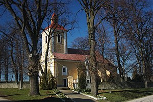
The Church of the Virgin Mary is a Roman Catholic church located in a minor square in Senica, Slovakia.

Štadión FK Senica
Football stadium in Senica, Slovakia
Distance: Approx. 906 meters
Latitude and longitude: 48.68413333,17.37680833
OMS Arena, is a multi-purpose stadium in Senica, Slovakia. It is mainly used mostly for football matches and hosts the home matches of FK Senica of the Slovak Superliga. The stadium has a capacity of 5,070 spectators.
Weather in this IP's area
broken clouds
-1 Celsius
-5 Celsius
-1 Celsius
-1 Celsius
1022 hPa
83 %
1022 hPa
983 hPa
10000 meters
3.5 m/s
9.58 m/s
312 degree
68 %