87.121.42.233 - IP Lookup: Free IP Address Lookup, Postal Code Lookup, IP Location Lookup, IP ASN, Public IP
Country:
Region:
City:
Location:
Time Zone:
Postal Code:
IP information under different IP Channel
ip-api
Country
Region
City
ASN
Time Zone
ISP
Blacklist
Proxy
Latitude
Longitude
Postal
Route
Luminati
Country
ASN
Time Zone
Europe/Sofia
ISP
Neterra Ltd.
Latitude
Longitude
Postal
IPinfo
Country
Region
City
ASN
Time Zone
ISP
Blacklist
Proxy
Latitude
Longitude
Postal
Route
IP2Location
87.121.42.233Country
Region
plovdiv
City
karlovo
Time Zone
Europe/Sofia
ISP
Language
User-Agent
Latitude
Longitude
Postal
db-ip
Country
Region
City
ASN
Time Zone
ISP
Blacklist
Proxy
Latitude
Longitude
Postal
Route
ipdata
Country
Region
City
ASN
Time Zone
ISP
Blacklist
Proxy
Latitude
Longitude
Postal
Route
Popular places and events near this IP address

Sopot, Plovdiv Province
Town in Plovdiv, Bulgaria
Distance: Approx. 4497 meters
Latitude and longitude: 42.65,24.75
Sopot (Bulgarian: Сопот [ˈsɔpot]) is a Bulgarian town situated in the fertile sub-Balkan mountain valley of Karlovo (which is the western part of the famous Rose Valley), immediately below the steep southern slopes of the Troyan Balkan Mountain (Central Stara Planina). Sopot is part of Plovdiv Province and is the administrative centre of a municipality with the same name.
Banya, Plovdiv Province
Place in Plovdiv, Bulgaria
Distance: Approx. 9667 meters
Latitude and longitude: 42.55,24.83333333
Banya (Bulgarian: Баня [ˈbaɲɐ]) is a town in Southern Bulgaria. It is in Karlovo Municipality, Plovdiv Province and is close to the town of Karlovo.

Karlovo
Town in Plovdiv, Bulgaria
Distance: Approx. 1291 meters
Latitude and longitude: 42.64361111,24.80722222
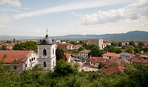
Karlovo (Bulgarian: Карлово [ˈkarɫovo]) is a historically important town in central Bulgaria located in a fertile valley along the river Stryama at the southern foot of the Balkan Mountains. It is administratively part of Plovdiv Province and has a population of about 19,373 (as of 2021), the mayor being Dr. Emil Kabaivanov.Karlovo is famous for the worldwide-known rose oil, which is grown there and used in producing perfume.
Banya Palace
Summer villa in Banya, Bulgaria
Distance: Approx. 9602 meters
Latitude and longitude: 42.55222222,24.84
Banya Palace (Bulgarian: дворец в Баня, dvorets v Banya) is a royal summer villa or small palace on the northern outskirts of the town of Banya in Karlovo municipality, Plovdiv Province, southern Bulgaria. It was commissioned to University of Karlsruhe-educated architect Ivan Vasilyov after Tsar Boris III of Bulgaria visited the town in 1925 and liked the climatic conditions and the curative mineral springs in the area, and finished in 1929. The white-painted palace's architecture draws heavily from 19th-century Bulgarian National Revival architecture.
Sopot Municipality, Bulgaria
Municipality in Plovdiv Province, Bulgaria
Distance: Approx. 4497 meters
Latitude and longitude: 42.65,24.75
Sopot Municipality is a municipality in Plovdiv Province, Bulgaria. The municipality consists only of two places: the town of Sopot and the village of Anevo.
Voynyagovo
Village in Plovdiv, Bulgaria
Distance: Approx. 8474 meters
Latitude and longitude: 42.56666667,24.75
Voynyagovo (Bulgarian: Войнягово) is a village in central southern Bulgaria, part of Karlovo Municipality, Plovdiv Province. As of 2008, it has a population of 1,260. The village lies in the Sredna Gora mountains, 318 metres (1,043 ft) above sea level.

Karlovsko Praskalo
Waterfall in Balkan Mountains, Bulgaria
Distance: Approx. 9579 meters
Latitude and longitude: 42.71,24.85305556
Karlovsko Praskalo (Bulgarian: Карловско пръскало) is a waterfall in the Central Balkan National Park, Balkan Mountains, central Bulgaria. It is located at 1,450 m altitude in the southern slope of the Zhaltets Peak. The waterfall is 30 m high.
Anevo Fortress
Castle in Bulgaria
Distance: Approx. 7335 meters
Latitude and longitude: 42.67777778,24.73388889
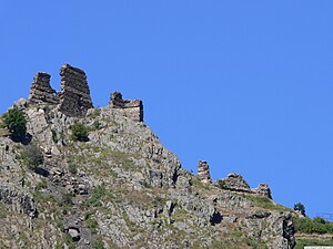
The Anevo Fortress (Bulgarian: Аневско кале, Anevsko kale) or Kopsis (Копсис) is a medieval castle in central Bulgaria, the ruins of which are located some 3 kilometres (1.9 mi) from the village of Anevo in Sopot Municipality, Plovdiv Province. Constructed in the first half of the 12th century, it lies on a steep hilltop at the southern foot of the Balkan Mountains, not far from the Stryama river. In the end of the 13th century, the fortress was the capital of a small short-lived quasi-independent domain ruled by the brothers of Tsar Smilets of Bulgaria, Voysil and Radoslav.

Kurshum Mosque
Mosque in Karlovo, Plovidv, Bulgaria
Distance: Approx. 1179 meters
Latitude and longitude: 42.6422,24.8078
Kurshum Djamia Mosque is located in Karlovo, Plovdiv Province, Bulgaria. Kurshum Mosque was built in 1485 by Karlu Ali Bey. It is the oldest architectural monument in Karlovo.
Vasil Levski Monument (Karlovo)
Historical monument in Bulgaria
Distance: Approx. 677 meters
Latitude and longitude: 42.6374,24.8061
The Vasil Levski Monument stands in Vasil Levski Square in Karlovo, Bulgaria, between the churches of St. Nicholas and the Holy Mother. The foundation stone of the monument was laid on 15 May 1903, in front of prince regnant Ferdinand I. It was designed by the sculptor Marin Vasilev.

Stara Reka Reserve
Distance: Approx. 1279 meters
Latitude and longitude: 42.64351389,24.80715278
Stara Reka (Bulgarian: Стара река, meaning Old river) is one of the nine nature reserves in the Central Balkan National Park in central Bulgaria. Stara Reka was established on 19 March 1981 to protect the unique ecosystems of the Balkan Mountains. It spans an area of 1974.7 hectares, or 19.747km2.
Saranska Valley
Valley in Bulgaria
Distance: Approx. 9939 meters
Latitude and longitude: 42.7136,24.7469
Saranska Valley (Bulgarian: Саранска котловина) is situated in central western Bulgaria and is the third of the eleven Sub-Balkan valleys in direction west–east. It is named after the village of Sarantsi. The valley is enclosed between the Murgash division of the Balkan Mountains to the north and the Sredna Gora mountain range to the south.
Weather in this IP's area
moderate rain
3 Celsius
3 Celsius
1 Celsius
3 Celsius
997 hPa
99 %
997 hPa
949 hPa
1641 meters
1.19 m/s
4.7 m/s
174 degree
100 %


