87.121.255.9 - IP Lookup: Free IP Address Lookup, Postal Code Lookup, IP Location Lookup, IP ASN, Public IP
Country:
Region:
City:
Location:
Time Zone:
Postal Code:
ISP:
ASN:
language:
User-Agent:
Proxy IP:
Blacklist:
IP information under different IP Channel
ip-api
Country
Region
City
ASN
Time Zone
ISP
Blacklist
Proxy
Latitude
Longitude
Postal
Route
db-ip
Country
Region
City
ASN
Time Zone
ISP
Blacklist
Proxy
Latitude
Longitude
Postal
Route
IPinfo
Country
Region
City
ASN
Time Zone
ISP
Blacklist
Proxy
Latitude
Longitude
Postal
Route
IP2Location
87.121.255.9Country
Region
louth
City
dundalk
Time Zone
Europe/Dublin
ISP
Language
User-Agent
Latitude
Longitude
Postal
ipdata
Country
Region
City
ASN
Time Zone
ISP
Blacklist
Proxy
Latitude
Longitude
Postal
Route
Popular places and events near this IP address

Dundalk
County town of County Louth, Ireland
Distance: Approx. 1183 meters
Latitude and longitude: 54.00444444,-6.40027778
Dundalk ( dun-DAW(L)K; Irish: Dún Dealgan) is the county town of County Louth, Ireland. The town is situated on the Castletown River, which flows into Dundalk Bay on the north-east coast of Ireland, and is halfway between Dublin and Belfast, close to and south of the border with Northern Ireland. It is surrounded by several townlands and villages that form the wider Dundalk Municipal District.
Battle of Tragh-Bhaile
Battle fought in Ireland in 1399 between the forces of Henry O'Neill's sons and the Anglo-Irish
Distance: Approx. 1265 meters
Latitude and longitude: 54.009,-6.4049
The Battle of Tragh-Bhaile was fought in Ireland in 1399 between the forces of Henry O'Neill's sons and the Anglo-Irish. The Anglo-Irish were victorious. The O'Neill forces, led by Donal MacHenry of Tyrone, attacked the King's troops at Tragh-Bhaile (Dundalk, County Louth), but were repulsed.

Dundalk Clarke railway station
Railway station in County Louth, Ireland
Distance: Approx. 329 meters
Latitude and longitude: 54.002,-6.413
Dundalk Clarke railway station (Irish: Stáisiún Uí Chléirigh) serves Dundalk in County Louth, Ireland. It consists of an island platform, with a bay facing south. It is served by the Dublin-Belfast Enterprise intercity trains as well as local Commuter services to and from Dublin.

Dundalk Grammar School
Primary, secondary and boarding school in Dundalk, Louth, Ireland
Distance: Approx. 504 meters
Latitude and longitude: 53.9975,-6.41027778
Dundalk Grammar School, is an independent school in Dundalk, County Louth, Ireland. The school is co-educational with both primary and secondary departments. It is one of a small number of schools in Ireland offering students an education from school entry (4 years) until school leaving age (18–19 years).
St. Patrick's Church, Dundalk
Distance: Approx. 1227 meters
Latitude and longitude: 54.00382111,-6.39910611
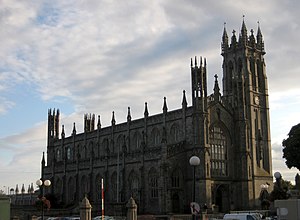
The Church of St. Patrick, also named St. Patrick's Pro-Cathedral, is a large Roman Catholic church located in Dundalk, County Louth, Ireland.
Dundalk Gaels GFC
Louth-based Gaelic games club
Distance: Approx. 989 meters
Latitude and longitude: 53.99832,-6.40186
Dundalk Gaels GFC is a GAA club from Dundalk, County Louth, Ireland which fields Gaelic football teams in competitions organized by Louth GAA.
St. Patrick's Cathedral, Bridgetown
Church in Bridgetown, Barbados
Distance: Approx. 1224 meters
Latitude and longitude: 54.00395,-6.39924
St. Patrick's Cathedral, located in Bridgetown, Barbados, is the seat of the Roman Catholic Diocese of Bridgetown. It is one of two cathedrals in that territory, the other being the Anglican Cathedral of St.

Dundalk Distillery
Former Irish whisky distillery
Distance: Approx. 1382 meters
Latitude and longitude: 54.00461111,-6.39708333
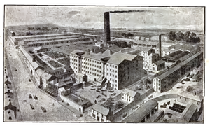
The Dundalk Distillery was an Irish whiskey distillery that operated in Dundalk, County Louth, Ireland between 1708 and 1926. It is thought to have been one of the old registered distilleries in Ireland. Two of the distillery buildings, the grain store and maltings, still exist and now house the County Museum and Dundalk Library.

Donnelly's Bar and Kay's Tavern attacks
1975 attacks by the Ulster Volunteer Force
Distance: Approx. 1265 meters
Latitude and longitude: 54.009,-6.4049
During the evening of 19 December 1975, two coordinated attacks were carried out by the Ulster Volunteer Force (UVF) in pubs either side of the Irish border. The first attack, a car bombing, took place outside Kay's Tavern, a pub along Crowe Street in Dundalk, County Louth, Republic of Ireland - close to the border. The second, a gun and bomb attack, took place at Donnelly's Bar & Filling Station in Silverbridge, County Armagh, just across the border inside Northern Ireland.

Dundalk Courthouse
Building in County Louth, Ireland
Distance: Approx. 1136 meters
Latitude and longitude: 54.0046,-6.4012
Dundalk Courthouse is a judicial facility in Dundalk, County Louth, Ireland.
Clan Na Gael GFC (Louth)
Louth-based Gaelic games club
Distance: Approx. 1248 meters
Latitude and longitude: 54.011,-6.413
Clan na Gael GFC is a GAA club from Dundalk, County Louth, which fields Gaelic football teams in competitions organised by Louth GAA. Their motto is 'Once a Clan, Always a Clan'.

Dundalk Town Hall
Municipal building in Dundalk, County Louth, Ireland
Distance: Approx. 1176 meters
Latitude and longitude: 54.0047,-6.4006
Dundalk Town Hall (Irish: Halla Baile Dhún Dealgan), is a municipal building in Crowe Street, Dundalk, County Louth, Ireland. It currently accommodates the An Táin Arts Centre.
Weather in this IP's area
scattered clouds
6 Celsius
6 Celsius
6 Celsius
6 Celsius
1006 hPa
93 %
1006 hPa
997 hPa
10000 meters
0.92 m/s
0.97 m/s
247 degree
28 %
