Country:
Region:
City:
Latitude and Longitude:
Time Zone:
Postal Code:
IP information under different IP Channel
ip-api
Country
Region
City
ASN
Time Zone
ISP
Blacklist
Proxy
Latitude
Longitude
Postal
Route
Luminati
Country
Region
bt
City
botosani
ASN
Time Zone
Europe/Bucharest
ISP
Orange Romania S.A.
Latitude
Longitude
Postal
IPinfo
Country
Region
City
ASN
Time Zone
ISP
Blacklist
Proxy
Latitude
Longitude
Postal
Route
db-ip
Country
Region
City
ASN
Time Zone
ISP
Blacklist
Proxy
Latitude
Longitude
Postal
Route
ipdata
Country
Region
City
ASN
Time Zone
ISP
Blacklist
Proxy
Latitude
Longitude
Postal
Route
Popular places and events near this IP address

Deva, Romania
Municipality in Hunedoara, Romania
Distance: Approx. 1718 meters
Latitude and longitude: 45.87805556,22.91444444
Deva (Romanian pronunciation: [ˈdeva] ; Hungarian: Déva, Hungarian pronunciation: [ˈdeːvɒ]; German: Diemrich, Schlossberg, Denburg; Latin: Sargetia; is a city in Romania, in the historical region of Transylvania, on the left bank of the river Mureș. It is the capital of Hunedoara County.

Hunyad County
County of the Kingdom of Hungary
Distance: Approx. 516 meters
Latitude and longitude: 45.88333333,22.9
Hunyad (today mainly Hunedoara) was an administrative county (comitatus) of the Kingdom of Hungary, of the Eastern Hungarian Kingdom and of the Principality of Transylvania. Its territory is now in Romania in Transylvania. The capital of the county was Déva (present-day Deva).
Bethlen Castle
Distance: Approx. 202 meters
Latitude and longitude: 45.885931,22.898335
Magna Curia (Latin for The Great Court) or The Bethlen Castle is a palace located in Deva, Romania.
Museum of Dacian and Roman Civilisation
Archaeological museum in Deva, Romania
Distance: Approx. 205 meters
Latitude and longitude: 45.885884,22.898308
The Museum of Dacian and Roman Civilisation is a museum in Deva, Romania. A brief history of Deva and its other neighbouring citadels as well as extensive archaeological discoveries from the numerous sights in and around the Orăştie Mountains are exhibited in the museum. The museum was founded in 1882 as the County Museum and houses one of the most important archaeological collections in Transylvania, including numismatic, ethnographic and natural science exhibits.

Cerna (Mureș)
River in Hunedoara County, Romania
Distance: Approx. 4123 meters
Latitude and longitude: 45.88361111,22.94972222
The Cerna (also: Cerna Hunedoreană or Cerna Ardeleană, Hungarian: Cserna-patak) is a left tributary of the river Mureș in Transylvania, Romania. Its name both in Romanian and Hungarian languages originates from a Slav language, meaning "black (water)". Its source is in the Poiana Ruscă Mountains.
Certej (river)
River in Hunedoara County, Romania
Distance: Approx. 2522 meters
Latitude and longitude: 45.905,22.9173
The Certej (Hungarian: Csertés-patak) is a right tributary of the river Mureș in Romania. It discharges into the Mureș near the city Deva. Its length is 18 km (11 mi) and its basin size is 78 km2 (30 sq mi).

Fortress of Deva
Castle in Deva, Hunedoara County, Romania
Distance: Approx. 139 meters
Latitude and longitude: 45.88861111,22.89722222
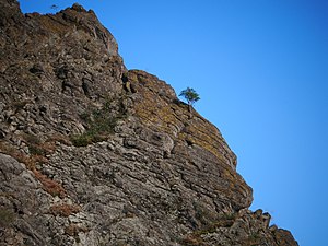
The Fortress of Deva (Romanian: Cetatea Devei, Hungarian: Déva vára) is a fortress located in the city of Deva, Hunedoara County, Romania, on top of a volcanic hill.
Boholt
River in Hunedoara County, Romania
Distance: Approx. 3697 meters
Latitude and longitude: 45.9152,22.8707
The Boholt (Hungarian: Boholt-patak) is a right tributary of the river Mureș in Romania. It discharges into the Mureș in Șoimuș. Its length is 12 km (7.5 mi) and its basin size is 23 km2 (8.9 sq mi).

Șoimuș
Commune in Hunedoara, Romania
Distance: Approx. 3334 meters
Latitude and longitude: 45.91694444,22.88972222
Șoimuș (Hungarian: Marossolymos, German: Falkendorf) is a commune in Hunedoara County, Transylvania, Romania. It is composed of ten villages: Bălata (Balátatelep), Bejan (Bezsán), Bejan-Târnăvița (Bezsántelep), Boholt (Boholt), Căinelu de Jos (Alsókajanel), Chișcădaga (Kecskedága), Fornădia (Fornádia), Păuliș (until 1960 Buruene; Burjánfalva), Sulighete (Szúliget), and Șoimuș. The commune at situated in the southwestern extremity of the Transylvanian Plateau, in the southern foothills of the Metaliferi Mountains, on the right bank of the Mureș River.
Decebal National College
Public school in Deva, Hunedoara County, Romania
Distance: Approx. 552 meters
Latitude and longitude: 45.8833,22.9008
Decebal National College (Colegiul Național Decebal) is a high school in Deva, Romania. Its headmaster is Marin Florin Ilieș.

Dacian fortress of Cozia
Distance: Approx. 4198 meters
Latitude and longitude: 45.883,22.843
The Dacian fortress of Cozia was a Dacian fortified town.

Hunedoara County Prefecture
Building in Deva, Romania
Distance: Approx. 139 meters
Latitude and longitude: 45.88861111,22.89722222
The Hunedoara County Prefecture (Romanian: Palatul Administrativ din Deva, Hungarian: Dévai vármegyeház) is a building in Deva, Romania. Built in 1889–1890 in a late eclectic style after the plans of architect Ignác Alpár, it houses both the prefect's office of Hunedoara County and the county council.
Weather in this IP's area
overcast clouds
12 Celsius
10 Celsius
12 Celsius
12 Celsius
1000 hPa
57 %
1000 hPa
968 hPa
10000 meters
2.46 m/s
5.96 m/s
162 degree
99 %
07:35:53
16:52:39
