Country:
 Romania
Region:
City:
Latitude and Longitude:
Time Zone:
Postal Code:
IP information under different IP Channel
ip-api
Country
Region
City
ASN
Time Zone
ISP
Blacklist
Proxy
Latitude
Longitude
Postal
Route
IPinfo
Country
Region
City
ASN
Time Zone
ISP
Blacklist
Proxy
Latitude
Longitude
Postal
Route
MaxMind
Country
Region
City
ASN
Time Zone
ISP
Blacklist
Proxy
Latitude
Longitude
Postal
Route
Luminati
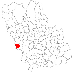
Country
RORegion
bt
City
botosani
ASN
Time Zone
Europe/Bucharest
ISP
Orange Romania S.A.
Latitude
Longitude
Postal
db-ip
Country
Region
City
ASN
Time Zone
ISP
Blacklist
Proxy
Latitude
Longitude
Postal
Route
ipdata
Country
Region
City
ASN
Time Zone
ISP
Blacklist
Proxy
Latitude
Longitude
Postal
Route
Popular places and events near this IP address

Băicoi
Town in Prahova, Romania
Distance: Approx. 6951 meters
Latitude and longitude: 45.04527778,25.86583333
Băicoi (Romanian pronunciation: [bəjˈkoj]) is a town in Prahova County, Romania, near the 45th parallel. Five localities are administered by the town: Dâmbu, Liliești, Schela, Tufeni, and Țintea. Over time, these have become neighborhoods of the town.
Bănești, Prahova
Commune in Prahova, Romania
Distance: Approx. 5644 meters
Latitude and longitude: 45.1,25.76666667
Bănești is a commune in Prahova County, Muntenia, Romania. It is composed of two villages, Bănești and Urleta. The commune is situated at the northern edge of the Wallachian Plain, at an altitude of 395 m (1,296 ft), in the foothills of the Southern Carpathians.
Filipeștii de Pădure
Commune in Prahova, Romania
Distance: Approx. 5967 meters
Latitude and longitude: 45,25.75
Filipeștii de Pădure is a commune in Prahova County, Muntenia, Romania. It is composed of four villages: Dițești, Filipeștii de Pădure, Minieri and Siliștea Dealului.

Filipeștii de Târg
Commune in Prahova, Romania
Distance: Approx. 7423 meters
Latitude and longitude: 44.98333333,25.78333333
Filipeștii de Târg is a commune in Prahova County, Muntenia, Romania. It is composed of three villages: Brătășanca, Filipeștii de Târg, and Mărginenii de Jos. The locality was a town until 1950.

Florești, Prahova
Commune in Prahova, Romania
Distance: Approx. 2545 meters
Latitude and longitude: 45.03333333,25.8
Florești is a commune in Prahova County, Muntenia, Romania. It is composed of five villages: Cap Roșu, Călinești, Cătina, Florești, and Novăcești. The commune is located in the western part of the county, on the banks of the Prahova River.

Telega, Prahova
Commune in Prahova, Romania
Distance: Approx. 9298 meters
Latitude and longitude: 45.13333333,25.78333333
Telega is a commune in Prahova County, Muntenia, Romania. It is composed of six villages: Boșilcești, Buștenari, Doftana, Melicești, Telega and Țonțești. The commune is located in the west-central part of the county, in the Sub Carpathian hills, 36 km (22 mi) northwest of the county seat, Ploiești.

Doftana (Prahova)
River in Prahova County, Romania
Distance: Approx. 5949 meters
Latitude and longitude: 45.0996,25.7499
The Doftana is a left tributary of the river Prahova in Romania. It discharges into the Prahova in Bănești near Câmpina. It flows through the villages Trăisteni, Teșila, Seciuri, Brebu Mânăstirei, Doftana and the city Câmpina.

Scorțeni, Prahova
Commune in Prahova, Romania
Distance: Approx. 7359 meters
Latitude and longitude: 45.09305556,25.84861111
Scorțeni is a commune in Prahova County, Muntenia, Romania.

Mislei
River in Prahova County, Romania
Distance: Approx. 5794 meters
Latitude and longitude: 45.0894,25.8257
The Mislei is a left tributary of the river Telega in Romania. It discharges into the Telega in the village Mislea. Its length is 7 km (4.3 mi) and its basin size is 13 km2 (5.0 sq mi).

Măgureni
Commune in Prahova, Romania
Distance: Approx. 2159 meters
Latitude and longitude: 45.0439,25.7516
Măgureni is a commune in Prahova County, Muntenia, Romania. It is composed of three villages: Cocorăștii Caplii, Lunca Prahovei and Măgureni. At the 2002 census, 6,630 inhabitants were counted, all but three of whom were ethnic Romanians.
Dacian fortress of Iedera de Jos
Distance: Approx. 8085 meters
Latitude and longitude: 45.0501,25.6749
The Dacian fortress of Iedera de Jos is located within the county of Dâmbovița, Romania.

Mislea Prison
Romanian prison
Distance: Approx. 6010 meters
Latitude and longitude: 45.09236111,25.82491667
Mislea Prison was a prison located in Mislea, Prahova County, Romania.
Weather in this IP's area
broken clouds
15 Celsius
15 Celsius
15 Celsius
16 Celsius
1010 hPa
65 %
1010 hPa
973 hPa
10000 meters
2.09 m/s
2.1 m/s
324 degree
65 %
07:19:58
18:50:15