Country:
 Romania
Region:
City:
Latitude and Longitude:
Time Zone:
Postal Code:
IP information under different IP Channel
ip-api
Country
Region
City
ASN
Time Zone
ISP
Blacklist
Proxy
Latitude
Longitude
Postal
Route
IPinfo
Country
Region
City
ASN
Time Zone
ISP
Blacklist
Proxy
Latitude
Longitude
Postal
Route
MaxMind
Country
Region
City
ASN
Time Zone
ISP
Blacklist
Proxy
Latitude
Longitude
Postal
Route
Luminati
Country
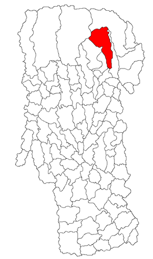
RORegion
bt
City
botosani
ASN
Time Zone
Europe/Bucharest
ISP
Orange Romania S.A.
Latitude
Longitude
Postal
db-ip
Country
Region
City
ASN
Time Zone
ISP
Blacklist
Proxy
Latitude
Longitude
Postal
Route
ipdata
Country
Region
City
ASN
Time Zone
ISP
Blacklist
Proxy
Latitude
Longitude
Postal
Route
Popular places and events near this IP address

Dragoslavele
Commune in Argeș, Romania
Distance: Approx. 142 meters
Latitude and longitude: 45.35,25.16666667
Dragoslavele is a commune in the northern part of Argeș County, Muntenia, Romania, located by the former border between Wallachia and Transylvania, on the Wallachian side. It is a relatively important location for boarding house tourism. The commune is composed of two villages, Dragoslavele and Valea Hotarului.

Rucăr
Commune in Argeș, Romania
Distance: Approx. 4070 meters
Latitude and longitude: 45.3875,25.17083333
Rucăr is a commune located in the north-eastern part of Argeș County, Romania, situated in the Carpathian Mountains. The commune is composed of two villages, Rucăr and Sătic, and its population as of 2021 was 5,259. Historically important for its role as a border region between Wallachia and its neighboring countries, it is today popular with tourists from Bran Castle.
Ghimbav (river)
River in Argeș County, Romania
Distance: Approx. 4764 meters
Latitude and longitude: 45.388,25.1984
The Ghimbav is a left tributary of the river Dâmbovița in Romania. Its source is in the Leaota Mountains. It flows into the Dâmbovița upstream from Rucăr.

Valea Cheii (Dâmbovița)
River in Argeș County, Romania
Distance: Approx. 5676 meters
Latitude and longitude: 45.3962,25.2014
The Valea Cheii (also: Cheia, in its upper course also: Rudărița) is a left tributary of the river Dâmbovița in Romania. Its source is in the Leaota Mountains. It flows into the Dâmbovița downstream from Podu Dâmboviței.
Râușor (Dâmbovița)
River in Argeș County, Romania
Distance: Approx. 3890 meters
Latitude and longitude: 45.3858,25.1723
The Râușor (in its upper course also: Boteanu) is a right tributary of the river Dâmbovița in Romania. It flows into the Dâmbovița in Rucăr. Its length is 16 km (9.9 mi) and its basin size is 50 km2 (19 sq mi).

Dâmbovicioara (river)
River in Argeș County, Romania
Distance: Approx. 7203 meters
Latitude and longitude: 45.4116,25.2001
The Dâmbovicioara is a left tributary of the river Dâmbovița in Romania. Its source is in the Piatra Craiului Mountains. It flows into the Dâmbovița in Podu Dâmboviței.

Dâmbovicioara
Commune in Argeș, Romania
Distance: Approx. 9930 meters
Latitude and longitude: 45.43333333,25.21666667
Dâmbovicioara is a commune in Argeș County, Muntenia, Romania. It is composed of three villages: Ciocanu, Dâmbovicioara, and Podu Dâmboviței.
Lerești
Commune in Argeș, Romania
Distance: Approx. 8154 meters
Latitude and longitude: 45.33333333,25.06666667
Lerești is a commune in Argeș County, Muntenia, Romania. It is composed of three villages: Lerești, Pojorâta and Voinești.

Râușor Dam
Dam located in Argeș County, Romania
Distance: Approx. 9499 meters
Latitude and longitude: 45.393824,25.062729
Râușor is a rock-fill water dam build in 1987 in the far north of Argeș County, Romania. It impounds the Râul Târgului. It has a wall height of 120 m (390 ft) and a total volume of 60 million m³.

Mausoleum of Mateiaș
Monument in Romania
Distance: Approx. 6921 meters
Latitude and longitude: 45.29214,25.13932
Heroes' Mausoleum, in the commune of Valea Mare-Pravăț, Argeș County, Romania, also known as the Mausoleum of Mateiaș, is a historic monument dedicated to the heroes of the war of 1916–1918, considered by Romanians as the War for National Integration. It is located on the European Route E574 (DN 73), 11 km from Câmpulung towards Brașov, on Mateiaș Hill. The monument is listed at position no.

Dragoslavele Hermitage
Monument and Hermitage site in Dragoslavele, Argeș County, Romania
Distance: Approx. 738 meters
Latitude and longitude: 45.34833333,25.15916667
Dragoslavele Hermitage (LMI code AG-II-m-B-13680) is a historical and religious monument, dedicated to the Great Martyr "Saint George", located in Dragoslavele commune in Argeș county, on the Pitești-Brașov road, near the Rucăr-Bran Pass. Monks live here, under the pastorate of the Hieromonk Cosma Juncu. The monastic complex includes: The wooden church "St.
Weather in this IP's area
broken clouds
16 Celsius
15 Celsius
16 Celsius
17 Celsius
1012 hPa
44 %
1012 hPa
935 hPa
10000 meters
2.32 m/s
3.02 m/s
213 degree
67 %
07:20:04
18:56:17