86.111.50.145 - IP Lookup: Free IP Address Lookup, Postal Code Lookup, IP Location Lookup, IP ASN, Public IP
Country:
Region:
City:
Location:
Time Zone:
Postal Code:
ISP:
ASN:
language:
User-Agent:
Proxy IP:
Blacklist:
IP information under different IP Channel
ip-api
Country
Region
City
ASN
Time Zone
ISP
Blacklist
Proxy
Latitude
Longitude
Postal
Route
db-ip
Country
Region
City
ASN
Time Zone
ISP
Blacklist
Proxy
Latitude
Longitude
Postal
Route
IPinfo
Country
Region
City
ASN
Time Zone
ISP
Blacklist
Proxy
Latitude
Longitude
Postal
Route
IP2Location
86.111.50.145Country
Region
vorarlberg
City
thuringen
Time Zone
Europe/Vienna
ISP
Language
User-Agent
Latitude
Longitude
Postal
ipdata
Country
Region
City
ASN
Time Zone
ISP
Blacklist
Proxy
Latitude
Longitude
Postal
Route
Popular places and events near this IP address

Meng (river)
River in Vorarlberg, Austria
Distance: Approx. 4088 meters
Latitude and longitude: 47.1913,9.7142
The Meng is a river in Vorarlberg, Austria. The Meng is 18 kilometres (11 mi) long. It originates near the Naafkopf mountain.
Blons
Municipality in Vorarlberg, Austria
Distance: Approx. 4210 meters
Latitude and longitude: 47.21666667,9.81666667
Blons is a municipality in the district of Bludenz in Austrian state of Vorarlberg.
Bludesch
Municipality in Vorarlberg, Austria
Distance: Approx. 2524 meters
Latitude and longitude: 47.2,9.73333333
Bludesch is a municipality in the district of Bludenz in the Austrian state of Vorarlberg.

Ludesch
Municipality in Vorarlberg, Austria
Distance: Approx. 3 meters
Latitude and longitude: 47.2,9.76666667
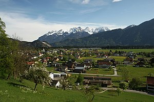
Ludesch is a municipality in the district of Bludenz in the Austrian state of Vorarlberg.

Raggal
Municipality in Vorarlberg, Austria
Distance: Approx. 4210 meters
Latitude and longitude: 47.21666667,9.81666667
Raggal is a municipality in the district of Bludenz in the Austrian state of Vorarlberg.
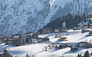
Thüringen, Austria
Municipality in Vorarlberg, Austria
Distance: Approx. 3 meters
Latitude and longitude: 47.2,9.76666667
Thüringen is a municipality in the district of Bludenz in the Austrian state of Vorarlberg, on the mouth of the Great Walsertal.
Thüringerberg
Municipality in Vorarlberg, Austria
Distance: Approx. 2078 meters
Latitude and longitude: 47.215,9.78305556
Thüringerberg is a municipality in the district of Bludenz in the Austrian state of Vorarlberg.

Schnifis
Municipality in Vorarlberg, Austria
Distance: Approx. 4214 meters
Latitude and longitude: 47.21666667,9.71666667
Schnifis is a municipality in the district of Feldkirch in the Austrian state of Vorarlberg.

Nenzing railway station
Railway station in Vorarlberg, Austria
Distance: Approx. 4464 meters
Latitude and longitude: 47.191037,9.709182
Nenzing railway station (German: Bahnhof Nenzing) is a railway station in Nenzing in the Bludenz district of the Austrian federal state of Vorarlberg. It was opened on 1 July 1872, together with the rest of the Vorarlberg railway. The station is owned and operated by the Austrian Federal Railways (ÖBB).
Hatlerdorf railway station
Railway station in Vorarlberg, Austria
Distance: Approx. 3199 meters
Latitude and longitude: 47.195332,9.724971
Hatlerdorf railway station (German: Bahnhof Hatlerdorf) is a railway station in Hatlerdorf (Dornbirn) in the Dornbirn district of the Austrian federal state of Vorarlberg. It is an intermediate station on the Vorarlberg railway. The station is owned and operated by the Austrian Federal Railways (ÖBB).

Ludesch railway station
Railway station in Vorarlberg, Austria
Distance: Approx. 2220 meters
Latitude and longitude: 47.180298,9.771235
Ludesch railway station (German: Bahnhof Ludesch), formerly called Ludesch-Thüringen or Großwalsertal railway station, respectively, is a railway station in Ludesch in the Bludenz district of the Austrian federal state of Vorarlberg. It is located on the Vorarlberg railway. The station is owned and operated by Austrian Federal Railways (ÖBB).
Nüziders railway station
Railway station in Vorarlberg, Austria
Distance: Approx. 3854 meters
Latitude and longitude: 47.170984,9.794498
Nüziders railway station (German: Bahnhof Nüziders) is a railway station in Nüziders in the Bludenz district of the Austrian federal state of Vorarlberg. It is located on the Vorarlberg railway. The station is owned and operated by Austrian Federal Railways (ÖBB).
Weather in this IP's area
light rain
4 Celsius
2 Celsius
2 Celsius
5 Celsius
1016 hPa
83 %
1016 hPa
874 hPa
7333 meters
2.24 m/s
4.02 m/s
333 degree
100 %


