86.111.39.161 - IP Lookup: Free IP Address Lookup, Postal Code Lookup, IP Location Lookup, IP ASN, Public IP
Country:
Region:
City:
Location:
Time Zone:
Postal Code:
IP information under different IP Channel
ip-api
Country
Region
City
ASN
Time Zone
ISP
Blacklist
Proxy
Latitude
Longitude
Postal
Route
Luminati
Country
Region
8
City
koblach
ASN
Time Zone
Europe/Vienna
ISP
iPlace Internet & Network Services GmbH
Latitude
Longitude
Postal
IPinfo
Country
Region
City
ASN
Time Zone
ISP
Blacklist
Proxy
Latitude
Longitude
Postal
Route
IP2Location
86.111.39.161Country
Region
vorarlberg
City
rankweil
Time Zone
Europe/Vienna
ISP
Language
User-Agent
Latitude
Longitude
Postal
db-ip
Country
Region
City
ASN
Time Zone
ISP
Blacklist
Proxy
Latitude
Longitude
Postal
Route
ipdata
Country
Region
City
ASN
Time Zone
ISP
Blacklist
Proxy
Latitude
Longitude
Postal
Route
Popular places and events near this IP address
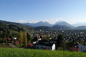
Rankweil
Municipality in Vorarlberg, Austria
Distance: Approx. 718 meters
Latitude and longitude: 47.26666667,9.65
Rankweil is a town in the westernmost Austrian state of Vorarlberg, in the district Feldkirch. It is the second largest town in the district Feldkirch and the eighth largest town in Vorarlberg.
Feldkirch District
District in Vorarlberg, Austria
Distance: Approx. 1807 meters
Latitude and longitude: 47.279,9.664
The Bezirk Feldkirch is an administrative district (Bezirk) in Vorarlberg, Austria. Area of the district is 278.26 km2, population is 100,656 (2012), and population density 362 persons per km2. Administrative center of the district is Feldkirch.
Zwischenwasser
Municipality in Vorarlberg, Austria
Distance: Approx. 718 meters
Latitude and longitude: 47.26666667,9.65
Zwischenwasser is a municipality in the district of Feldkirch in the Austrian state of Vorarlberg. Zwischenwasser has three districts: Muntlix (the largest), Batschuns and Dafins.

Viktorsberg
Municipality in Vorarlberg, Austria
Distance: Approx. 2241 meters
Latitude and longitude: 47.28333333,9.66666667
Viktorsberg is a municipality in the district of Feldkirch in the Austrian state of Vorarlberg.
Röthis
Municipality in Vorarlberg, Austria
Distance: Approx. 2776 meters
Latitude and longitude: 47.29166667,9.66388889
Röthis is a municipality in the district of Feldkirch in the Austrian state of Vorarlberg.
Sulz, Vorarlberg
Municipality in Vorarlberg, Austria
Distance: Approx. 718 meters
Latitude and longitude: 47.26666667,9.65
Sulz is a municipality in the district of Feldkirch in the Austrian state of Vorarlberg.
Altenstadt (Feldkirch)
District of Feldkirch, Vorarlberg, Austria
Distance: Approx. 2225 meters
Latitude and longitude: 47.26027778,9.61833333
Altenstadt is a district of Feldkirch, a city in the westernmost Austrian state of Vorarlberg. Other districts of Feldkirch are Gisingen, Levis, Nofels, Tisis and Tosters.
Clunia, Austria
Distance: Approx. 2509 meters
Latitude and longitude: 47.267498,9.610311
Clunia is the name of an ancient Roman city that is situated in Feldkirch (Vorarlberg, Austria) and indicated on the Tabula Peutingeriana. In Roman time it is thought to have been a weigh station between Brigantium and Mediolanum (present Milan).

Rankweil railway station
Railway station in Vorarlberg, Austria
Distance: Approx. 481 meters
Latitude and longitude: 47.272215,9.636953
Rankweil railway station (German: Bahnhof Rankweil) is a railway station in Rankweil in the Feldkirch district of the Austrian federal state of Vorarlberg. It was opened on 1 July 1872, together with the rest of the Vorarlberg railway. The station is owned and operated by the Austrian Federal Railways (ÖBB).

Altenstadt railway station
Railway station in Feldkirch, Vorarlberg
Distance: Approx. 2659 meters
Latitude and longitude: 47.256383,9.615378
Altenstadt railway station is a railway station in the Altenstadt district of the town of Feldkirch in the westernmost Austrian Federal State of Vorarlberg. The station is located on the Feldkirch–Buchs railway line and is served by regional trains only. The station is owned and operated by Austrian Federal Railways (ÖBB).
Sulz-Röthis railway station
Railway station in Vorarlberg, Austria
Distance: Approx. 2736 meters
Latitude and longitude: 47.294934,9.634236
Sulz-Röthis railway station (German: Bahnhof Sulz-Röthis) is a railway station in Sulz in the Feldkirch district of the Austrian federal state of Vorarlberg. It is located on the Vorarlberg railway and serves the towns of Sulz and Röthis. The station is owned and operated by Austrian Federal Railways (ÖBB).
Feldkirch Amberg railway station
Railway station in Vorarlberg, Austria
Distance: Approx. 2354 meters
Latitude and longitude: 47.255728,9.621711
Feldkirch Amberg railway station (German: Bahnhof Feldkirch-Amberg) is a railway station in the Levis district of the town of Feldkirch in the Feldkirch district of the Austrian federal state of Vorarlberg. It is located near the Amberg Castle (Schloss Amberg) and owned and operated by the Austrian Federal Railways (ÖBB). The station was opened on 1 July 1872, together with the rest of the Vorarlberg railway.
Weather in this IP's area
broken clouds
-0 Celsius
-0 Celsius
-2 Celsius
1 Celsius
1036 hPa
77 %
1036 hPa
916 hPa
10000 meters
0.89 m/s
1.34 m/s
108 degree
60 %


