Country:
 Netherlands
Region:
City:
Latitude and Longitude:
Time Zone:
Postal Code:
IP information under different IP Channel
ip-api
Country
Region
City
ASN
Time Zone
ISP
Blacklist
Proxy
Latitude
Longitude
Postal
Route
IPinfo
Country
Region
City
ASN
Time Zone
ISP
Blacklist
Proxy
Latitude
Longitude
Postal
Route
MaxMind
Country
Region
City
ASN
Time Zone
ISP
Blacklist
Proxy
Latitude
Longitude
Postal
Route
Luminati
Country
NLASN
Time Zone
Europe/Amsterdam
ISP
CLDIN B.V.
Latitude
Longitude
Postal
db-ip
Country
Region
City
ASN
Time Zone
ISP
Blacklist
Proxy
Latitude
Longitude
Postal
Route
ipdata
Country
Region
City
ASN
Time Zone
ISP
Blacklist
Proxy
Latitude
Longitude
Postal
Route
Popular places and events near this IP address

Valkenswaard
Municipality in North Brabant, Netherlands
Distance: Approx. 566 meters
Latitude and longitude: 51.35,5.46666667
Valkenswaard (Dutch pronunciation: [ˌvɑlkə(n)sˈʋaːrt] ) is a municipality and a town in the southern Netherlands, in the Metropoolregio Eindhoven of the province of North Brabant. The municipality had a population of 31,221 in 2021, with an area of 56.50 km2 (21.81 sq mi) of which 1.58 km2 (0.61 sq mi) is water. The name Valkenswaard stems from its history of falconers, who caught wild falcons there; valk is Dutch for "falcon".
Waalre
Municipality in North Brabant, Netherlands
Distance: Approx. 5023 meters
Latitude and longitude: 51.4,5.46666667
Waalre (Dutch pronunciation: [ˈʋaːlrə] ) is an affluent municipality and town in the province of North Brabant in the southern Netherlands, immediately south of the city of Eindhoven.

Aalst, North Brabant
Village in North Brabant, Netherlands
Distance: Approx. 4651 meters
Latitude and longitude: 51.39638889,5.47666667
Aalst is a village located 6 km south of Eindhoven, the Netherlands, on the Tongelreep stream and the road to Valkenswaard. It was an independent municipality until 1923, when it merged with the municipality of Waalre. Aalst experienced rapid growth during the 1970s and 1980s as housing estates were built in the Ekenrooi area, which served as an overflow area for Eindhoven.

Dommelen
Town in North Brabant, Netherlands
Distance: Approx. 2670 meters
Latitude and longitude: 51.35694444,5.43055556
Dommelen is a village in southern Netherlands. It is located in the municipality of Valkenswaard, North Brabant. Dommelen derives its name from the little brook Dommel that runs through it.

Leende
Village in North Brabant, Netherlands
Distance: Approx. 5845 meters
Latitude and longitude: 51.34972222,5.5525
Leende is a village in the Dutch province of North Brabant. It is located in the municipality of Heeze-Leende, approximately 12 km southeast of Eindhoven.

Riethoven
Village in North Brabant, Netherlands
Distance: Approx. 5969 meters
Latitude and longitude: 51.35,5.38333333
Riethoven (Dutch pronunciation: [ˈritˌɦoːvə(n)]) is a village in the Dutch province of North Brabant. It is located in the municipality of Bergeijk, about 15 km (9.3 mi) southwest of Eindhoven. The adjacent township of Walik is in general considered to be a part of Riethoven.

Westerhoven
Village in North Brabant, Netherlands
Distance: Approx. 5503 meters
Latitude and longitude: 51.33277778,5.39805556
Westerhoven is a village in the Dutch province of North Brabant. It is located in the municipality of Bergeijk, about 15 km southwest of Eindhoven.

Heikant, Waalre
Buurtschap in North Brabant, Netherlands
Distance: Approx. 2851 meters
Latitude and longitude: 51.37666667,5.44722222
Heikant is a hamlet in the municipality of Waalre, in the Dutch province of North Brabant. It is located about 3 km south of the centre of Waalre.
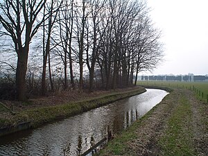
Run (stream)
River in Netherlands
Distance: Approx. 5872 meters
Latitude and longitude: 51.3995,5.4237
The Run is a stream in the Dutch province of North Brabant. It is a left tributary of the Dommel and part of the Meuse basin. The Run originates near the town of Weebosch and flows in a general northeast direction towards Veldhoven.
De Treeswijkhoeve
Restaurant in Waalre, Netherlands
Distance: Approx. 1981 meters
Latitude and longitude: 51.37266667,5.46712222
De Treeswijkhoeve is a restaurant in Waalre in the Netherlands. It is a fine dining restaurant that was awarded one Michelin star in the period 2006–2012. The restaurant has been awarded two Michelin stars since 2013.

Aalstermolen
Windmill in the Netherlands
Distance: Approx. 4594 meters
Latitude and longitude: 51.396128,5.471814
The Aalstermolen (English: Aalster Mill) is a windmill located on the Raadhuisstraat 28A in Aalst, Waalre, in the province of North Brabant, Netherlands. Built in 1904 on an artificial hill, the windmill functioned as gristmill. The mill was built as a tower mill and its sails have a span of 25.70 meters.

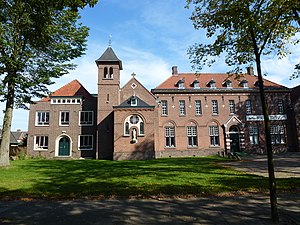
Valkenswaard War Cemetery
WWII CWGC cemetery in The Netherlands
Distance: Approx. 979 meters
Latitude and longitude: 51.34944444,5.45777778
Valkenswaard war cemetery is a Second World War military war grave cemetery, located in the village of Valkenswaard, 12 km (7.5 mi) south of Eindhoven in The Netherlands. It contains British soldiers killed during the Allied push into the Netherlands during the autumn and winter of 1944. 216 identified British service personnel are interred in the cemetery and a further four are unidentified.
Weather in this IP's area
light rain
14 Celsius
13 Celsius
13 Celsius
15 Celsius
1018 hPa
68 %
1018 hPa
1015 hPa
10000 meters
4.12 m/s
170 degree
100 %
08:10:41
18:34:42