86.105.110.178 - IP Lookup: Free IP Address Lookup, Postal Code Lookup, IP Location Lookup, IP ASN, Public IP
Country:
Region:
City:
Location:
Time Zone:
Postal Code:
ISP:
ASN:
language:
User-Agent:
Proxy IP:
Blacklist:
IP information under different IP Channel
ip-api
Country
Region
City
ASN
Time Zone
ISP
Blacklist
Proxy
Latitude
Longitude
Postal
Route
db-ip
Country
Region
City
ASN
Time Zone
ISP
Blacklist
Proxy
Latitude
Longitude
Postal
Route
IPinfo
Country
Region
City
ASN
Time Zone
ISP
Blacklist
Proxy
Latitude
Longitude
Postal
Route
IP2Location
86.105.110.178Country
Region
teleorman
City
traian
Time Zone
Europe/Bucharest
ISP
Language
User-Agent
Latitude
Longitude
Postal
ipdata
Country
Region
City
ASN
Time Zone
ISP
Blacklist
Proxy
Latitude
Longitude
Postal
Route
Popular places and events near this IP address

Seaca, Teleorman
Commune in Teleorman, Romania
Distance: Approx. 5673 meters
Latitude and longitude: 43.75,25.06666667
Seaca is a commune in Teleorman County, Muntenia, Romania, about 15 km east of Turnu Măgurele and 10 km north of the Danube River. Its population is about 2,500 people. It is composed of two villages, Năvodari and Seaca.

Ciuperceni, Teleorman
Commune in Teleorman, Romania
Distance: Approx. 4020 meters
Latitude and longitude: 43.76666667,24.95
Ciuperceni is a commune in Teleorman County, Muntenia, Romania. It is composed of two villages, Ciuperceni and Poiana.

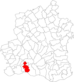
Traian, Teleorman
Commune in Teleorman, Romania
Distance: Approx. 4 meters
Latitude and longitude: 43.76666667,25
Traian is a commune in Teleorman County, Muntenia, Romania. It is composed of a single village, Traian. The commune is located in the southern part of the county, on the left bank of the Danube.
Castra of Poiana
Fort in the Roman province of Dacia
Distance: Approx. 4037 meters
Latitude and longitude: 43.7323,24.9841
The castra of Poiana was a fort in the Roman province of Dacia near the present town of Poiana (previously Flamanda) . It was built in the 2nd century AD and abandoned in the next century. It was a part of the Limes Transalutanus frontier system and situated at the southern end next to the Danube (and a presumed crossing point).
Weather in this IP's area
overcast clouds
10 Celsius
9 Celsius
10 Celsius
10 Celsius
1017 hPa
65 %
1017 hPa
1009 hPa
10000 meters
1.86 m/s
1.86 m/s
93 degree
100 %