85.90.123.159 - IP Lookup: Free IP Address Lookup, Postal Code Lookup, IP Location Lookup, IP ASN, Public IP
Country:
 Russian Federation
Region:
City:
Location:
Time Zone:
Postal Code:
ISP:
ASN:
language:
User-Agent:
Proxy IP:
Blacklist:
IP information under different IP Channel
ip-api
Country
Region
City
ASN
Time Zone
ISP
Blacklist
Proxy
Latitude
Longitude
Postal
Route
db-ip
Country
Region
City
ASN
Time Zone
ISP
Blacklist
Proxy
Latitude
Longitude
Postal
Route
IPinfo
Country
Region
City
ASN
Time Zone
ISP
Blacklist
Proxy
Latitude
Longitude
Postal
Route
IP2Location
85.90.123.159Country
ruRegion
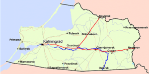
kaliningradskaya oblast'
City
yantarnyy
Time Zone
Europe/Kaliningrad
ISP
Language
User-Agent
Latitude
Longitude
Postal
ipdata
Country
Region
City
ASN
Time Zone
ISP
Blacklist
Proxy
Latitude
Longitude
Postal
Route
Popular places and events near this IP address

German submarine U-2 (1935)
German World War II submarine
Distance: Approx. 8042 meters
Latitude and longitude: 54.8,19.917
German submarine U-2 was a Type IIA U-boat of Nazi Germany's Kriegsmarine. Her keel was laid down 11 February 1935 by Deutsche Werke of Kiel as yard number 237; she was launched on 1 July and commissioned on 25 July 1935 with Oberleutnant zur See (Oblt.z.S.) Hermann Michahelles in command.

Yantarny, Kaliningrad Oblast
Urban-type settlement in Kaliningrad Oblast, Russia
Distance: Approx. 792 meters
Latitude and longitude: 54.86666667,19.95
Yantarny (Russian: ; German: ; Polish: Palmniki; Lithuanian: Palvininkai) is an urban locality (an urban-type settlement) in Kaliningrad Oblast, Russia, located on the Sambian Peninsula, about 40 kilometers (25 mi) from Kaliningrad, the administrative center of the oblast. Population: 5,524 (2010 Census); 5,455 (2002 Census); 4,948 (1989 Soviet census).

Donskoye (air base)
Distance: Approx. 7852 meters
Latitude and longitude: 54.93666667,19.985
Donskoye (also Bryusterort or Donskoe) is an air base in Kaliningrad Oblast, Russia, located 1 km east of Donskoye. The base is home to the 72nd Guards Aviation Base. It probably dates back to World War II, and is located nearly at Russia's most extreme western point.
Amber Coast
Distance: Approx. 5170 meters
Latitude and longitude: 54.827,19.966
The Amber Coast is the name given to a coastal strip of the Baltic Sea in the northwest of Kaliningrad (Russia, Kaliningrad Oblast, Sambia Peninsula, formerly northern East Prussia in Germany). In this area amber (Baltic amber) has been excavated since the mid-19th century and up to today in open-pit mining. Two deposits – Palmnikenskoe and Primorskoe, containing 80% of world amber reserves, were found near Yantarny on the Western coast of the Sambia Peninsula in 1948-1951’s.
Primorye, Kaliningrad Oblast
Settlement in Kaliningrad Oblast, Russia
Distance: Approx. 9870 meters
Latitude and longitude: 54.94166667,20.03333333
Primorye (Russian: Примо́рье) before 1946 known as Groß Kuhren (Lithuanian: Didieji Kuršiai) is an urban locality (an urban-type settlement) in Svetlogorsky District of Kaliningrad Oblast, Russia. Population: 954 (2010 Census); 848 (2002 Census); 705 (1989 Soviet census).
Weather in this IP's area
overcast clouds
2 Celsius
-4 Celsius
2 Celsius
2 Celsius
1024 hPa
67 %
1024 hPa
1023 hPa
10000 meters
7.02 m/s
8.23 m/s
313 degree
90 %