85.89.14.166 - IP Lookup: Free IP Address Lookup, Postal Code Lookup, IP Location Lookup, IP ASN, Public IP
Country:
Region:
City:
Location:
Time Zone:
Postal Code:
IP information under different IP Channel
ip-api
Country
Region
City
ASN
Time Zone
ISP
Blacklist
Proxy
Latitude
Longitude
Postal
Route
Luminati
Country
Region
50
City
levanger
ASN
Time Zone
Europe/Oslo
ISP
Nte Telekom As
Latitude
Longitude
Postal
IPinfo
Country
Region
City
ASN
Time Zone
ISP
Blacklist
Proxy
Latitude
Longitude
Postal
Route
IP2Location
85.89.14.166Country
Region
trondelag
City
skogn
Time Zone
Europe/Oslo
ISP
Language
User-Agent
Latitude
Longitude
Postal
db-ip
Country
Region
City
ASN
Time Zone
ISP
Blacklist
Proxy
Latitude
Longitude
Postal
Route
ipdata
Country
Region
City
ASN
Time Zone
ISP
Blacklist
Proxy
Latitude
Longitude
Postal
Route
Popular places and events near this IP address
Levanger Municipality
Municipality in Trøndelag, Norway
Distance: Approx. 5853 meters
Latitude and longitude: 63.65472222,11.26027778
Levanger is a municipality in Trøndelag county, Norway. It is part of the district of Innherred. The administrative centre of the municipality is the town of Levanger.
Momarka
Village in Levanger Municipality, Norway
Distance: Approx. 5160 meters
Latitude and longitude: 63.7276,11.2841
Momarka is a village in Levanger Municipality in Trøndelag county, Norway. It is located just south of the town of Levanger. The Nordlandsbanen railway line and the European route E6 highway both run through the village.
Nesset, Levanger
Village in Levanger Municipality, Norway
Distance: Approx. 5440 meters
Latitude and longitude: 63.7444,11.2461
Nesset is village area in Levanger Municipality in Trøndelag county, Norway. It is located on a peninsula in the Trondheimsfjord just west of the town of Levanger, and north of Alstadhaug. Bamberg Church is located in Nesset.
Norske Skog Skogn
Pulp and paper mill in Levanger, Norway
Distance: Approx. 2282 meters
Latitude and longitude: 63.71111111,11.16111111
Norske Skog Skogn AS is a pulp mill and paper mill situated in Levanger Municipality, Norway, which produces newsprint. Situated on the Fiborgtangen peninsula in Skogn, the mill has three paper machines with a total annual capacity of 600,000 tonnes. Pulp is produced both from virgin fibers at an on-site thermomechanical pulp (TMP) mill and from recycled paper at a deinking (DIP) mill.
Skogn
Village in Levanger Municipality, Norway
Distance: Approx. 550 meters
Latitude and longitude: 63.7037,11.1926
Skogn is a village in Levanger Municipality in Trøndelag county, Norway. The village is located on the eastern shore of the Trondheimsfjorden, about 8 kilometres (5.0 mi) southwest of the town of Levanger. The European route E06 highway runs through the village, just past the Fiborgtangen industrial area located along the shore.
Fiborgtangen
Industrial area in Levanger, Norway
Distance: Approx. 2888 meters
Latitude and longitude: 63.7153,11.1527
Fiborgtangen is a peninsula and industrial site located along Trondheimsfjord in the northwest part of the village of Skogn in Levanger Municipality in Trøndelag county, Norway. The 500-decare (0.50 km2; 0.19 sq mi) site hosts the paper mill Norske Skog Skogn and the associated port used to ship newsprint away from the plant. Fiborgtangen is also the site chosen by Industrikraft Midt-Norge to build a thermal power plant powered by natural gas.

Skogn Station
Railway station in Levanger, Norway
Distance: Approx. 630 meters
Latitude and longitude: 63.705057,11.194286
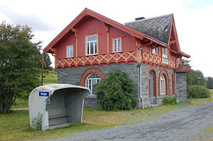
Skogn Station (Norwegian: Skogn stasjon) is a railway station located in the village of Skogn in Levanger Municipality in Trøndelag county, Norway. It is located on the Nordland Line railway line. The station is served hourly by the Trøndelag Commuter Rail service to Steinkjer and Trondheim.

Ronglan Station
Railway station in Levanger, Norway
Distance: Approx. 5700 meters
Latitude and longitude: 63.666313,11.113006
Ronglan Station (Norwegian: Ronglan stasjon) is a railway station located in the village of Ronglan in Levanger Municipality in Trøndelag county, Norway. It is located on the Nordland Line. The station is served irregularly by the Trøndelag Commuter Rail service to Steinkjer and Trondheim, with several services not stopping at Ronglan.

Ronglan
Village in Levanger Municipality, Norway
Distance: Approx. 5831 meters
Latitude and longitude: 63.6648,11.1125
Ronglan is a village in Levanger Municipality in Trøndelag county, Norway. It is located southwest of the village of Skogn and southeast of the village of Ekne. The European route E6 highway goes through the village.

Alstadhaug
Village in Levanger Municipality, Norway
Distance: Approx. 2932 meters
Latitude and longitude: 63.7239,11.225
Alstadhaug is small village in Levanger Municipality in Trøndelag county, Norway. It is located northeast of the village of Skogn, south of the village of Nesset, and west of the village of Momarka. The area is also a Church of Norway parish based at the Alstadhaug Church which is located in the village.

Alstadhaug Church
Church in Trøndelag, Norway
Distance: Approx. 2935 meters
Latitude and longitude: 63.72389485,11.22517079
Alstadhaug Church (Norwegian: Alstadhaug kirke) is a parish church of the Church of Norway in the village of Alstadhaug in Levanger Municipality in Trøndelag county. It is the church for the Alstadhaug parish, which is part of the Stiklestad prosti (deanery) in the Diocese of Nidaros. The church was built in a long church style during the 12th century by an unknown architect.

Skogn Municipality
Former municipality in Trøndelag, Norway
Distance: Approx. 664 meters
Latitude and longitude: 63.70083333,11.18666667
Skogn is a former municipality in the old Nord-Trøndelag county, Norway. The 340-square-kilometre (130 sq mi) municipality existed from 1838 until its dissolution in 1962. The municipality was located to the south and southwest of the town of Levanger in what is now Levanger Municipality in Trøndelag county.
Weather in this IP's area
few clouds
-14 Celsius
-19 Celsius
-14 Celsius
-14 Celsius
1000 hPa
89 %
1000 hPa
992 hPa
10000 meters
2.02 m/s
2.38 m/s
79 degree
23 %

