85.254.74.26 - IP Lookup: Free IP Address Lookup, Postal Code Lookup, IP Location Lookup, IP ASN, Public IP
Country:
Region:
City:
Location:
Time Zone:
Postal Code:
IP information under different IP Channel
ip-api
Country
Region
City
ASN
Time Zone
ISP
Blacklist
Proxy
Latitude
Longitude
Postal
Route
Luminati
Country
Region
rix
City
riga
ASN
Time Zone
Europe/Riga
ISP
UAB Bite Lietuva
Latitude
Longitude
Postal
IPinfo
Country
Region
City
ASN
Time Zone
ISP
Blacklist
Proxy
Latitude
Longitude
Postal
Route
IP2Location
85.254.74.26Country
Region
dobeles novads
City
dobele
Time Zone
Europe/Riga
ISP
Language
User-Agent
Latitude
Longitude
Postal
db-ip
Country
Region
City
ASN
Time Zone
ISP
Blacklist
Proxy
Latitude
Longitude
Postal
Route
ipdata
Country
Region
City
ASN
Time Zone
ISP
Blacklist
Proxy
Latitude
Longitude
Postal
Route
Popular places and events near this IP address

Dobele
Town in Latvia
Distance: Approx. 1181 meters
Latitude and longitude: 56.61666667,23.26666667
Dobele (; German: Doblen) is a town in the cultural region Zemgale in Latvia, and is located near the center of Latvia on the banks of the river Bērze. It received town rights in 1917 whilst being a part of the German occupied Courland Governorate during the First World War. As of 2020, the population was 8,856.

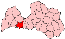
Dobele District
District of Latvia
Distance: Approx. 1181 meters
Latitude and longitude: 56.61666667,23.26666667
Dobele District (Latvian: Dobeles rajons) was an administrative division of Latvia, located in the Courland and Semigallia regions, in the country's centre. It was organized into two cities, a municipality and fifteen parishes, each with a local government authority. The main city in the district was Dobele.
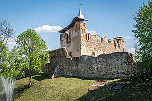
Dobele Castle
Castle in Latvia
Distance: Approx. 477 meters
Latitude and longitude: 56.622171,23.272757
Dobele Castle (Latvian: Dobeles pils, German: Ordensburg Doblen) is a castle in the town of Dobele in the historical region of Zemgale, Latvia. The Livonian order built the castle on the west bank of the Berze river in 1335, on the site of an old hillfort.
Liepziedi
Village in Latvia
Distance: Approx. 858 meters
Latitude and longitude: 56.62347778,23.26487222
Liepziedi is a village in the Auri Parish of the Dobele Municipality. It is located in the historical region of Zemgale, and the Zemgale Planning Region in Latvia.
Lielbērze
Village in Latvia
Distance: Approx. 3288 meters
Latitude and longitude: 56.65,23.25
Lielbērze is a village in Auri Parish and Dobele Municipality in the historical region of Zemgale, and the Zemgale Planning Region in Latvia.
Bērzkrasti
Village in Latvia
Distance: Approx. 2798 meters
Latitude and longitude: 56.6,23.28333333
Bērzkrasti is a village in Auri Parish and Dobele Municipality in the historical region of Zemgale, and the Zemgale Planning Region in Latvia.
Miltiņi
Village in Latvia
Distance: Approx. 3477 meters
Latitude and longitude: 56.63333333,23.33333333
Miltiņi is a village in Bērze Parish and Dobele Municipality in the historical region of Zemgale, and the Zemgale Planning Region in Latvia.
Ceriņi
Village in Latvia
Distance: Approx. 1912 meters
Latitude and longitude: 56.6125,23.3
Ceriņi is a village in Krimūna Parish and Dobele Municipality in the historical region of Zemgale, and the Zemgale Planning Region in Latvia.
Lauciņi
Village in Latvia
Distance: Approx. 1208 meters
Latitude and longitude: 56.62,23.2961
Lauciņi is a village in Krimūna Parish and Dobele Municipality in the historical region of Zemgale, and the Zemgale Planning Region in Latvia.
Parūķis
Village in Latvia
Distance: Approx. 2618 meters
Latitude and longitude: 56.605,23.3011
Parūķis is a village in Krimūna Parish and Dobele Municipality in the historical region of Zemgale, and the Zemgale Planning Region in Latvia.
Dobele Station
Railway station in Latvia
Distance: Approx. 544 meters
Latitude and longitude: 56.62864444,23.28451111
Dobele Station is a railway station on the Jelgava – Liepāja Railway.

Dobele State Gymnasium
School in Latvia
Distance: Approx. 593 meters
Latitude and longitude: 56.62,23.27527778
Dobele State Gymnasium ((Latvian: Dobeles Valsts ģimnāzija)) is a gymnasium (a pre-university high school) in Dobele, Latvia, founded in 1922. The official language of the school is Latvian, and students can also study English, Russian, and German. Students in grades 10 - 12 concentrate on either Mathematics and Science, Humanities, or Business and Commerce.
Weather in this IP's area
overcast clouds
3 Celsius
1 Celsius
3 Celsius
3 Celsius
1015 hPa
76 %
1015 hPa
1010 hPa
10000 meters
2.31 m/s
5.49 m/s
236 degree
100 %

