Country:
Region:
City:
Latitude and Longitude:
Time Zone:
Postal Code:
IP information under different IP Channel
ip-api
Country
Region
City
ASN
Time Zone
ISP
Blacklist
Proxy
Latitude
Longitude
Postal
Route
Luminati
Country
Region
tc
City
povazskabystrica
ASN
Time Zone
Europe/Bratislava
ISP
SWAN, a.s.
Latitude
Longitude
Postal
IPinfo
Country
Region
City
ASN
Time Zone
ISP
Blacklist
Proxy
Latitude
Longitude
Postal
Route
db-ip
Country
Region
City
ASN
Time Zone
ISP
Blacklist
Proxy
Latitude
Longitude
Postal
Route
ipdata
Country
Region
City
ASN
Time Zone
ISP
Blacklist
Proxy
Latitude
Longitude
Postal
Route
Popular places and events near this IP address

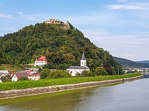
Považská Bystrica
Place in Trenčín region, Slovakia
Distance: Approx. 1810 meters
Latitude and longitude: 49.11388889,18.44166667
Považská Bystrica (Slovak pronunciation: [ˈpɔʋaʂskaː ˈbistritsa] ; German: Waagbistritz; Hungarian: Vágbeszterce) is a town in northwestern Slovakia. It is located on the Váh river, around 30 km from the city of Žilina. It belongs to Upper Váh region of tourism.

Považská Bystrica District
District in Trenčín Region, Slovakia
Distance: Approx. 1954 meters
Latitude and longitude: 49.11722222,18.44833333
Považská Bystrica District (Slovak: okres Považská Bystrica, pronounced [ˈɔkres ˈpɔʋaʂskaː ˈbistritsa]; Hungarian: Vágbesztercei járás) is a district in the Trenčín Region of western Slovakia. Until 1918, the district was part of the county of Kingdom of Hungary of Trencsén.

Udiča
Municipality in Slovakia
Distance: Approx. 4882 meters
Latitude and longitude: 49.16666667,18.4
Udiča (Hungarian: Váguda) is a village and municipality in Považská Bystrica District in the Trenčín Region of north-western Slovakia.

Vrtižer
Distance: Approx. 4038 meters
Latitude and longitude: 49.15,18.46666667
Vrtižer (Hungarian: Kisfarkasd) is a city part of Považská Bystrica, in the Považská Bystrica District, Trenčín Region, Slovakia. The Highway bridge of the D1 motorway between Vrtižer and Sverepec was opened to vehicle traffic 31 May 2010.

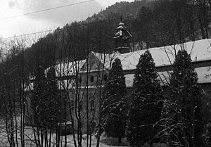
Chapel of Saint Helena, Slovakia
Distance: Approx. 2434 meters
Latitude and longitude: 49.1075,18.44291667
The Chapel of Saint Helena in Považská Bystrica, Slovakia, was built in 1728 in the Baroque style by Count Peter Szapáry. After it was built, it was robbed and badly damaged more than once, which led to a massive restoration effort in the 1990s. Today the chapel is located on a housing estate and is currently holding regular church services.

Burg Považská Bystrica
Manor-house in / , Slovakia
Distance: Approx. 3174 meters
Latitude and longitude: 49.14354,18.45945
Burg is a manor-house underneath the castle Považský hrad, on the south. Order to build the manor was given by Simon Balassa. Building works on the manor started in the first third of the 17th century and were finished 1631, when family moved from Castle.

Manor Povazske Podhradie
Manor-house in / , Slovakia
Distance: Approx. 3283 meters
Latitude and longitude: 49.144,18.4608
Szapáry castle is a manor house on the east, lower from Burg and below the castle Považský hrad in Považská Bystrica municipality. Built was in 1676 probably by the Hungarian nobleman Péter Szapáry. In the interior of the manor was a chapel and school used by common people from the neighbourhood.

Kalvaria Povazska Bystrica
Church property in Považská Bystrica, Slovakia
Distance: Approx. 2847 meters
Latitude and longitude: 49.11373611,18.45939167
Kalvaria Považská Bystrica (Slovak pronunciation: [ˈkalʋarɪɐ ˈpɔʋaʂskaː ˈbistritsa] is a collection of fourteen buildings, of which thirteen are chapels, situated in Slovakia depicting the journey of Jesus Christ through to his crucifixion.

Viaduct Považská Bystrica
Bridge in Považská Bystrica, Slovakia
Distance: Approx. 1009 meters
Latitude and longitude: 49.12333333,18.43833333
Estakáda Považská Bystrica (working name: Most 206) is an extradosed bridge leading across the narrowest part of Považská Bystrica in Slovakia.

Dolný Moštenec
Distance: Approx. 4449 meters
Latitude and longitude: 49.0879,18.44353
Dolný Moštenec is a town section of Považská Bystrica District in the Trenčín Region of north-western Slovakia.

Orlove
Distance: Approx. 1013 meters
Latitude and longitude: 49.13333333,18.43333333
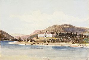
Orlové (Hungarian: Vágzsigmondháza) is a part of the city Považská Bystrica in northwestern Slovakia. It joined the city in 1971. In Orlove is situated a manor house from 1612 inside of it Kaplnka sv.
Štadión MŠK Považská Bystrica
Distance: Approx. 1040 meters
Latitude and longitude: 49.11694444,18.42861111
Štadión MŠK is a multi-use stadium in Považská Bystrica, Slovakia. It is currently used mostly for football matches and is the home ground of MŠK Považská Bystrica. The stadium is now in reconstruction since 2021.
Weather in this IP's area
mist
2 Celsius
2 Celsius
1 Celsius
3 Celsius
1027 hPa
100 %
1027 hPa
992 hPa
3000 meters
0.51 m/s
100 %
06:56:41
16:05:26