Country:
 Poland
Region:
City:
Latitude and Longitude:
Time Zone:
Postal Code:
IP information under different IP Channel
ip-api
Country
Region
City
ASN
Time Zone
ISP
Blacklist
Proxy
Latitude
Longitude
Postal
Route
IPinfo
Country
Region
City
ASN
Time Zone
ISP
Blacklist
Proxy
Latitude
Longitude
Postal
Route
MaxMind
Country
Region
City
ASN
Time Zone
ISP
Blacklist
Proxy
Latitude
Longitude
Postal
Route
Luminati
Country
PLRegion
02
City
wroclaw
ASN
Time Zone
Europe/Warsaw
ISP
KRUK S.A.
Latitude
Longitude
Postal
db-ip
Country
Region
City
ASN
Time Zone
ISP
Blacklist
Proxy
Latitude
Longitude
Postal
Route
ipdata
Country
Region
City
ASN
Time Zone
ISP
Blacklist
Proxy
Latitude
Longitude
Postal
Route
Popular places and events near this IP address

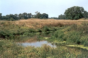
Ślęza
River in Poland
Distance: Approx. 1727 meters
Latitude and longitude: 51.1593,16.9505
The Ślęza (Polish: [ˈɕlɛ̃za]; German: Lohe) is a 78.6 km river in Lower Silesia, southern Poland, a left tributary of the Oder. It starts in the Niemcza Hills (Polish: Wzgórza Niemczańskie), part of the Sudeten Foreland (Przedgórze Sudeckie), and flows near Mount Ślęża through the Silesian Lowland (Nizina Śląska) and enters the Oder in Wrocław. The most important tributary is the Mała Ślęza ("Small Ślęza").

Fabryczna
Former borough in Wrocław, Poland
Distance: Approx. 5175 meters
Latitude and longitude: 51.119121,16.926234
Fabryczna (Polish pronunciation: [faˈbrɨt͡ʂna]) is a former borough of Wrocław located in the western part of the city. Before the changes in 1991, it was the largest district of Wrocław. On 21 March 1991, the newly created City Office of Wrocław assumed many of the functions previously carried out within the borough.
Widawa
River in Poland
Distance: Approx. 3773 meters
Latitude and longitude: 51.199,16.9187
The Widawa (German: Weide) is a river in Poland, a right-bank tributary of the Oder River. Towns along the Widawa include Namysłów, Bierutów, and Wrocław.

Wrocław Stadium
Stadium in Poland
Distance: Approx. 2937 meters
Latitude and longitude: 51.14116667,16.94377778
The Wrocław Stadium (Polish: Stadion Wrocław), known for sponsorship reasons as the Tarczyński Arena Wrocław since 2021, is a UEFA Category Four association football stadium built for the 2012 UEFA European Football Championship. The Stadium is located on aleja Śląska (English: Silesian Avenue) in the district of Fabryczna, Wrocław. It is the home stadium of the Śląsk Wrocław football team playing in the Polish Ekstraklasa.

Wilkszyn
Village in Lower Silesian Voivodeship, Poland
Distance: Approx. 5408 meters
Latitude and longitude: 51.19166667,16.8625
Wilkszyn [ˈvilkʂɨn] is a village in the administrative district of Gmina Miękinia, within Środa Śląska County, Lower Silesian Voivodeship, in south-western Poland. It lies approximately 8 kilometres (5 mi) north-east of Miękinia, 21 kilometres (13 mi) east of Środa Śląska, and 15 kilometres (9 mi) north-west of the regional capital Wrocław.

Kotowice, Trzebnica County
Village in Lower Silesian Voivodeship, Poland
Distance: Approx. 6506 meters
Latitude and longitude: 51.22388889,16.92111111
Kotowice [kɔtɔˈvit͡sɛ] is a village in the administrative district of Gmina Oborniki Śląskie, within Trzebnica County, Lower Silesian Voivodeship, in south-western Poland.

Paniowice
Village in Lower Silesian Voivodeship, Poland
Distance: Approx. 5298 meters
Latitude and longitude: 51.2125,16.94083333
Paniowice [paɲɔˈvit͡sɛ] is a village in the administrative district of Gmina Oborniki Śląskie, within Trzebnica County, Lower Silesian Voivodeship, in south-western Poland.
Szymanów, Trzebnica County
Village in Lower Silesian Voivodeship, Poland
Distance: Approx. 6786 meters
Latitude and longitude: 51.19472222,17.01333333
Szymanów (Polish: [ʂɨˈmanuf]) is a village in the administrative district of Gmina Wisznia Mała, within Trzebnica County, Lower Silesian Voivodeship, in south-western Poland. It lies approximately 13 kilometres (8 mi) south of Trzebnica, and 8 kilometres (5 mi) north of the regional capital Wrocław.

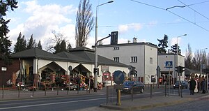
Hala Orbita
Distance: Approx. 5547 meters
Latitude and longitude: 51.13247222,16.98724444
Hala Orbita is a multi-purpose Indoor arena in Wrocław, Poland. It hosts the home games of Śląsk Wrocław basketball club, Śląsk Wrocław handball club and Gwardia Wrocław men's and women's volleyball clubs. It has a seating capacity for 3,000 people.
Osobowice Cemetery
Cemetery in Wroclaw, Poland
Distance: Approx. 6672 meters
Latitude and longitude: 51.13583333,17.01083333
The Osobowice Cemetery (German: Friedhof Oswitz) is a large municipal cemetery in Wrocław (the capital of the Lower Silesian Voivodeship), Poland. It is located along Osobowicka 47-59 Street. It covers the area of 52 hectares (130 acres).

Bystrzyca (Oder)
River in Poland
Distance: Approx. 3321 meters
Latitude and longitude: 51.194727,16.917614
The Bystrzyca is a river of Poland, a left tributary of the Oder, which it meets a few kilometers north (downstream) from Wrocław. The Bystrzyca was dammed in 1917 near the village of Lubachów to create Lake Lubachowskie, and dammed at Mietków in 1974 to create the large reservoir Zalew Mietkowski. The river also forms the western boundary of the Owl Mountains range in the Central Sudetes.

Stolberg Palace
Palace in Świniary, Wrocław, Poland
Distance: Approx. 5145 meters
Latitude and longitude: 51.1983,16.98
Stolberg Palace (Polish: Pałac Stolbergów) is a historic palace in Świniary, Wrocław, Poland.
Weather in this IP's area
light rain
17 Celsius
17 Celsius
17 Celsius
19 Celsius
1019 hPa
81 %
1019 hPa
1006 hPa
10000 meters
0.89 m/s
1.34 m/s
96 degree
100 %
06:29:26
19:04:53