Country:
 Poland
Region:
City:
Latitude and Longitude:
Time Zone:
Postal Code:
IP information under different IP Channel
ip-api
Country
Region
City
ASN
Time Zone
ISP
Blacklist
Proxy
Latitude
Longitude
Postal
Route
IPinfo
Country
Region
City
ASN
Time Zone
ISP
Blacklist
Proxy
Latitude
Longitude
Postal
Route
MaxMind
Country
Region
City
ASN
Time Zone
ISP
Blacklist
Proxy
Latitude
Longitude
Postal
Route
Luminati
Country
PLRegion
32
City
miedzyzdroje
ASN
Time Zone
Europe/Warsaw
ISP
T-Mobile Polska S.A.
Latitude
Longitude
Postal
db-ip
Country
Region
City
ASN
Time Zone
ISP
Blacklist
Proxy
Latitude
Longitude
Postal
Route
ipdata
Country
Region
City
ASN
Time Zone
ISP
Blacklist
Proxy
Latitude
Longitude
Postal
Route
Popular places and events near this IP address

Wolin
Name both of a Polish island and a town on it
Distance: Approx. 3759 meters
Latitude and longitude: 53.91666667,14.5
Wolin (Polish: [ˈvɔlin]; German: Wollin [vɔˈliːn]) is a Polish island in the Baltic Sea, just off the Polish coast. Administratively, the island belongs to the West Pomeranian Voivodeship. Wolin is separated from the island of Usedom (Uznam) by the Strait of Świna, and from mainland Pomerania by the Strait of Dziwna.

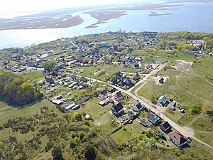
Międzyzdroje
Place in West Pomeranian Voivodeship, Poland
Distance: Approx. 480 meters
Latitude and longitude: 53.92694444,14.45055556
Międzyzdroje (pronounced ['mʲɛnd͡zɨˈzdrɔjɛ]; German: Misdroy), historically known as Misdroy in English, is a city and a seaside resort in northwestern Poland on the island of Wolin on the Baltic coast. The city is located in the West Pomeranian Voivodeship, and is a seat of the Kamień County and the municipality of Międzyzdroje. In 2016, it was inhabited by around 5,500 people.

Wolin National Park
National park in Poland
Distance: Approx. 1031 meters
Latitude and longitude: 53.93333333,14.45
Wolin National Park (Polish: Woliński Park Narodowy) is one of 23 national parks in Poland, situated on the island of Wolin in the far north-west of the country, in West Pomeranian Voivodeship. An IUCN category II protected area, it was established on 3 March 1960 and covers an area of 109.37 square kilometres (42.23 sq mi). The park has its headquarters in the town of Międzyzdroje.
Gmina Międzyzdroje
Gmina in West Pomeranian Voivodeship, Poland
Distance: Approx. 480 meters
Latitude and longitude: 53.92694444,14.45055556
Gmina Międzyzdroje or Gmina Misdroy is an urban-rural gmina (administrative district) in Kamień County, West Pomeranian Voivodeship, in north-western Poland. Its seat is the town of Międzyzdroje, which lies approximately 23 kilometres (14 mi) west of Kamień Pomorski and 58 km (36 mi) north of the regional capital Szczecin. The gmina covers an area of 117.17 square kilometres (45.2 sq mi), and as of 2006 its total population is 6,477 (out of which the population of Międzyzdroje amounts to 5,436, and the population of the rural part of the gmina is 1,041).
Lubin, Kamień County
Village in West Pomeranian Voivodeship, Poland
Distance: Approx. 6332 meters
Latitude and longitude: 53.86833333,14.43138889
Lubin (Polish: [ˈlubin]; German: Lebbin) is a village on the Wolin island in the administrative district of Gmina Międzyzdroje, within Kamień County, West Pomeranian Voivodeship, in north-western Poland. It lies approximately 7 kilometres (4 mi) south of Międzyzdroje, 26 km (16 mi) south-west of Kamień Pomorski, and 52 km (32 mi) north of the regional capital Szczecin. The village has a population of 340.
Trzciągowo
Village in West Pomeranian Voivodeship, Poland
Distance: Approx. 5164 meters
Latitude and longitude: 53.8795,14.462
Trzciągowo [tʂt͡ɕɔnˈɡɔvɔ] (German: Stengow) is a village in the administrative district of Gmina Międzyzdroje, within Kamień County, West Pomeranian Voivodeship, in north-western Poland. It lies approximately 7 kilometres (4 mi) south of Międzyzdroje, 25 km (16 mi) south-west of Kamień Pomorski, and 51 km (32 mi) north of the regional capital Szczecin.
Wapnica, Kamień County
Village in West Pomeranian Voivodeship, Poland
Distance: Approx. 5013 meters
Latitude and longitude: 53.88,14.435
Wapnica [vapˈnit͡sa] (German: Kalkofen) is a village in the administrative district of Gmina Międzyzdroje, within Kamień County, West Pomeranian Voivodeship, in north-western Poland. It lies approximately 6 kilometres (4 mi) south of Międzyzdroje, 25 km (16 mi) south-west of Kamień Pomorski, and 53 km (33 mi) north of the regional capital Szczecin. The village has a population of 350.
Wicko, West Pomeranian Voivodeship
Village in West Pomeranian Voivodeship, Poland
Distance: Approx. 3912 meters
Latitude and longitude: 53.88972222,14.43861111
Wicko [ˈvit͡skɔ] (German: Vietzig) is a village in the administrative district of Gmina Międzyzdroje, within Kamień County, West Pomeranian Voivodeship, in north-western Poland. It lies approximately 5 kilometres (3 mi) south of Międzyzdroje, 25 km (16 mi) west of Kamień Pomorski, and 54 km (34 mi) north of the regional capital Szczecin. For the history of the region, see History of Pomerania.
Zalesie, Kamień County
Village in West Pomeranian Voivodeship, Poland
Distance: Approx. 3021 meters
Latitude and longitude: 53.89805556,14.43555556
Zalesie ([zaˈlɛɕɛ]; German: Laatzig) is a village in the administrative district of Gmina Międzyzdroje, within Kamień County, West Pomeranian Voivodeship, in north-western Poland. It lies approximately 4 kilometres (2 mi) south of Międzyzdroje, 25 km (16 mi) west of Kamień Pomorski, and 55 km (34 mi) north of the regional capital Szczecin.
Warnowo, West Pomeranian Voivodeship
Village in West Pomeranian Voivodeship, Poland
Distance: Approx. 6736 meters
Latitude and longitude: 53.93166667,14.54638889
Warnowo [varˈnɔvɔ] (German Warnow) is a village in the administrative district of Gmina Wolin, within Kamień County, West Pomeranian Voivodeship, in north-western Poland. It lies approximately 11 kilometres (7 mi) north-west of Wolin, 17 km (11 mi) west of Kamień Pomorski, and 58 km (36 mi) north of the regional capital Szczecin. The village has a population of 340.

Biała Góra, Kamień County
Hamlet in West Pomeranian Voivodeship, Poland
Distance: Approx. 3227 meters
Latitude and longitude: 53.94611111,14.4775
Biała Góra is a hamlet in the West Pomeranian Voivodeship, Poland, located within the Gmina Międzyzdroje, Kamień County.

White Mountain (Wolin)
Hill in West Pomeranian Voivodeship, Poland
Distance: Approx. 3227 meters
Latitude and longitude: 53.94611111,14.4775
The White Mountain is a hill of the Wolin Range, located in the north-eastern part of the island of Wolin, in the West Pomeranian Voivodeship, Poland, within Gmina Międzyzdroje, Kamień County. Its height above mean sea level is 65 m (213.26 ft). To the southeast from the hill is located the hamlet of Biała Góra.
Weather in this IP's area
overcast clouds
17 Celsius
17 Celsius
17 Celsius
17 Celsius
1024 hPa
88 %
1024 hPa
1024 hPa
10000 meters
3.6 m/s
20 degree
100 %
06:37:44
19:16:27