Country:
Region:
City:
Latitude and Longitude:
Time Zone:
Postal Code:
IP information under different IP Channel
ip-api
Country
Region
City
ASN
Time Zone
ISP
Blacklist
Proxy
Latitude
Longitude
Postal
Route
Luminati
Country
Region
wal
City
anderlues
ASN
Time Zone
Europe/Brussels
ISP
Centre hospitalier universitaire de Tivoli - Institut medical des Mutualites socialistes
Latitude
Longitude
Postal
IPinfo
Country
Region
City
ASN
Time Zone
ISP
Blacklist
Proxy
Latitude
Longitude
Postal
Route
db-ip
Country
Region
City
ASN
Time Zone
ISP
Blacklist
Proxy
Latitude
Longitude
Postal
Route
ipdata
Country
Region
City
ASN
Time Zone
ISP
Blacklist
Proxy
Latitude
Longitude
Postal
Route
Popular places and events near this IP address
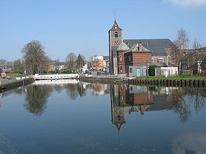
Manage, Belgium
Municipality in French community
Distance: Approx. 3500 meters
Latitude and longitude: 50.5,4.23333333
Manage (French pronunciation: [manaʒ] ; Walloon: Manadje) is a municipality of Wallonia located in the province of Hainaut, Belgium. On January 1, 2006, Manage had a total population of 22,341. The total area is 19.60 km2 which gives a population density of 1,140 inhabitants per km2.

La Louvière
City and municipality in Hainaut Province, Belgium
Distance: Approx. 2151 meters
Latitude and longitude: 50.46666667,4.18333333
La Louvière (French pronunciation: [la luvjɛʁ] ; Walloon: El Lovire) is a city and municipality of Wallonia located in the province of Hainaut, Belgium. The municipality consists of the following districts: Boussoit, Haine-Saint-Paul, Haine-Saint-Pierre, Houdeng-Aimeries, Houdeng-Gœgnies, La Louvière, Maurage, Saint-Vaast, Strépy-Bracquegnies, and Trivières. La Louvière is the capital of the Centre region, a former coal mining area in the Sillon industriel, between the Borinage to the West and the Pays Noir to the East.

Morlanwelz
Municipality in French community
Distance: Approx. 5039 meters
Latitude and longitude: 50.45,4.23333333
Morlanwelz (French pronunciation: [mɔʁlɑ̃we] ; Walloon: Marlanwé) is a municipality of Wallonia located in the province of Hainaut, Belgium. On 1 January 2006 Morlanwelz had a total population of 18,595. The total area is 20.26 km2 which gives a population density of 918 inhabitants per km2.

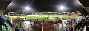
Stade du Tivoli
Distance: Approx. 1159 meters
Latitude and longitude: 50.478278,4.201026
The Stade Communal du Tivoli is a multi-use stadium in La Louvière, Belgium. It is currently used mostly for football matches. It was the home ground of R.A.A. Louviéroise.
Boat Lifts on the Canal du Centre
UNESCO World Heritage Site in Hainaut, Belgium
Distance: Approx. 3730 meters
Latitude and longitude: 50.48111111,4.13722222
The lifts on the Canal du Centre are a series of four hydraulic boat lifts near the town of La Louvière in Belgium which are classified as a World Heritage Site by UNESCO. All four are located on the Canal du Centre in Belgium's historic sillon industriel industrial belt.

Houdeng-Gœgnies
Distance: Approx. 2802 meters
Latitude and longitude: 50.48333333,4.15
Houdeng-Gœgnies (Walloon: Gôgnere) is a village of Wallonia and a district of the municipality of La Louvière, located in the province of Hainaut, Belgium.
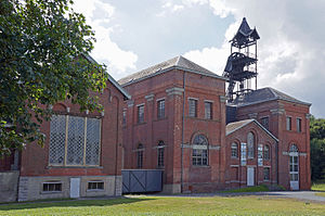
Bois-du-Luc
Ancient coal mine in Belgium
Distance: Approx. 3268 meters
Latitude and longitude: 50.470461,4.149881
The Bois-du-Luc was a coal mine in Houdeng-Aimeries, near La Louvière, in Belgium which today is preserved as an industrial heritage site. As well as the site of the headquarters of the Société des Charbonnages de Bois-du-Luc et d'Havre, the Bois du Luc was the site of the Saint Emmanuel Pit (Fosse Saint-Emmanuel) which belonged to the company. The Fosse Saint-Emmanuel was one of the oldest mines in Belgium, with recorded activity dating back to 1685.

Usine Gustave Boël
Steel works located in La Louvière, Belgium
Distance: Approx. 775 meters
Latitude and longitude: 50.482425,4.179665
The SA Usine Boel (Usines Gustave Boël, or UGB) was a steel works located in La Louvière, Belgium, founded in 1851 as Fonderies et Laminoirs Ernest Boucquéau. From 1880 the works became the property of Gustave Boël. After a failed acquisition by Koninklijke Hoogovens in 1997 the company became a subsidiary of Duferco in 1999, Duferco La Louvière.

Morlanwelz train collision and runaway
Distance: Approx. 4629 meters
Latitude and longitude: 50.4741,4.1266
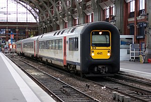
On 27 November 2017, a Belgian passenger train ran away during recovery operations following a collision at a level crossing. After 14 kilometres (8.7 mi), it collided with a stationary train at Strépy-Bracquegnies, killing two and injuring seven. The accident was caused by a failed coupling.

Trivières
Distance: Approx. 4841 meters
Latitude and longitude: 50.45111111,4.14777778
Trivières (Walloon: Triviere) is a village of Wallonia and a district of the municipality of La Louvière, located in the province of Hainaut, Belgium. It is located between Mons and Charleroi, about 35 miles (56 km) south of Brussels. It was a fully fledged municipality before the fusion of the Belgian municipalities.

Houdeng-Aimeries
Distance: Approx. 2802 meters
Latitude and longitude: 50.48333333,4.15
Houdeng-Aimeries (Walloon: Oudè) is a village of Wallonia and a district of the municipality of La Louvière, located in the province of Hainaut, Belgium. The village contains two UNESCO World Heritage sites; its 16.93 m high boat lift was listed in 1998, together with the other three hydraulic boat lifts on the Canal du Centre near La Louvière, and Bois-du-Luc is a former coal mine today preserved as one of the four Walloon mining sites listed in 2012 under the Major Mining Sites of Wallonia.

Château of Mariemont
Former royal residence in Mariemont, Belgium
Distance: Approx. 3957 meters
Latitude and longitude: 50.467,4.237
The Château of Mariemont (French: Château de Mariemont; Dutch: Kasteel van Mariemont) was a royal residence and hunting lodge for the governors of the Habsburg Netherlands. It was located in Mariemont, in today's village of Morlanwelz, Belgium. The château's construction started in the 16th century by order of Queen Mary of Hungary and it became a favoured residence in the 17th and 18th centuries.
Weather in this IP's area
broken clouds
9 Celsius
9 Celsius
8 Celsius
10 Celsius
1024 hPa
93 %
1024 hPa
1008 hPa
10000 meters
1.03 m/s
75 %
07:48:11
17:06:05


