Country:
 Romania
Region:
City:
Latitude and Longitude:
Time Zone:
Postal Code:
IP information under different IP Channel
ip-api
Country
Region
City
ASN
Time Zone
ISP
Blacklist
Proxy
Latitude
Longitude
Postal
Route
IPinfo
Country
Region
City
ASN
Time Zone
ISP
Blacklist
Proxy
Latitude
Longitude
Postal
Route
MaxMind
Country
Region
City
ASN
Time Zone
ISP
Blacklist
Proxy
Latitude
Longitude
Postal
Route
Luminati
Country
ROASN
Time Zone
Europe/Bucharest
ISP
Allnet Cloud Srl
Latitude
Longitude
Postal
db-ip
Country
Region
City
ASN
Time Zone
ISP
Blacklist
Proxy
Latitude
Longitude
Postal
Route
ipdata
Country
Region
City
ASN
Time Zone
ISP
Blacklist
Proxy
Latitude
Longitude
Postal
Route
Popular places and events near this IP address

Bucharest North railway station
Railway and metro station in Bucharest
Distance: Approx. 785 meters
Latitude and longitude: 44.44636667,26.07420833
Bucharest North railway station (Romanian: Gara București Nord; officially Bucharest North Group A; colloquially Gara de Nord) is the main railway station in Bucharest and the largest railway station in Romania. The vast majority of mainline trains to and from Bucharest originate from Gara de Nord.

Basarab metro station
Bucharest metro station
Distance: Approx. 209 meters
Latitude and longitude: 44.45073,26.06944
Basarab is a metro station in Bucharest. It is located near the Basarab railway station (Gara Basarab), which is part of Bucharest's main railway station, at the intersection of Calea Griviței and Nicolae Titulescu Avenue. Access to Gara Basarab proper (a small annex of Gara de Nord, used mainly for commuter trains) is possible via a tunnel crossing the 14 platforms and tracks of Gara de Nord.

Crângași
Neighborhood in Bucharest, Romania
Distance: Approx. 864 meters
Latitude and longitude: 44.46032222,26.07063611
Crângași is one of the smallest neighborhoods in the 6th Sector of Bucharest, Romania. It is situated on the west side of the city near the Dâmbovița River, where it flows into Lacul Morii. Its name means "people living in a young forest".

Basarab railway station
Railway station in Bucharest, Romania
Distance: Approx. 289 meters
Latitude and longitude: 44.45044167,26.067575
Basarab railway station (Romanian: Gara Basarab) in Bucharest is situated near the city's main station, Gara de Nord. Built in 1959 to handle a share of the main station's traffic and mainly used by short-distance commuter trains run by Căile Ferate Române, it is often considered to be an annex of Gara de Nord, to which it was linked by a footbridge, demolished in 2009 to make way for the Basarab Overpass. Basarab railway station is served directly by the Bucharest Metro system, via Basarab metro station.

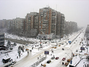
Sector 1 (Bucharest)
Sector in Municipality of Bucharest, Romania
Distance: Approx. 374 meters
Latitude and longitude: 44.45388889,26.07394444
Sector 1 is an administrative unit of Bucharest located in the northern part of the city. It contains also the northwestern districts of Băneasa and Pipera. Sector 1 is thought to be the wealthiest sector in Bucharest.
Sector 6 (Bucharest)
Sector in Municipality of Bucharest, Romania
Distance: Approx. 758 meters
Latitude and longitude: 44.44627778,26.06605556
Sector 6 (Romanian: Sectorul 6) is an administrative unit of Bucharest.

Podul Grant
Distance: Approx. 712 meters
Latitude and longitude: 44.45538611,26.06153889
Podul Grant (Grant Bridge) is a bridge that serves both motorway and lightrail transportation in Bucharest, Romania. It is named after Effingham Grant, the British consul in Bucharest during the mid-19th century. Initially, the bridge was made of steel, and opened in 1910.

Gara de Nord metro station
Metro station in Bucharest, Romania
Distance: Approx. 806 meters
Latitude and longitude: 44.44722222,26.07638889
Gara de Nord is the name of two separate metro stations, situated near Gara de Nord train station in Bucharest and serving lines M1 and M4. Neither of the metro stations nor the railway station are interconnected, passengers being required to use the next station (Basarab) to switch from M1 to M4 directly, without having to validate a ticket. The first station was opened on 24 December 1987 as the eastern terminus on an extension from Crângași.

Bucharest Tower Center
Class A office building in Bucharest
Distance: Approx. 948 meters
Latitude and longitude: 44.45448,26.08124
Tower Center International is a class A office building in Bucharest. It has 26 floors, with a total of 31,000 m2 (330,000 sq ft) floor space. It is located near Victory Square, or 1 Mai zone.

Premium Plaza
Office building in Bucharest, Romania
Distance: Approx. 719 meters
Latitude and longitude: 44.4519,26.0786
Premium Plaza is a class A office building located in the city of Bucharest, Romania. The building was opened in 2007. It stands at a height of 64 meters and has 15 floors, with a net area of 8,645 m2.
Basarab Tower
Distance: Approx. 737 meters
Latitude and longitude: 44.45208,26.06036
Basarab Tower was an elevator testing building in Bucharest built between 1986 and 1988. It had 23 floors and measured 114 meters. The surface of a level was 400 square meters.
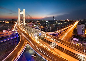
Basarab Overpass
Bridge in Bucharest, Romania
Distance: Approx. 377 meters
Latitude and longitude: 44.44945,26.06785
The Basarab Overpass (Romanian: Pasajul Basarab) is a road overpass in Bucharest, Romania, connecting Nicolae Titulescu blvd. and Grozăvești Road, part of Bucharest's inner city ring. A design by engineer Javier Manterola, its construction was undertaken by FCC and Astaldi.
Weather in this IP's area
clear sky
8 Celsius
8 Celsius
6 Celsius
8 Celsius
1027 hPa
60 %
1027 hPa
1017 hPa
10000 meters
0.89 m/s
2.24 m/s
07:34:41
18:26:38