85.184.227.170 - IP Lookup: Free IP Address Lookup, Postal Code Lookup, IP Location Lookup, IP ASN, Public IP
Country:
Region:
City:
Location:
Time Zone:
Postal Code:
IP information under different IP Channel
ip-api
Country
Region
City
ASN
Time Zone
ISP
Blacklist
Proxy
Latitude
Longitude
Postal
Route
Luminati
Country
Region
ct
City
lescala
ASN
Time Zone
Europe/Madrid
ISP
Prisco Electronica S.L.
Latitude
Longitude
Postal
IPinfo
Country
Region
City
ASN
Time Zone
ISP
Blacklist
Proxy
Latitude
Longitude
Postal
Route
IP2Location
85.184.227.170Country
Region
catalunya
City
l'escala
Time Zone
Europe/Madrid
ISP
Language
User-Agent
Latitude
Longitude
Postal
db-ip
Country
Region
City
ASN
Time Zone
ISP
Blacklist
Proxy
Latitude
Longitude
Postal
Route
ipdata
Country
Region
City
ASN
Time Zone
ISP
Blacklist
Proxy
Latitude
Longitude
Postal
Route
Popular places and events near this IP address
Empúries
Ancient city on the Mediterranean coast in the south-east of the Iberian Peninsula
Distance: Approx. 1421 meters
Latitude and longitude: 42.13472222,3.12055556
Empúries (Catalan: Empúries [əmˈpuɾiəs]) was an ancient Greek city on the Mediterranean coast of Catalonia, Spain. The city Ἐμπόριον (Greek: Ἐμπόριον, Emporion, meaning "trading place", cf. emporion) was founded in 575 BC by Greeks from Phocaea.

Empordà
Natural region
Distance: Approx. 6979 meters
Latitude and longitude: 42.08194444,3.07194444
Empordà (Catalan: [əmpuɾˈða]; Spanish: Ampurdán [ampuɾˈðan]) is a natural and historical region of Catalonia, Spain, divided since 1936 into two comarques, Alt Empordà and Baix Empordà. The city of Figueres, an important urban and economic center of the Empordà, was designated the capital of Alt Empordà, while La Bisbal d'Empordà, following a more geographic and historical criteria, became the capital of Baix Empordà. Empordà has been the cradle for many pictoric schools, with surrealism standing out, including artists such as Salvador Dalí, Angel Planells, Joan Massanet and Evarist Vallès.

L'Escala
Municipality in Catalonia, Spain
Distance: Approx. 1395 meters
Latitude and longitude: 42.114,3.139
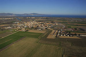
L'Escala (Catalan pronunciation: [ləsˈkalə]) is a municipality in the comarca of the Alt Empordà in Girona, Catalonia, Spain. It is situated on the Costa Brava, located between the southern end of the Gulf of Roses and Cala (bay) Montgó. It is an important fishing port and tourist centre, and has a festival dedicated to its famous anchovies.

Gulf of Roses
Distance: Approx. 7624 meters
Latitude and longitude: 42.183,3.183
The Gulf of Roses (Catalan: Golf de Roses [ˈɡolv ðə ˈrɔzəs]) is the most northeastern bay on the Catalan coast of Spain. The bay is 16 kilometres (10 mi) wide and is formed by the valley of the Fluvià river but also contains the estuaries of the Manol and the Muga rivers. These rivers drain the southern flanks of the eastern end of the Pyrenees and Alberes.

Sant Pere Pescador
Municipality in Catalonia, Spain
Distance: Approx. 8134 meters
Latitude and longitude: 42.18888889,3.08333333
Sant Pere Pescador (Catalan pronunciation: [ˈsam ˈpeɾə pəskəˈðo]) is a municipality in the comarca of Alt Empordà, Girona, Catalonia, Spain, is a small town in the Bay of Roses on the river Fluvià, on the coastline of the Costa Brava. The town has the benefit of a sandy 7 km long beach. The first reference to the town dates from 974 when it was owned by the monastery of Sant Pere de Rodes part of the County of Empúries.

Viladamat
Municipality in Catalonia, Spain
Distance: Approx. 4788 meters
Latitude and longitude: 42.135,3.076
Viladamat (Catalan pronunciation: [ˌbiləðəˈmat]) is a village of Alt Empordà, 6 kilometers to the north from l'Escala, a municipality in Catalonia, Spain.
L'Armentera
Municipality in Catalonia, Spain
Distance: Approx. 7131 meters
Latitude and longitude: 42.174,3.076
L'Armentera (Catalan pronunciation: [ləɾmənˈteɾə]) is a municipality in the comarca of Alt Empordà, Girona, Catalonia, Spain, on the coastline of the Costa Brava.
Montgrí Massif
Mountain range in Spain
Distance: Approx. 7183 meters
Latitude and longitude: 42.06166667,3.12083333
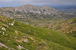
The Montgrí (Catalan pronunciation: [muŋˈɡɾi]) is a small mountain range in Catalonia, on the north bank of the Ter river. It is part of the Catalan Coastal Range and its highest point is 311 m.

Montgrí Castle
Distance: Approx. 8216 meters
Latitude and longitude: 42.0518,3.13134
The Montgrí Castle (Catalan: Castell del Montgrí) is a historical edifice in Torroella de Montgrí, Catalonia, Spain, built between 1294 and 1301. Its reason to be was the existing conflict between the counts of Empúries - who ruled over most of the area around the town - and the counts of Barcelona, the most powerful of Catalonia at that time, who also had great power over the Mediterranean. In order to control the moves of the counts of Empuriés, the court of Barcelona commanded Bernat de Llabià, the governor of the Royal town of Torroella de Montgrí, to supervise the building of a fortress on top of the Montgrí Massif.

Bellcaire d'Empordà
Municipality in Catalonia, Spain
Distance: Approx. 5824 meters
Latitude and longitude: 42.08083333,3.09611111
Bellcaire d'Empordà (Catalan pronunciation: [ˌbeʎˈkajɾə ðəmpuɾˈða]) is a municipality in the comarca of Baix Empordà, in Catalonia, Spain. The municipality covers an area of 12.68 square kilometres (4.90 sq mi) and the population in 2014 was 650.

Empúries Marathon
Distance: Approx. 1296 meters
Latitude and longitude: 42.1336,3.1212
The Empúries Marathon (Catalan: Marató d'Empúries) is a long-distance run (42.195 km) which takes place in Empúries, the ancient Greek and Roman colony, next Sant Martí d'Empúries and L'Escala in Girona (Catalonia). The first edition of the marathon was held in 2003 to mark the collaboration of the City of L'Escala with the Universal Forum of Cultures in Barcelona 2004. Organized by the L'Escala Town Council and with the support of the Catalan Athletics Federation, the Empúries Marathon is held annually in the month of April or May, along with two additional athletics races: the half-marathon and 10,000-meter race.

Anchovy and Salt Museum
Museum in L'Escala, Catalonia, Spain
Distance: Approx. 532 meters
Latitude and longitude: 42.12577778,3.12616667
Anchovy and Salt Museum is a museum in the town of L'Escala, Catalonia, Spain. It was opened in 2006 as an institution dedicated to displaying the cultural heritage of the village. The permanent exhibition shows the history of fishing from the 16th century to the present day, especially the salted anchovy, an industry which, over the centuries, has been driving force of the town and has made it famous around the world.
Weather in this IP's area
clear sky
10 Celsius
7 Celsius
9 Celsius
11 Celsius
1030 hPa
36 %
1030 hPa
1025 hPa
10000 meters
7.65 m/s
12.2 m/s
1 degree


