85.184.224.78 - IP Lookup: Free IP Address Lookup, Postal Code Lookup, IP Location Lookup, IP ASN, Public IP
Country:
Region:
City:
Location:
Time Zone:
Postal Code:
IP information under different IP Channel
ip-api
Country
Region
City
ASN
Time Zone
ISP
Blacklist
Proxy
Latitude
Longitude
Postal
Route
Luminati
Country
Region
ct
City
lescala
ASN
Time Zone
Europe/Madrid
ISP
Prisco Electronica S.L.
Latitude
Longitude
Postal
IPinfo
Country
Region
City
ASN
Time Zone
ISP
Blacklist
Proxy
Latitude
Longitude
Postal
Route
IP2Location
85.184.224.78Country
Region
catalunya
City
roses
Time Zone
Europe/Madrid
ISP
Language
User-Agent
Latitude
Longitude
Postal
db-ip
Country
Region
City
ASN
Time Zone
ISP
Blacklist
Proxy
Latitude
Longitude
Postal
Route
ipdata
Country
Region
City
ASN
Time Zone
ISP
Blacklist
Proxy
Latitude
Longitude
Postal
Route
Popular places and events near this IP address

Roses, Spain
Municipality in Catalonia, Spain
Distance: Approx. 521 meters
Latitude and longitude: 42.26305556,3.18305556
Roses (Catalan pronunciation: [ˈrɔzəs]; Spanish: Rosas, [ˈrosas]) is a municipality in the comarca of the Alt Empordà, located on the Costa Brava, Catalonia, Spain. Roses is the site of the former bishopric of Rotdon, now a Latin Catholic titular see. It is situated on the coast at the northern end of the Gulf of Roses, and is an important fishing port and tourist centre.

El Bulli
Restaurant in Roses, Spain
Distance: Approx. 4291 meters
Latitude and longitude: 42.25,3.22638889
El Bulli (Catalan pronunciation: [əl ˈβuʎi]) was a restaurant near the town of Roses, Spain, run by chef Ferran Adrià, later joined by Albert Adrià, and renowned for its modernist cuisine. Established in 1964, the restaurant overlooked Cala Montjoi, a bay on the Costa Brava of Catalonia. El Bulli held three Michelin stars and was described as "the most imaginative generator of haute cuisine on the planet" in 2006.

Empuriabrava
Community in Castelló d'Empúries, Girona, Catalonia, Spain
Distance: Approx. 5139 meters
Latitude and longitude: 42.25,3.11666667
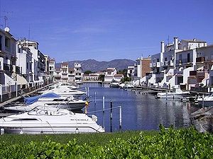
Empuriabrava (Spanish: Ampuriabrava) is a community in the municipality of Castelló d'Empúries, in the Alt Empordà (Costa Brava, province of Girona, Catalonia, Spain). It is located in the Gulf of Roses, surrounded by the Natural Park of the Aiguamolls de l'Empordà, and is the largest residential marina in Europe, with some 24 km of navigable waterways. Originally built on a swamp, Empuriabrava was transformed into a tourist community, initially planned in 1964 and completed in 1975.
Sant Pere de Rodes
Former Benedictine monastery in Catalonia, Spain
Distance: Approx. 6910 meters
Latitude and longitude: 42.32361111,3.16666667
Sant Pere de Roda (Catalan pronunciation: [ˈsam ˈpeɾə ðə ˈrɔðəs]) is a former Benedictine monastery in the comarca of Alt Empordà, in the North East of Catalonia, Spain.
Aiguamolls de l'Empordà
Natural park near Girona, Spain
Distance: Approx. 7234 meters
Latitude and longitude: 42.21944444,3.11055556
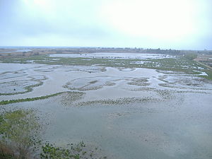
The Parc Natural dels Aiguamolls de l'Empordà is a natural park in Catalonia, Spain. It forms part of the Bay of Roses and, like the Ebro Delta, was a malarial swampland. The marshland lies between the Rivers Fluvià and Muga.

La Selva de Mar
Municipality in Catalonia, Spain
Distance: Approx. 6929 meters
Latitude and longitude: 42.32361111,3.18888889
La Selva de Mar is a municipality in the comarca of Alt Empordà in Catalonia, Spain. It is quite small with a population of about 197. The nearest town is El Port de la Selva, a common destination for beach-going tourists.
Palau-saverdera
Municipality in Catalonia, Spain
Distance: Approx. 4775 meters
Latitude and longitude: 42.3,3.15
Palau-saverdera (Old Catalan for 'Palace-[Castle of] the Verdera'; (Catalan pronunciation: [pəˌlawsəβəɾˈðeɾə]) is a municipality in the comarca of Alt Empordà, Girona, Catalonia, Spain.

Siege of Roses (1794–1795)
Distance: Approx. 742 meters
Latitude and longitude: 42.26666667,3.18333333
The siege of Roses (or siege of Rosas) began on 28 November 1794 and lasted until 4 February 1795 when the Spanish garrison abandoned the port and the forces of the First French Republic took control. Dominique Catherine de Pérignon commanded the French army and Domingo Salvator Izquierdo led the Spanish defenders. The siege took place during the War of the Pyrenees which was part of the French Revolutionary Wars.

Santa Maria, Roses
Distance: Approx. 842 meters
Latitude and longitude: 42.267742,3.170253
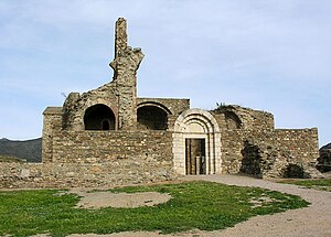
Santa Maria de Roses is a ruined Benedictine monastery in the municipality of Roses, Alt Empordà comarca, Catalonia, Spain. It is situated within the Ciutadella de Roses, a fortification in the Province of Girona. It is the earliest known example of Lombard architectural style in the country.

Ciutadella de Roses
Ruined fortification in Catalonia, Spain
Distance: Approx. 791 meters
Latitude and longitude: 42.266944,3.17
Ciutadella de Roses ("Citadel of Roses"; Spanish, Ciudadela de Rosas) is a ruined fortification in the municipality of Roses, Alt Empordà comarca, Province of Girona, Catalonia, Spain. There are various buildings in its surrounds, such as the Castell de la Trinitat, as well as the monastery Santa Maria de Roses, the country's earliest known example of the Lombard architectural style. Construction of the present citadel was ordered by Charles V, Holy Roman Emperor in 1543 at the same time as Castell de la Trinitat to protect it from pirate attacks and from the French.

Castell de la Trinitat
Castle in Spain
Distance: Approx. 1727 meters
Latitude and longitude: 42.247348,3.183786
Castell de la Trinitat is located on the Gulf of Roses, Alt Empordà comarca, Province of Girona, Catalonia, Spain. Along with the Ciutadella de Roses, it provided defenses for the town of Roses. The name comes from a chapel built in 1508, which was destroyed, along with a defense tower that stood in the area, when the castle was built, ordered by Emperor Charles V (Carlos I) in 1543.
Sublimotion
Spanish restaurant
Distance: Approx. 4291 meters
Latitude and longitude: 42.25,3.22638889
Sublimotion is a restaurant located in Sant Josep de sa Talaia, Ibiza, Spain run by chef Paco Roncero who utilizes molecular gastronomy in cooking. The restaurant is known for being among the most expensive in the world.
Weather in this IP's area
scattered clouds
8 Celsius
7 Celsius
8 Celsius
9 Celsius
1030 hPa
89 %
1030 hPa
1027 hPa
10000 meters
2.64 m/s
2.41 m/s
33 degree
32 %


