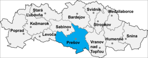
Country:
Region:
City:
Latitude and Longitude:
Time Zone:
Postal Code:
IP information under different IP Channel
ip-api
Country
Region
City
ASN
Time Zone
ISP
Blacklist
Proxy
Latitude
Longitude
Postal
Route
Luminati
Country
Region
ki
City
roznava
ASN
Time Zone
Europe/Bratislava
ISP
DELTA ONLINE spol. s r.o.
Latitude
Longitude
Postal
IPinfo
Country
Region
City
ASN
Time Zone
ISP
Blacklist
Proxy
Latitude
Longitude
Postal
Route
db-ip
Country
Region
City
ASN
Time Zone
ISP
Blacklist
Proxy
Latitude
Longitude
Postal
Route
ipdata
Country
Region
City
ASN
Time Zone
ISP
Blacklist
Proxy
Latitude
Longitude
Postal
Route
Popular places and events near this IP address
Kavečany
Borough in Slovakia
Distance: Approx. 1599 meters
Latitude and longitude: 48.78333333,21.21666667
Kavečany (Hungarian: Kavocsán) is a borough (city ward) of Košice, Slovakia. The borough is situated 6 km northwest of Košice, at an altitude of roughly 453 metres (1,486 ft) above sea level, in the Košice I district. Kavečany retains a rural character, with a population of more than 1150 inhabitants.

Sídlisko Ťahanovce
Borough in Slovakia
Distance: Approx. 4766 meters
Latitude and longitude: 48.75388889,21.2675
Sídlisko Ťahanovce ([pronunciation: 'seedlisko 'tyahano-utse], literally: "Ťahanovce Housing Estate", Hungarian: Tihany-lakótelep) is a borough (city ward) of Košice, Slovakia. Construction of the microdistrict began in May 1985. Today there are more than 20,000 people living in Sídlisko Ťahanovce (1/10 of all Košice's inhabitants).

Ťahanovce
Borough in Slovakia
Distance: Approx. 4693 meters
Latitude and longitude: 48.75,21.25
Ťahanovce (Hungarian: Hernádtihany, pronounced [ˈhɛrnaːttihɒɲ]) is a borough (city ward) of the city of Košice, Slovakia. The first written mention about Ťahanovce is dated back to 1263. It was an independent village until 1969 when it was connected with Košice.

Štadión Lokomotívy
Distance: Approx. 5627 meters
Latitude and longitude: 48.74083611,21.24449722
Štadión Lokomotívy v Čermeli is a multi-purpose stadium in Košice, Slovakia. It is currently used mostly for football matches and it was the home ground of FC Košice. The stadium is still contracted with FC Lokomotíva Košice, men categories are playing there.

Družstevná pri Hornáde
Distance: Approx. 1794 meters
Latitude and longitude: 48.805,21.24722222
Družstevná pri Hornáde is a village and municipality of the Košice-okolie District, located in the Kosice Region of eastern Slovakia.
Budimír
Village in Slovakia
Distance: Approx. 4864 meters
Latitude and longitude: 48.8,21.3
Budimír (Hungarian: Budamér) is a village and municipality in Košice-okolie District in the Kosice Region of eastern Slovakia.

Trebejov
Village and municipality in Slovakia
Distance: Approx. 4714 meters
Latitude and longitude: 48.83333333,21.23333333
Trebejov (Hungarian: Terebő) is a village and municipality in Košice-okolie District in the Kosice Region of eastern Slovakia. In historical records, the village was first mentioned in 1289. The village lies at an altitude of 240 m, and covers an area of 7.671 km².

Sokoľ
Municipality of Slovakia
Distance: Approx. 3161 meters
Latitude and longitude: 48.81666667,21.21666667
Sokoľ (lit. 'Falcon'; Hungarian: Hernádszokoly) is a village and municipality in Košice-okolie District in the Kosice Region of eastern Slovakia.

Janovík
Village and municipality in Slovakia
Distance: Approx. 4837 meters
Latitude and longitude: 48.83333333,21.25
Janovík (Hungarian: Janovík) is a village and municipality in Prešov District in the Prešov Region of eastern Slovakia.

Košice Zoo
Zoo in Košice, Slovakia
Distance: Approx. 2432 meters
Latitude and longitude: 48.78361111,21.20388889
The Košice Zoo (Slovak: Zoologická záhrada Košice) is a zoo in Košice, Slovakia in the borough of Kavečany. It covers 292 hectares (720 acres) and is the largest zoo in Slovakia and the third largest in Europe. Visitors are allowed in only about one third of the site.
Stadium Družstevná pri Hornáde
Football stadium in Slovakia
Distance: Approx. 1300 meters
Latitude and longitude: 48.8001,21.2462
Stadium Družstevná pri Hornáde (Slovak: Štadión Družstevná pri Hornáde) is a football stadium near Košice, Slovakia, and is the home stadium of the FC Lokomotíva Košice. Stadium capacity is 1000 (656 seats ), including 204 seats for away fans and 50 VIP seats.

Košice Children's Heritage Railway
Heritage railway line in Slovakia
Distance: Approx. 4594 meters
Latitude and longitude: 48.750033,21.22754
The Košice Children's Heritage Railway (Slovak: Košická detská historická železnica, KDHŽ) is a 4.2 km (2.6 mi) long single-track heritage railway with a track gauge of 1,000 mm (3 ft 3+3⁄8 in). The railway was opened on 20 September 1955 as a pioneer railway near Košice in Slovakia and is still in operation today. It is located in the rural part of the city's Košice-Sever borough.
Weather in this IP's area
clear sky
7 Celsius
4 Celsius
5 Celsius
7 Celsius
1033 hPa
60 %
1033 hPa
991 hPa
10000 meters
3.6 m/s
10 degree
06:33:17
16:04:25

