Country:
Region:
City:
Latitude and Longitude:
Time Zone:
Postal Code:
IP information under different IP Channel
ip-api
Country
Region
City
ASN
Time Zone
ISP
Blacklist
Proxy
Latitude
Longitude
Postal
Route
Luminati
Country
Region
15
City
costadacaparica
ASN
Time Zone
Europe/Lisbon
ISP
Nos Comunicacoes, S.A.
Latitude
Longitude
Postal
IPinfo
Country
Region
City
ASN
Time Zone
ISP
Blacklist
Proxy
Latitude
Longitude
Postal
Route
db-ip
Country
Region
City
ASN
Time Zone
ISP
Blacklist
Proxy
Latitude
Longitude
Postal
Route
ipdata
Country
Region
City
ASN
Time Zone
ISP
Blacklist
Proxy
Latitude
Longitude
Postal
Route
Popular places and events near this IP address

Vieira do Minho
Municipality in Norte, Portugal
Distance: Approx. 766 meters
Latitude and longitude: 41.63333333,-8.13333333
Vieira do Minho (Portuguese pronunciation: [viˈɐjɾɐ ðu ˈmiɲu] ) is a municipality in the district of Braga, in the north of Portugal. The population in 2011 was 12,997, in an area of 216.44 km².
Ermal Island
Distance: Approx. 4321 meters
Latitude and longitude: 41.595279,-8.129736
Ermal Island (Portuguese, Ilha do Ermal) is a peninsula situated in the Ermal Dam, parish of Mosteiro, municipality of Vieira do Minho, Portugal, about 25 km (16 mi) north of Braga. The hard rock – heavy metal music festival "Festival da Ilha do Ermal" takes place in Ermal. The bands which have performed at Ermal include Slipknot, Sepultura and Angra.

Ponte de Mem Gutierres
Bridge in Póvoa de Lanhoso, Esperança e Brunhais
Distance: Approx. 6549 meters
Latitude and longitude: 41.57680556,-8.16625
Ponte de Mem Gutierres is a Romanesque bridge in Portugal, located in the civil parish of Esperança e Brunhais, in the municipality of Póvoa de Lanhoso. Crossing the river Ave in the district of Braga, the bridge connects either margin lined with picturesque houses.

Caniçada Dam
Dam in Norte, Portugal
Distance: Approx. 7693 meters
Latitude and longitude: 41.653,-8.231
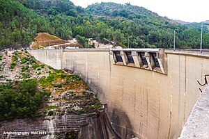
The Caniçada Dam (Portuguese: Barragem da Caniçada/HICA-Hidroeléctrica do Cávado-Caniçada; Portuguese pronunciation: [bɐˈʁaʒɐ̃j dɐ kɐniˈsaðɐ]) is a concrete arch dam on the Cávado River, the civil parish of Parada do Bouro, in the municipality of Vieira do Minho, in the Portuguese Norte (district of Braga). It is owned by Companhia Portuguesa de Produção de Electricidade (CPPE).

Salamonde Dam
Dam in Braga District, Portugal
Distance: Approx. 7824 meters
Latitude and longitude: 41.69183333,-8.09125
Salamonde Dam (Portuguese: Barragem de Salamonde; Portuguese pronunciation: [bɐˈʁaʒɐ̃j dɨ sɐlɐˈmõdɨ]) is a concrete arch dam on the Cávado River, where the river forms the border line between the districts of Braga and Vila Real. It is located in the municipality Vieira do Minho, in Braga District, Portugal. The dam was completed in 1953.
Esperança e Brunhais
Civil parish in Norte, Portugal
Distance: Approx. 6013 meters
Latitude and longitude: 41.58444444,-8.17444444
Esperança e Brunhais (officially, União das Freguesias de Esperança e Brunhais) is a Portuguese freguesia in the Municipality of Póvoa de Lanhoso, it has an area of 7.12 km2 and 652 inhabitants as of 2011. It was created during the administrative reorganization of 2012/2013, from the aggregation of the former parishes of Esperança and Brunhais.
Weather in this IP's area
broken clouds
15 Celsius
15 Celsius
15 Celsius
15 Celsius
1019 hPa
84 %
1019 hPa
972 hPa
10000 meters
0.27 m/s
0.49 m/s
317 degree
61 %
07:25:42
17:10:14