Country:
Region:
City:
Latitude and Longitude:
Time Zone:
Postal Code:
IP information under different IP Channel
ip-api
Country
Region
City
ASN
Time Zone
ISP
Blacklist
Proxy
Latitude
Longitude
Postal
Route
Luminati
Country
Region
11
City
lisbon
ASN
Time Zone
Europe/Lisbon
ISP
Nos Comunicacoes, S.A.
Latitude
Longitude
Postal
IPinfo
Country
Region
City
ASN
Time Zone
ISP
Blacklist
Proxy
Latitude
Longitude
Postal
Route
db-ip
Country
Region
City
ASN
Time Zone
ISP
Blacklist
Proxy
Latitude
Longitude
Postal
Route
ipdata
Country
Region
City
ASN
Time Zone
ISP
Blacklist
Proxy
Latitude
Longitude
Postal
Route
Popular places and events near this IP address

Sacavém
Civil parish in Lisbon, Portugal
Distance: Approx. 3196 meters
Latitude and longitude: 38.79444444,-9.10527778
Sacavém (Portuguese pronunciation: [sɐkɐˈvɐ̃j]; Arabic: شقبان) is a city and former civil parish in the municipality of Loures, Lisbon District, Portugal. In 2013, the parish merged into the new parish Sacavém e Prior Velho. It is a few kilometers north-east of the Portuguese capital, Lisbon.
Camarate
Civil parish in Lisbon, Portugal
Distance: Approx. 4016 meters
Latitude and longitude: 38.79802778,-9.13393611
Camarate (Portuguese pronunciation: [kɐmɐˈɾatɨ]) is a former civil parish in the municipality of Loures, Lisbon District, Portugal. In 2013, the parish merged into the new parish Camarate, Unhos e Apelação. With a population of 23,000 inhabitants in 2001, the parish of Camarate extends into an area of 5.52 km².

Portela (Loures)
Civil parish in Lisbon, Portugal
Distance: Approx. 4402 meters
Latitude and longitude: 38.78472222,-9.11361111
Portela (Portuguese pronunciation: [puɾˈtɛlɐ]) is a former civil parish in the municipality of Loures, Lisbon District, Portugal. In 2013, the parish merged into the new parish Moscavide e Portela.
Sacavém e Prior Velho
Civil parish in Lisbon, Portugal
Distance: Approx. 3393 meters
Latitude and longitude: 38.793,-9.108
Sacavém e Prior Velho is a civil parish in the municipality of Loures, Portugal. It was formed in 2013 by the merger of the former parishes Sacavém and Prior Velho. The population in 2011 was 24,822, in an area of 3.89 km².
Frielas
Civil parish in Lisbon, Portugal
Distance: Approx. 3834 meters
Latitude and longitude: 38.82583333,-9.14444444
Frielas (Portuguese pronunciation: [fɾiˈɛlɐʃ]) is a former civil parish in the municipality of Loures, Lisbon District, Portugal. In 2013, the parish merged into the new parish Santo António dos Cavaleiros e Frielas. Frielas has an area of 5.63 km2, 2676 inhabitants according to the census made in 2001 and a density of 475 inhabitants per km2.
Castelo de Pirescoxe
Castle in Portugal
Distance: Approx. 1750 meters
Latitude and longitude: 38.8370842,-9.0917047
Castelo de Pirescoxe is a castle in Portugal. It is situated in the parish of Santa Iria de Azóia, Loures, Lisbon District. It is classified by IGESPAR as a site of public interest.
Roman villa of Frielas
Roman villa near Loures, Portugal
Distance: Approx. 3793 meters
Latitude and longitude: 38.8268747,-9.1438332
The Roman Villa of Frielas is located in the parish of Frielas in the municipality of Loures in the Lisbon District of Portugal. It fell under the territory of the Roman settlement of Olisipo, which covered a large area from Lisbon to the south to Torres Vedras in the north. It is believed to have been re-used in the medieval period during the Islamic occupation of Portugal.
Camarate, Unhos e Apelação
Civil parish in Lisbon, Portugal
Distance: Approx. 3338 meters
Latitude and longitude: 38.802,-9.128
Camarate, Unhos e Apelação is a civil parish in the municipality of Loures, Portugal. It was formed in 2013 by the merger of the former parishes Camarate, Unhos and Apelação. The population in 2011 was 34,943, in an area of 11.57 km².
Moscavide e Portela
Civil parish in Lisbon, Portugal
Distance: Approx. 4892 meters
Latitude and longitude: 38.779,-9.103
Moscavide e Portela is a civil parish in the municipality of Loures, Portugal. It was formed in 2013 by the merger of the former parishes Moscavide and Portela. The population in 2011 was 21,891, in an area of 1.66 km².

Ceramics Museum of Sacavém
Museum near Lisbon, Portugal
Distance: Approx. 3201 meters
Latitude and longitude: 38.794187,-9.102438
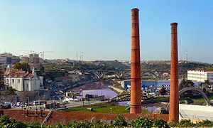
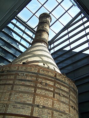
The Ceramics Museum of Sacavém (Portuguese: Museu de Cerâmica de Sacavém) is situated in the town of Sacavém in the municipality of Loures, just northeast of Lisbon in Portugal. The museum was opened in July 2000 and was constructed on the grounds of a former ceramics factory. Most of the exhibits reflect the output of that factory and its documentation centre is devoted to the study of the history and production of the factory and the industrial heritage of the municipality.

Fort of Sacavém
19th-century fort in Portugal
Distance: Approx. 3015 meters
Latitude and longitude: 38.795833,-9.1015
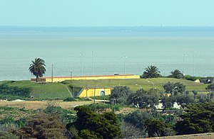
The Redoubt of Mount Cintra (or Mount Sintra), commonly known as the Fort of Sacavém, is located in the town of Sacavém in the municipality of Loures in the Lisbon District of Portugal. It is situated immediately to the north of Lisbon. The fort’s construction began in 1875 and was completed in 1892.

Trancão River
River in Portugal
Distance: Approx. 3116 meters
Latitude and longitude: 38.79611111,-9.09
The Trancão River (Portuguese pronunciation: [tɾɐ̃ˈkɐ̃w]), formerly called Rio de Sacavém, is a small river in Portugal (about 29 km) from District of Lisbon. Near its mouth, this watercourse can also be called Ribeira de Sacavém ou Vala de Sacavém.
Weather in this IP's area
few clouds
19 Celsius
20 Celsius
19 Celsius
20 Celsius
1018 hPa
79 %
1018 hPa
1010 hPa
10000 meters
2.06 m/s
80 degree
20 %
07:22:41
17:20:55


