Country:
 Portugal
Region:
City:
Latitude and Longitude:
Time Zone:
Postal Code:
IP information under different IP Channel
ip-api
Country
Region
City
ASN
Time Zone
ISP
Blacklist
Proxy
Latitude
Longitude
Postal
Route
IPinfo
Country
Region
City
ASN
Time Zone
ISP
Blacklist
Proxy
Latitude
Longitude
Postal
Route
MaxMind
Country
Region
City
ASN
Time Zone
ISP
Blacklist
Proxy
Latitude
Longitude
Postal
Route
Luminati
Country
PTRegion
07
City
evora
ASN
Time Zone
Europe/Lisbon
ISP
Nos Comunicacoes, S.A.
Latitude
Longitude
Postal
db-ip
Country
Region
City
ASN
Time Zone
ISP
Blacklist
Proxy
Latitude
Longitude
Postal
Route
ipdata
Country
Region
City
ASN
Time Zone
ISP
Blacklist
Proxy
Latitude
Longitude
Postal
Route
Popular places and events near this IP address

Capela dos Ossos
Historical monument in Évora, Portugal
Distance: Approx. 1400 meters
Latitude and longitude: 38.56888889,-7.90888889
The Capela dos Ossos (English: Chapel of Bones) is one of the best-known monuments in Évora, Portugal. It is a small interior chapel located next to the entrance of the Church of St. Francis.

University of Évora
Public university in Évora, Portugal
Distance: Approx. 1248 meters
Latitude and longitude: 38.5731,-7.9044
The University of Évora (Universidade de Évora) is a public university in Évora, Portugal. It is the second oldest university in the country, established in 1559 by the cardinal Henry, and receiving University status in April of the same year from Pope Paul IV, as documented in his Cum a nobis papal bull. Running under the aegis of the Society of Jesus (also known as Jesuits) meant that the university was a target of the Marquis of Pombal's Jesuit oppression, being closed down permanently in 1779 and its masters either incarcerated or exiled.

Cathedral of Évora
Roman Catholic church in Évora, Portugal
Distance: Approx. 1328 meters
Latitude and longitude: 38.5718,-7.9066
The Cathedral of Évora (Portuguese: Sé de Évora) is a Roman Catholic church in the city of Évora, Portugal. It is one of the oldest and most important local monuments, lying on the highest spot of the city. It is part of the historical city centre, and the seat of the Archdiocese of Evora.

Alentejo Central
Intermunicipal community in Alentejo, Portugal
Distance: Approx. 595 meters
Latitude and longitude: 38.56666667,-7.9
The Comunidade Intermunicipal do Alentejo Central (Portuguese pronunciation: [ɐlẽˈtɛʒu sẽˈtɾal]; English: Central Alentejo) is an administrative division in Portugal. It was created in 2009. The seat of the intermunicipal community is Évora, the main city.
Igreja de São Francisco (Évora)
Church building in Portugal
Distance: Approx. 1413 meters
Latitude and longitude: 38.569,-7.909
The Church of St. Francis (Portuguese: Igreja de São Francisco) is located in Évora, Portugal. It is best known for its lugubrious Chapel of the Bones.
Palace of the Dukes of Cadaval
Building in Évora, Évora District, Portugal
Distance: Approx. 1468 meters
Latitude and longitude: 38.5733,-7.90733
The Palace of the Dukes of Cadaval is located in Évora historic centre, in Portugal, next-door to the Lóios Convent and Church (today a remarkable Pousada) and facing the Roman Temple of Évora. It belongs to the Duke of Cadaval family, and today it has a harmonious architectural elements combination: Moorish (Mudéjar), Gothic and Manueline period. The palace with its 17th-century façade is constituted in part by an old castle burnt in 1384.

Alto Alentejo Province
Province in Portugal
Distance: Approx. 1411 meters
Latitude and longitude: 38.5725,-7.9072
Alto Alentejo was a Portuguese province. It was abolished with the Constitution of 1976. The area is now covered by Alto Alentejo Subregion and Alentejo Central Subregion.

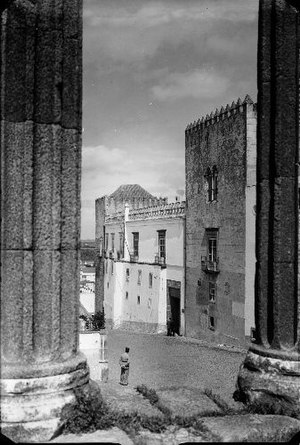
Évora
Municipality in Alentejo, Portugal
Distance: Approx. 595 meters
Latitude and longitude: 38.56666667,-7.9
Évora (US: EV-uurr-ə, Portuguese: [ˈɛvuɾɐ] ) is a city and a municipality in Portugal. It has 53,591 inhabitants (2021), in an area of 1,307.08 square kilometers (504.67 sq mi). It is the historic capital of the Alentejo and serves as the seat of the Évora District.
Alentejo Region
NUTS of Portugal
Distance: Approx. 596 meters
Latitude and longitude: 38.5667,-7.9
Alentejo Region (Portuguese pronunciation: [ɐlẽ'tɛʒu]) is one of the seven NUTS 2 regions of Portugal. It covers all of the historical Alentejo Province and part of the historical Ribatejo and Estremadura provinces. The greater region is defined within Portugal by the land bordering the left bank of the river Tagus to the North and extending to the South where it borders the Algarve region.

Igreja do Espírito Santo (Évora)
Distance: Approx. 1227 meters
Latitude and longitude: 38.5728,-7.9044
Igreja do Espírito Santo is a church in Portugal. It is classified as a National Monument.

Church of Nossa Senhora da Graça (Évora)
Distance: Approx. 1279 meters
Latitude and longitude: 38.5696,-7.9072
Igreja da Graça is an old church and convent in Évora, Portugal. Currently this convent is used by the Portuguese Armed Forces. Its construction was concluded in 1511 and it is now classified as a National Monument, and it is an integral part of Évora's old city centre, which is classified as a UNESCO World Heritage Site.
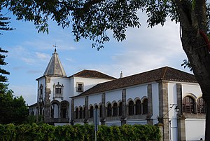
Royal Palace of Évora
Building in Évora, Évora District, Portugal
Distance: Approx. 1426 meters
Latitude and longitude: 38.56777778,-7.90944444
The Royal Palace of Évora (Portuguese: Paço Real de Évora), also known as the Royal Palace of São Francisco (Paço Real de São Francisco) and the Palace of King Manuel I (Palácio de D. Manuel), is a former royal residence of the Kings of Portugal, in Évora, the capital of Alentejo. The palace has its origins in a convent built in the 13th century. During the 14th century, the convent came under royal use when the royal family was in the Alentejo, but only became a proper palace under the reign of King John I, who used it as a personal retreat from the court.
Weather in this IP's area
broken clouds
24 Celsius
23 Celsius
24 Celsius
24 Celsius
1018 hPa
34 %
1018 hPa
989 hPa
10000 meters
4.47 m/s
9.31 m/s
325 degree
80 %
07:26:37
19:16:08