85.133.58.10 - IP Lookup: Free IP Address Lookup, Postal Code Lookup, IP Location Lookup, IP ASN, Public IP
Country:
 Great Britain
Region:
City:
Location:
Time Zone:
Postal Code:
ISP:
ASN:
language:
User-Agent:
Proxy IP:
Blacklist:
IP information under different IP Channel
ip-api
Country
Region
City
ASN
Time Zone
ISP
Blacklist
Proxy
Latitude
Longitude
Postal
Route
db-ip
Country
Region
City
ASN
Time Zone
ISP
Blacklist
Proxy
Latitude
Longitude
Postal
Route
IPinfo
Country
Region
City
ASN
Time Zone
ISP
Blacklist
Proxy
Latitude
Longitude
Postal
Route
IP2Location
85.133.58.10Country
gbRegion
england
City
egg buckland
Time Zone
Europe/London
ISP
Language
User-Agent
Latitude
Longitude
Postal
ipdata
Country
Region
City
ASN
Time Zone
ISP
Blacklist
Proxy
Latitude
Longitude
Postal
Route
Popular places and events near this IP address

Crownhill
Suburb of Plymouth, Devon
Distance: Approx. 1382 meters
Latitude and longitude: 50.410556,-4.126944
Crownhill is a suburb in northern Plymouth, in the county of Devon, England. It is the home to Crownhill fort, a popular tourist attraction and museum. According to the 2021 census, Crownhill has a population of 6,411 people.

Eggbuckland
Suburb of Plymouth, Devon
Distance: Approx. 228 meters
Latitude and longitude: 50.400556,-4.113611
Eggbuckland is a suburb of the city of Plymouth, in the ceremonial county of Devon, England. Before the Second World War Eggbuckland was a small village a few miles north of Plymouth. During the reconstruction of Plymouth many new suburbs were built and soon a new estate was built within one mile to the south east of Eggbuckland.
Hartley, Plymouth
Suburb of Plymouth, Devon
Distance: Approx. 1131 meters
Latitude and longitude: 50.39222222,-4.12694444
Hartley is a suburb of Plymouth in the county of Devon, England. It is built on higher ground offering views south towards the sea, east into the South Hams, north over Dartmoor and west to Cornwall. It is bisected by the Tavistock Road which also provides ready access to Mutley and the City centre to the south and more immediate access to the A38 Plymouth Parkway, part of the Devon Expressway linking near Exeter to the motorway network.

Compton, Plymouth
Suburb of Plymouth, England
Distance: Approx. 1263 meters
Latitude and longitude: 50.388889,-4.120278
Compton or Compton Gifford is a suburb of Plymouth, in the ceremonial county of Devon, England. Once a small village, it was developed in the 1930s and now lies between the suburbs of Peverell Mannamead and Efford. There are two parts, Higher and Lower Compton named after two farms and now distinguished by their respective public houses.
Efford
Suburb of Plymouth, Devon
Distance: Approx. 1296 meters
Latitude and longitude: 50.389167,-4.11
Efford (anciently Eppeford, Elforde, etc.) is an historic manor formerly in the parish of Eggbuckland, Devon, England. Today it has been absorbed by the city of Plymouth to become a large, mostly post-World War II, eastern suburb of the city. It stands on high ground approximately 300 feet above the Laira estuary of the River Plym and provides views over long distances: to the north across Dartmoor, to the east and south-east across the South Hams.
Eggbuckland Community College
Academy in Plymouth, Devon, England
Distance: Approx. 429 meters
Latitude and longitude: 50.39971,-4.12273
Eggbuckland Community College is a coeducational secondary school and sixth form with academy status, located in the Eggbuckland area of Plymouth, Devon, England. The school converted to academy status on 1 September 2013.

Plumer Barracks
Distance: Approx. 1384 meters
Latitude and longitude: 50.40827,-4.13127
Plumer Barracks was a military installation at Crownhill in Plymouth.

Fort Efford
Distance: Approx. 1296 meters
Latitude and longitude: 50.389167,-4.11
Fort Efford is a former 19th-century Fort, built as a result of the Royal Commission on National Defence of 1859. It was built to defend the landward approaches to the North East of Plymouth. This was part of an overall scheme for the defence of the Royal Naval Dockyard at Devonport, Plymouth.
Fort Austin
British naval base
Distance: Approx. 944 meters
Latitude and longitude: 50.3997,-4.1034
Fort Austin is a former 19th-century Fort, built as a result of the Royal Commission on National Defence of 1859. It was built to defend the landward approaches to the North East of Plymouth. This was part of an overall scheme for the defence of the Royal Naval Dockyard at Devonport.

Bowden Fort
Distance: Approx. 680 meters
Latitude and longitude: 50.40611111,-4.11666667
Bowden Fort is a former 19th-century fort, built as a result of the Royal Commission on National Defence of 1859. Part of an extensive scheme known as Palmerston Forts, after the prime minister who championed the scheme, it was built to defend the landward approaches to the north east of Plymouth, as an element of the plan for the defence of the Royal Naval Dockyard at Devonport. Designed by Captain (later Maj General) Edmund Frederick Du Cane, it was built by George Baker and Company and finished by the Royal Engineers.
Forder Battery
Distance: Approx. 726 meters
Latitude and longitude: 50.4045,-4.1093
Forder Battery is a former 19th-century fort, built as a result of the Royal Commission on National Defence of 1859. Part of an extensive scheme known as Palmerston Forts, after the prime minister who championed the scheme, it was built to defend the landward approaches to the north east of Plymouth, as an element of the plan for the defence of the Royal Naval Dockyard at Devonport. Designed by Captain (later Maj General) Edmund Frederick Du Cane, it was built by George Baker and Company and finished by the Royal Engineers.
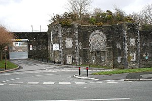
Egg Buckland Keep
Distance: Approx. 534 meters
Latitude and longitude: 50.4037,-4.1119
Egg Buckland Keep is a former 19th-century fortified barracks, built as a result of the Royal Commission on National Defence of 1859. Part of an extensive scheme known as Palmerston Forts, after the prime minister who championed the scheme, it was built to defend the landward approaches to the north east of Plymouth, as an element of the plan for the defence of the Royal Naval Dockyard at Devonport. The keep was designed to house the garrison for the nearby Forder Battery, Bowden Fort and Fort Austin.
Weather in this IP's area
light rain
7 Celsius
5 Celsius
5 Celsius
7 Celsius
1019 hPa
80 %
1019 hPa
1005 hPa
10000 meters
3.13 m/s
8.94 m/s
121 degree
100 %