85.119.246.89 - IP Lookup: Free IP Address Lookup, Postal Code Lookup, IP Location Lookup, IP ASN, Public IP
Country:
Region:
City:
Location:
Time Zone:
Postal Code:
ISP:
ASN:
language:
User-Agent:
Proxy IP:
Blacklist:
IP information under different IP Channel
ip-api
Country
Region
City
ASN
Time Zone
ISP
Blacklist
Proxy
Latitude
Longitude
Postal
Route
db-ip
Country
Region
City
ASN
Time Zone
ISP
Blacklist
Proxy
Latitude
Longitude
Postal
Route
IPinfo
Country
Region
City
ASN
Time Zone
ISP
Blacklist
Proxy
Latitude
Longitude
Postal
Route
IP2Location
85.119.246.89Country
Region
gelderland
City
duiven
Time Zone
Europe/Amsterdam
ISP
Language
User-Agent
Latitude
Longitude
Postal
ipdata
Country
Region
City
ASN
Time Zone
ISP
Blacklist
Proxy
Latitude
Longitude
Postal
Route
Popular places and events near this IP address
Duiven
Municipality in Gelderland, Netherlands
Distance: Approx. 1383 meters
Latitude and longitude: 51.95,6.03333333
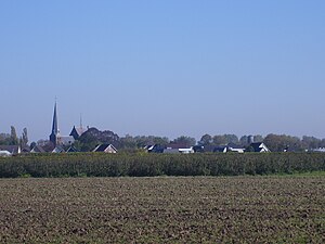
Duiven (Dutch pronunciation: [ˈdœyvə(n)] ) is a municipality and a town in the eastern Netherlands. Duiven's name can be translated into English to mean "pigeons" or "doves". Although the coat of arms and logo of the municipality feature pigeons, the name is etymologically related to "dunes" (Dutch: duinen).
Westervoort
Municipality in Gelderland, Netherlands
Distance: Approx. 3929 meters
Latitude and longitude: 51.96666667,5.96666667
Westervoort (Dutch pronunciation: [ˌʋɛstərˈvoːrt] ) is a municipality and a town in the eastern Netherlands. The town has two rivers inside its borders, the Rhine and the IJssel. It is a commuter town closely linked to Arnhem, the capital of Gelderland, which is situated on the west bank of the IJssel river, the east bank being occupied by Westervoort.

Helhoek, Gelderland
Hamlet in Gelderland, Netherlands
Distance: Approx. 2308 meters
Latitude and longitude: 51.935,6.04166667
Helhoek is a hamlet in the Dutch province of Gelderland. It is located in the municipality of Duiven, between the towns of Duiven and Zevenaar. It was first mentioned between 1830 and 1855 as Helhoek.
Bahr, Netherlands
Hamlet in Gelderland, Netherlands
Distance: Approx. 4721 meters
Latitude and longitude: 51.98444444,6.04527778
Bahr is a hamlet in the Dutch province of Gelderland. It is located in the municipality Zevenaar, about 3 km southeast of Rheden. The village was first mentioned in 1272 as de Bare.

Duiven railway station
Railway station located in Duiven, Netherlands
Distance: Approx. 375 meters
Latitude and longitude: 51.94333333,6.01416667
Duiven is a railway station located in Duiven, Netherlands. The station was opened on 15 February 1856 and is located on the Oberhausen–Arnhem railway between Arnhem and Elten (Germany). The train services at this station are operated by Arriva and Breng.
Canal of Drusus
Distance: Approx. 3262 meters
Latitude and longitude: 51.95,5.96666667
The Canals of Drusus (Latin: Fossae Drusianae) were Roman canals constructed for military purposes by Nero Claudius Drusus around 12 BC. It is believed to have linked the Rhine delta with the Lake Flevo, (today's IJsselmeer). They facilitated troop transport to the north, avoiding the need to cross the open North Sea. This was of strategic importance for attacks on the Germanic people living on the Frisian coasts and along the Elbe estuary in the German Bight.

Zevenaar railway station
Railway station located in Zevenaar, Netherlands
Distance: Approx. 4823 meters
Latitude and longitude: 51.92305556,6.07277778
Zevenaar is a railway station located in Zevenaar, Netherlands. The station was opened on 15 February 1856 and is located on the Winterswijk–Zevenaar railway and the Oberhausen–Arnhem railway. There used to be a connection to Kleve (Germany) as well (from 1865-1914).

Westervoort railway station
Railway station located in Westervoort, Netherlands
Distance: Approx. 3456 meters
Latitude and longitude: 51.96222222,5.97027778
Westervoort is a railway station in the eastern Netherlands, in the town of Westervoort. The station is situated on the Oberhausen–Arnhem railway. Train services are operated by Arriva and Breng.
De Buitenmolen, Zevenaar
Tower mill in Zevenaar, Netherlands
Distance: Approx. 4260 meters
Latitude and longitude: 51.925411,6.06547
The Buitenmolen (Outer mill) is a tower mill in Zevenaar, Netherlands that was restored to working order in 1970. The mill was built in the beginning of the sixteenth century and is listed as a Rijksmonument, number 40427.

Groessen
Village in Gelderland, Netherlands
Distance: Approx. 1988 meters
Latitude and longitude: 51.9305,6.0261
Groessen is a village in the municipality of Duiven in the province of Gelderland, the Netherlands. It was first mentioned in 838 in uilla Gruosna, and means "settlement in grassland". The village developed near the Rhine.

Loo, Duiven
Village in Gelderland, Netherlands
Distance: Approx. 2608 meters
Latitude and longitude: 51.929,5.989
Loo is a village in the municipality of Duiven in the province of Gelderland, the Netherlands. The village has a ferry connection to Huissen. A couple of houses of Loo are part of Huissen, Lingewaard, because they were on a former river island which used to belong the Duchy of Cleves.

Lathum
Village in Gelderland, Netherlands
Distance: Approx. 4504 meters
Latitude and longitude: 51.98703,6.01913
Lathum is a village in the municipality of Zevenaar in the province of Gelderland, the Netherlands. The village was first mentioned between 1294 and 1295 as Latheym, and means "settlement of Laeta (lit: serf)". Lathum developed near the Castle Bahr en Lathum.
Weather in this IP's area
broken clouds
6 Celsius
3 Celsius
6 Celsius
7 Celsius
991 hPa
83 %
991 hPa
988 hPa
10000 meters
5.14 m/s
170 degree
71 %


