Country:
 Croatia
Region:
City:
Latitude and Longitude:
Time Zone:
Postal Code:
IP information under different IP Channel
ip-api
Country
Region
City
ASN
Time Zone
ISP
Blacklist
Proxy
Latitude
Longitude
Postal
Route
IPinfo
Country
Region
City
ASN
Time Zone
ISP
Blacklist
Proxy
Latitude
Longitude
Postal
Route
MaxMind
Country
Region
City
ASN
Time Zone
ISP
Blacklist
Proxy
Latitude
Longitude
Postal
Route
Luminati
Country
HRRegion
08
City
rijeka
ASN
Time Zone
Europe/Zagreb
ISP
Telemach Hrvatska d.o.o.
Latitude
Longitude
Postal
db-ip
Country
Region
City
ASN
Time Zone
ISP
Blacklist
Proxy
Latitude
Longitude
Postal
Route
ipdata
Country
Region
City
ASN
Time Zone
ISP
Blacklist
Proxy
Latitude
Longitude
Postal
Route
Popular places and events near this IP address
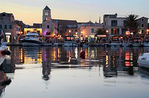
Vodice, Croatia
Town in Šibenik-Knin, Croatia
Distance: Approx. 1769 meters
Latitude and longitude: 43.75,15.76666667
Vodice (Croatian pronunciation: [ʋɔ̌ditsɛ], lit. in Croatian 'small waters') is a town, municipality and port in the Šibenik-Knin County, Croatia. It borders the Adriatic Sea and has a population of 8,649 (2021 census).

Šibenik Cathedral
Cathedral in Croatia
Distance: Approx. 8998 meters
Latitude and longitude: 43.73566111,15.88914722
The Cathedral of St. James (Croatian: Katedrala sv. Jakova) in Šibenik, Croatia, is a triple-nave Catholic basilica with three apses and a dome (32 m high inside).

Krka (Adriatic Sea)
River in Croatia
Distance: Approx. 7235 meters
Latitude and longitude: 43.7198,15.8526
The Krka (pronounced [ˈkr̩ka]) is a river in Croatia's Dalmatia region, known for its numerous waterfalls. It is 73 km (45 mi) long and its basin covers an area of 2,088 km2 (806 sq mi). It was known in ancient Greek as Kyrikos, or may be also as Catarbates (literally "steeply falling") by the ancient Greeks, it was known to the ancient Romans as Titius, Corcoras, or Korkoras.
Prvić
Distance: Approx. 3566 meters
Latitude and longitude: 43.73,15.795
Prvić (pronounced [pr̩̂v̞itɕ]; Italian: Provicchio) is a small island in the Croatian part of the Adriatic Sea. It is situated in the Šibenik archipelago, about half a mile from the mainland, in the vicinity of Vodice. The whole island is under protection of the Croatian Ministry of Culture since the island is considered a cultural heritage.

Roman Catholic Diocese of Šibenik
Roman Catholic diocese in Croatia
Distance: Approx. 8974 meters
Latitude and longitude: 43.7358,15.8889
The Diocese of Šibenik (Latin: Dioecesis Sebenicensis; Croatian: Šibenska biskupija) is a Latin diocese of the Catholic Church located in the city of Šibenik in the ecclesiastical province of Split-Makarska in Croatia.

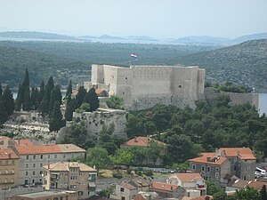
St. Nicholas Fortress
Distance: Approx. 7173 meters
Latitude and longitude: 43.722,15.854
St. Nicholas Fortress (Croatian: Tvrđava sv. Nikole) is a fortress located at the entrance to St.
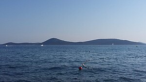
Tijat
Distance: Approx. 4527 meters
Latitude and longitude: 43.7225,15.76388889
Tijat is an uninhabited Croatian island in the Adriatic Sea located southwest of Vodice and west of Prvić. Its area is 2.78 km2 (1.07 sq mi). The land is mostly owned by people of Šepurina from island Prvić.
Zmajan
Island of Croatia
Distance: Approx. 8101 meters
Latitude and longitude: 43.690723,15.755669
Zmajan is an uninhabited Croatian island in the Adriatic Sea located south-southwest of Vodice and west of Zlarin. Its area is 3.3 km2 (1.3 sq mi).
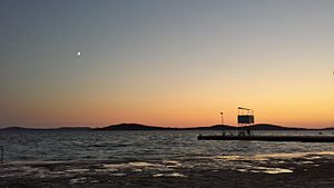
Panorama Viewpoint
Distance: Approx. 5115 meters
Latitude and longitude: 43.76222222,15.84638889
Panorama Viewpoint is located to the right of the Šibenik Bridge (from the direction of Vodice), near the Panorama cafe and hotel. The Šibenik bridge connects the two sides of the Šibenik Channel and the Panorama Viewpoint is located on the south side of the Channel.
Jadrija
City district in Dalmatia, Croatia
Distance: Approx. 6228 meters
Latitude and longitude: 43.72586389,15.84329444
Jadrija is a city district in Šibenik, Croatia. It is a popular seaside resort located on a man-made peninsula at the entrance of the St. Anthony Channel leading to Šibenik.
St. Michael's Fortress, Šibenik
Fortress in Šibenik, Croatia
Distance: Approx. 8965 meters
Latitude and longitude: 43.7377,15.8896
St. Michael's Fortress (Croatian: Tvrđava sv. Mihovila; Venetian: Castel vecchio; formerly known as St.

Banj beach
Beach in Croatia
Distance: Approx. 8451 meters
Latitude and longitude: 43.7411,15.8843
Banj Beach (Croatian: Plaža Banj) is the most famous beach based in Šibenik, Croatia. It was built in 2012. It is located one kilometer away from the center of the town.
Weather in this IP's area
broken clouds
18 Celsius
18 Celsius
17 Celsius
18 Celsius
1016 hPa
80 %
1016 hPa
1013 hPa
10000 meters
2.57 m/s
2.78 m/s
75 degree
56 %
06:42:03
18:58:29