Country:
 Germany
Region:
City:
Latitude and Longitude:
Time Zone:
Postal Code:
IP information under different IP Channel
ip-api
Country
Region
City
ASN
Time Zone
ISP
Blacklist
Proxy
Latitude
Longitude
Postal
Route
IPinfo
Country
Region
City
ASN
Time Zone
ISP
Blacklist
Proxy
Latitude
Longitude
Postal
Route
MaxMind
Country
Region
City
ASN
Time Zone
ISP
Blacklist
Proxy
Latitude
Longitude
Postal
Route
Luminati
Country
DERegion
ni
City
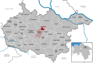
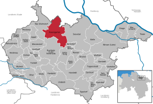
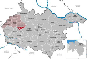
buchholzindernordheide
ASN
Time Zone
Europe/Berlin
ISP
Wizard Computersysteme GmbH
Latitude
Longitude
Postal
db-ip
Country
Region
City
ASN
Time Zone
ISP
Blacklist
Proxy
Latitude
Longitude
Postal
Route
ipdata
Country
Region
City
ASN
Time Zone
ISP
Blacklist
Proxy
Latitude
Longitude
Postal
Route
Popular places and events near this IP address
Bendestorf
Municipality in Lower Saxony, Germany
Distance: Approx. 5654 meters
Latitude and longitude: 53.33333333,9.95
Bendestorf is a municipality in Lower Saxony in Germany. It is situated ca. 30 km south of Hamburg and belongs to the Landkreis (district) Harburg and the Samtgemeinde of Jesteburg.
Rosengarten, Lower Saxony
Municipality in Lower Saxony, Germany
Distance: Approx. 6211 meters
Latitude and longitude: 53.38333333,9.9
Rosengarten is a rural municipality in the district of Harburg, Lower Saxony, Germany, near Hamburg. It had a population of 13,242 in 2004. It was formed in 1972 as a combination of the villages of Eckel, Ehestorf (with Alvesen), Emsen, Iddensen, Klecken, Leversen, Nenndorf, Sottorf, Tötensen, and Vahrendorf, and was named for a nearby forest of the same name.

Buchholz in der Nordheide
Town in Lower Saxony, Germany
Distance: Approx. 1666 meters
Latitude and longitude: 53.31666667,9.86666667
Buchholz in der Nordheide (Northern Low Saxon: Bookholt) is the largest town in the district of Harburg, in Lower Saxony, Germany. It is situated approximately 25 km southwest of Hamburg.

Jesteburg
Municipality in Lower Saxony, Germany
Distance: Approx. 6495 meters
Latitude and longitude: 53.30777778,9.95416667
Jesteburg is a municipality in the district of Harburg, in Lower Saxony, Germany. It is situated approximately 25 km south of Hamburg, and 6 km east of Buchholz in der Nordheide. Jesteburg is also the seat of the Samtgemeinde ("collective municipality") Jesteburg.
Drestedt
Municipality in Lower Saxony, Germany
Distance: Approx. 6540 meters
Latitude and longitude: 53.33333333,9.76666667
Drestedt is a municipality in the district of Harburg, in Lower Saxony, Germany.

Kakenstorf
Municipality in Lower Saxony, Germany
Distance: Approx. 6746 meters
Latitude and longitude: 53.31666667,9.76666667
Kakenstorf is a municipality in the district of Harburg, in Lower Saxony, Germany.

Wenzendorf
Municipality in Lower Saxony, Germany
Distance: Approx. 6849 meters
Latitude and longitude: 53.35,9.76666667
Wenzendorf is a municipality in Lower Saxony, Germany. It is also the name of the chief village of the municipality. The area is known mainly for the airfield near the village, where the Hamburger Flugzeugbau, the aircraft manufacturing arm of Blohm & Voss, built a factory during the Nazi era.
Jesteburg (Samtgemeinde)
Samtgemeinde in Lower Saxony, Germany
Distance: Approx. 6475 meters
Latitude and longitude: 53.308,9.954
Jesteburg is a Samtgemeinde ("collective municipality") in the district of Harburg, in Lower Saxony, Germany. Its seat is in the village Jesteburg. It consists of the municipalities, Bendestorf, Harmstorf and Jesteburg.
Sprötze
Ortsteil of Buchholz in der Nordheide in Lower Saxony, Germany
Distance: Approx. 4629 meters
Latitude and longitude: 53.30941111,9.80612222
The former independent municipality of Sprötze in the north German state of Lower Saxony was merged in 1972 with another five villages into the town of Buchholz in der Nordheide.
Brunsberg (Harburg)
Distance: Approx. 4242 meters
Latitude and longitude: 53.29861,9.83306
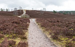
The Brunsberg is a 129 metres (423 ft) high hill on the northwestern edge of the Lüneburg Heath in northern Germany. It lies in the Brunsberg Nature Reserve, reserve no. LÜ 010 with an area of 60.6 hectares (150 acres), near Sprötze between the towns of Buchholz in der Nordheide and Tostedt.

Leine-Heide Cycle Path
Cycle route in Germany
Distance: Approx. 5156 meters
Latitude and longitude: 53.3715,9.8256
The Leine-Heide Cycle Path (German: Leine-Heide-Radweg) is a long-distance cycle path in Germany that has a total length of 410 kilometres (250 mi) and runs through the German federal states of Thuringia, Lower Saxony and Hamburg. Until 2009, it was called the Leine Cycle Path, after the River Leine; it ended north of the river's confluence with the Aller in Hodenhagen. Heide (‘heath’) refers to the Lüneburg Heath.
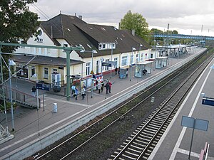
Buchholz (Nordheide) railway station
Railway station in Buchholz in der Nordheide, Germany
Distance: Approx. 1090 meters
Latitude and longitude: 53.3245,9.8763
Buchholz (Nordheide) (German: Bahnhof Buchholz (Nordheide)) is a railway station located in Buchholz in der Nordheide, Germany. The station is located on the Wanne-Eickel–Hamburg railway, Heath Railway and Wittenberge–Buchholz railway. The train services are operated by Metronom and Regionalverkehre Start Deutschland.
Weather in this IP's area
overcast clouds
26 Celsius
26 Celsius
26 Celsius
28 Celsius
1009 hPa
64 %
1009 hPa
1001 hPa
10000 meters
4.72 m/s
5.82 m/s
244 degree
98 %
06:42:43
19:53:54