Country:
 Great Britain
Region:
City:
Latitude and Longitude:
Time Zone:
Postal Code:
IP information under different IP Channel
ip-api
Country
Region
City
ASN
Time Zone
ISP
Blacklist
Proxy
Latitude
Longitude
Postal
Route
IPinfo
Country
Region
City
ASN
Time Zone
ISP
Blacklist
Proxy
Latitude
Longitude
Postal
Route
MaxMind
Country
Region
City
ASN
Time Zone
ISP
Blacklist
Proxy
Latitude
Longitude
Postal
Route
Luminati
Country
GBASN
Time Zone
Europe/London
ISP
Syscomm Limited
Latitude
Longitude
Postal
db-ip
Country
Region
City
ASN
Time Zone
ISP
Blacklist
Proxy
Latitude
Longitude
Postal
Route
ipdata
Country
Region
City
ASN
Time Zone
ISP
Blacklist
Proxy
Latitude
Longitude
Postal
Route
Popular places and events near this IP address

Coventry Transport Museum
Transport museum in Coventry, England
Distance: Approx. 223 meters
Latitude and longitude: 52.4108,-1.5092
Coventry Transport Museum (formerly known as the Museum of British Road Transport) is a transport museum, located in Coventry city centre, England. It houses the largest collection of British-made road transport held in public ownership. It is located in Coventry because the city was previously the centre of the British car industry.

BBC CWR
Radio station in Coventry, England
Distance: Approx. 358 meters
Latitude and longitude: 52.4096,-1.5084
BBC CWR (Coventry & Warwickshire Radio) is the BBC's local radio station serving Coventry and Warwickshire. It broadcasts on FM, DAB, digital TV and via BBC Sounds from studios at Priory Place in Coventry city centre. According to RAJAR, the station has a weekly audience of 64,000 listeners and a 3.7% share as of December 2023.
Sidney Stringer Academy
Secondary school in Coventry, England
Distance: Approx. 410 meters
Latitude and longitude: 52.4119,-1.5031
Sidney Stringer Academy is a coeducational (mixed) academy school for pupils aged 11–18 in Hillfields, Coventry, England. It was Sidney Stringer School and Community College from 1972 until 1994, then Sidney Stringer Community Technology College until c. 2004 and Sidney Stringer School to 2010 when it became Sidney Stringer Academy.

Belgrade Theatre
English live performance venue
Distance: Approx. 412 meters
Latitude and longitude: 52.4096,-1.512
The Belgrade Theatre is a live performance venue in Coventry, England. It was the first civic theatre to be built in Britain after the Second World War and is now a Grade II listed building.

Pool Meadow Bus Station
Distance: Approx. 302 meters
Latitude and longitude: 52.410365,-1.506999
Pool Meadow Bus Station is a bus station in the city of Coventry, England. It is managed by Transport for West Midlands. Local bus and national coach services operated by various companies serve the bus station which has 19 departure stands.

Coventry College
Further education college in Coventry, West Midlands, England
Distance: Approx. 368 meters
Latitude and longitude: 52.4144,-1.5042
City College Coventry was a further education college based in the city of Coventry, England. It was formed in 2002 through the merger of two previous colleges in the city, although through them it has roots going back to the 19th century. It was one of three further education colleges within the city boundaries, alongside Henley College and Hereward College.

Old Grammar School, Coventry
Distance: Approx. 265 meters
Latitude and longitude: 52.4107,-1.5108
The Old Grammar School, Coventry is a Grade I listed building in Coventry, England on the corner of Bishop Street and Hales Street.
Lady Herbert's Garden
Distance: Approx. 256 meters
Latitude and longitude: 52.41068,-1.507471
Lady Herbert's Garden is a garden in Coventry city centre, named as a memorial to Alfred Herbert's second wife Florence. Construction and initial laying out began in 1930 and the last section was completed in 1939. It is built around several sections of the remains of Coventry city walls, including Swanswell and Cook Street Gates.

Coventry Theatre
Theatre in Coventry, England
Distance: Approx. 229 meters
Latitude and longitude: 52.410753,-1.50869
The Coventry Theatre was a 2,000-seat theatre located on Hales Street in Coventry, England. It opened in 1937 as the New Hippodrome and was renamed the Coventry Theatre in 1955. In 1979 it was purchased by businessman Paul Gregg and became the Coventry Apollo.

Whittle Arch
Monument in Millenium Place, Coventry, England
Distance: Approx. 251 meters
Latitude and longitude: 52.41055,-1.50863
The Whittle Arch is a public art installation in Coventry, England. It is dedicated to Sir Frank Whittle, the inventor of the turbojet engine, who was born in Coventry. The arch was designed as part of Coventry's Phoenix Initiative regeneration project at the start of the 21st century.

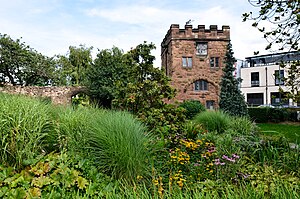
Cook Street Gate
Distance: Approx. 95 meters
Latitude and longitude: 52.412011,-1.508411
Cook Street Gate is a medieval gate in Coventry, England. It was probably built in the second half of the 14th century as part of the defensive circuit of the city. This gate is one of only two which survive of the original twelve town gates and the only one through which a road still runs.

Coventry and Warwickshire Hospital
Hospital in West Midlands, England
Distance: Approx. 112 meters
Latitude and longitude: 52.41291667,-1.50730556
The Coventry and Warwickshire Hospital was a former hospital in Coventry, England, on Stoney Stanton Road on the northern edge of the city centre. The hospital was opened in 1867 and closed in 2006, to be replaced by the new University Hospital Coventry sited about 4 miles (6.4 km) north east of the centre.
Weather in this IP's area
fog
8 Celsius
8 Celsius
7 Celsius
10 Celsius
1028 hPa
97 %
1028 hPa
1017 hPa
4000 meters
1.54 m/s
20 %
06:42:33
19:19:14