Country:
Region:
City:
Latitude and Longitude:
Time Zone:
Postal Code:
IP information under different IP Channel
ip-api
Country
Region
City
ASN
Time Zone
ISP
Blacklist
Proxy
Latitude
Longitude
Postal
Route
Luminati
Country
ASN
Time Zone
Europe/London
ISP
CloudCoCo Connect Limited
Latitude
Longitude
Postal
IPinfo
Country
Region
City
ASN
Time Zone
ISP
Blacklist
Proxy
Latitude
Longitude
Postal
Route
db-ip
Country
Region
City
ASN
Time Zone
ISP
Blacklist
Proxy
Latitude
Longitude
Postal
Route
ipdata
Country
Region
City
ASN
Time Zone
ISP
Blacklist
Proxy
Latitude
Longitude
Postal
Route
Popular places and events near this IP address
Peterhouse, Cambridge
College of the University of Cambridge
Distance: Approx. 155 meters
Latitude and longitude: 52.2009,0.1184
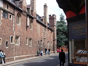
Peterhouse is the oldest constituent college of the University of Cambridge in England, founded in 1284 by Hugh de Balsham, Bishop of Ely. Peterhouse has around 300 undergraduate and 175 graduate students, and 54 fellows. Peterhouse alumni are notably eminent within the natural sciences, including scientists Lord Kelvin, Henry Cavendish, Charles Babbage, James Clerk Maxwell, James Dewar, Frank Whittle, and five Nobel prize winners in science: Sir John Kendrew, Sir Aaron Klug, Archer Martin, Max Perutz, and Michael Levitt.
Queens' College, Cambridge
College of University of Cambridge
Distance: Approx. 251 meters
Latitude and longitude: 52.2019,0.1147
Queens' College is a constituent college of the University of Cambridge. Queens' is one of the 16 "old colleges" of the university, founded in 1448 by Margaret of Anjou. Its buildings span the River Cam with the Mathematical Bridge and Silver Street connecting the two sides.

Fitzwilliam Museum
University Museum of fine art and antiquities in Cambridge, England
Distance: Approx. 192 meters
Latitude and longitude: 52.200278,0.119444
The Fitzwilliam Museum is the art and antiquities museum of the University of Cambridge. It is located on Trumpington Street opposite Fitzwilliam Street in central Cambridge. It was founded in 1816 under the will of Richard FitzWilliam, 7th Viscount FitzWilliam (1745–1816), and comprises one of the best collections of antiquities and modern art in western Europe.

Darwin College, Cambridge
Constituent college of the University of Cambridge
Distance: Approx. 213 meters
Latitude and longitude: 52.2006,0.1137
Darwin College is a constituent college of the University of Cambridge. Founded on 28 July 1964, Darwin was Cambridge University's first graduate-only college, and also the first to admit both men and women. The college is named after one of the university's most famous families and alumni, that of Charles Darwin.

Little St Mary's, Cambridge
Church in Cambridge, England
Distance: Approx. 161 meters
Latitude and longitude: 52.20114,0.11812
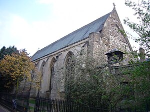
Little St Mary's or St Mary the Less is a Church of England parish church in Cambridge, England, on Trumpington Street between Pembroke College's Mill Lane Project development site and Peterhouse. The church is in the Diocese of Ely and follows the Anglo-Catholic or high-church tradition of the Church of England. In addition to its main Sunday Mass, the church has a strong tradition of daily morning and evening prayer, regular weekday Communion and the keeping of church festivals.

Trumpington Street
Street in central Cambridge, England
Distance: Approx. 200 meters
Latitude and longitude: 52.2009,0.1192
Trumpington Street is a major historic street in central Cambridge, England. At the north end it continues as King's Parade where King's College is located. To the south it continues as Trumpington Road (the A1134), an arterial route out of Cambridge, at the junction with Lensfield Road.

Silver Street, Cambridge
Street in Cambridge, England
Distance: Approx. 232 meters
Latitude and longitude: 52.202,0.1157
Silver Street is located in the southwest of central Cambridge, England. It links Queen's Road to the west with Trumpington Street to the east. The road continues west out of central Cambridge as Sidgwick Avenue.
Cambridge Poetry Festival
Literary festival in Cambridge, England
Distance: Approx. 227 meters
Latitude and longitude: 52.2,0.12
The Cambridge Poetry Festival, founded by Richard Berengarten (also known as Richard Burns), was an international biennale for poetry held in Cambridge, England, between 1975–1985. The festival was founded in an attempt to combine as many aspects as possible of this form of art. Thus Michael Hamburger could, for example, recite his English interpretations of Paul Celan's poetry in the presence of Gisèle Lestrange and a surprisingly large audience at an art gallery bestowed on her engravings.

Newnham Grange
Historic building in Cambridge, England
Distance: Approx. 210 meters
Latitude and longitude: 52.20086,0.11393
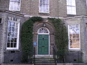
Newnham Grange () is a Grade II listed house on Silver Street, Cambridge, next to the River Cam and The Backs. Since 1962 it has been part of Darwin College, Cambridge.

Fitzbillies
Bakery in Cambridge, England
Distance: Approx. 243 meters
Latitude and longitude: 52.202,0.11811111
Fitzbillies is a small chain of three bakery-cafes in Cambridge, England. The company is known for its Chelsea buns. It was founded in November 1920 as an independent bakery on Trumpington Street, Cambridge, taking its name from its location near Fitzwilliam Museum.

William Stone Building
Distance: Approx. 258 meters
Latitude and longitude: 52.1988,0.1199
The William Stone Building is a residential structure within the grounds of Peterhouse, Cambridge, one of the constituent colleges of the University of Cambridge. It was recognised as a Grade II listed building in March 1993. The William Stone Building comprises residential accommodation for eight fellows and 24 students of Peterhouse.

Crusoe Bridge
Bridge in Coe Fen, Cambridge England
Distance: Approx. 212 meters
Latitude and longitude: 52.1982,0.1177
Crusoe Bridge is a footbridge over the River Cam in Cambridge, England. It is the fourth bridge over the Cam in the city, and is the last footbridge on its upper upstream in Cambridge. It connects Coe Fen with Sheep's Green, the wooden deck is on 4 steel piers.
Weather in this IP's area
scattered clouds
12 Celsius
11 Celsius
11 Celsius
13 Celsius
1031 hPa
86 %
1031 hPa
1030 hPa
10000 meters
2.81 m/s
5.22 m/s
115 degree
38 %
06:57:14
16:28:51

