Country:
 Germany
Region:
City:
Latitude and Longitude:
Time Zone:
Postal Code:
IP information under different IP Channel
ip-api
Country
Region
City
ASN
Time Zone
ISP
Blacklist
Proxy
Latitude
Longitude
Postal
Route
IPinfo
Country
Region
City
ASN
Time Zone
ISP
Blacklist
Proxy
Latitude
Longitude
Postal
Route
MaxMind
Country
Region
City
ASN
Time Zone
ISP
Blacklist
Proxy
Latitude
Longitude
Postal
Route
Luminati
Country
DERegion
mv
City
pasewalk
ASN
Time Zone
Europe/Berlin
ISP
e.discom Telekommunikation GmbH
Latitude
Longitude
Postal
db-ip
Country
Region
City
ASN
Time Zone
ISP
Blacklist
Proxy
Latitude
Longitude
Postal
Route
ipdata
Country
Region
City
ASN
Time Zone
ISP
Blacklist
Proxy
Latitude
Longitude
Postal
Route
Popular places and events near this IP address

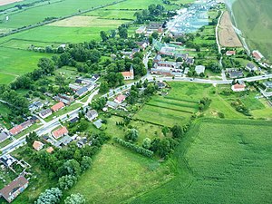
Pasewalk
Town in Mecklenburg-Vorpommern, Germany
Distance: Approx. 1469 meters
Latitude and longitude: 53.5,14
Pasewalk (German: [ˈpaːzəvalk] ) is a town in the Vorpommern-Greifswald district, in the state of Mecklenburg-Vorpommern in Germany. Located on the Uecker river, it is the capital of the former Uecker-Randow district, and the seat of the Uecker-Randow-Tal Amt, of which it is not part.
Papendorf, Uecker-Randow
Municipality in Mecklenburg-Vorpommern, Germany
Distance: Approx. 3706 meters
Latitude and longitude: 53.48333333,13.95
Papendorf is a municipality in the Vorpommern-Greifswald district, in Mecklenburg-Vorpommern, Germany.

Schönwalde, Mecklenburg-Vorpommern
Municipality in Mecklenburg-Vorpommern, Germany
Distance: Approx. 5657 meters
Latitude and longitude: 53.51666667,13.9
Schönwalde is a municipality in the Vorpommern-Greifswald district, in Mecklenburg-Vorpommern, Germany.

Viereck
Municipality in Mecklenburg-Vorpommern, Germany
Distance: Approx. 5543 meters
Latitude and longitude: 53.55,14.03333333
Viereck is a municipality in the Vorpommern-Greifswald district, in Mecklenburg-Vorpommern, Germany.

Rollwitz
Municipality in Mecklenburg-Vorpommern, Germany
Distance: Approx. 4769 meters
Latitude and longitude: 53.46666667,13.98333333
Rollwitz is a municipality in the Vorpommern-Greifswald district, in Mecklenburg-Vorpommern, Germany.

Polzow
Municipality in Mecklenburg-Vorpommern, Germany
Distance: Approx. 5535 meters
Latitude and longitude: 53.5,14.06666667
Polzow is a municipality in the Vorpommern-Greifswald district, in Mecklenburg-Vorpommern, Germany.

Krugsdorf
Municipality in Mecklenburg-Vorpommern, Germany
Distance: Approx. 6622 meters
Latitude and longitude: 53.5,14.08333333
Krugsdorf is a municipality in the Vorpommern-Greifswald district, in Mecklenburg-Vorpommern, Germany.
Uecker-Randow-Tal
Amt in Vorpommern-Greifswald, Mecklenburg-Vorpommern, Germany
Distance: Approx. 1469 meters
Latitude and longitude: 53.5,14
Uecker-Randow-Tal is an Amt in the district of Vorpommern-Greifswald, in Mecklenburg-Vorpommern, Germany. The seat of the Amt is in Pasewalk, itself not part of the Amt.

Capitulation of Pasewalk
1806 surrender during the War of the Fourth Coalition
Distance: Approx. 1469 meters
Latitude and longitude: 53.5,14
The Capitulation of Pasewalk on 29 October 1806 resulted in the surrender of Oberst (Colonel) von Hagen's 4,200 Prussian soldiers to an inferior force of two French light cavalry brigades led by Generals of Brigade Édouard Jean Baptiste Milhaud and Antoine Lasalle. The Prussians were completely demoralized after a two-week-long retreat following their decisive defeat at the Battle of Jena-Auerstedt. Pasewalk is 110 kilometers north of Berlin and about 40 kilometers west of Szczecin (Stettin), Poland.

Pasewalk station
Railway station in Pasewalk, Germany
Distance: Approx. 675 meters
Latitude and longitude: 53.515,13.98888889
Pasewalk (German: Bahnhof Pasewalk) is a railway station in the town of Pasewalk, Mecklenburg-Vorpommern, Germany. The station lies on the Angermünde–Stralsund railway and the Bützow–Szczecin railway. The train services are operated by Deutsche Bahn and Ostdeutsche Eisenbahn.
Sandförde station
Railway station in Sandförde
Distance: Approx. 6165 meters
Latitude and longitude: 53.5643,13.9711
Sandförde (German: Bahnhof Sandförde) is a railway station in the village of Sandförde, Mecklenburg-Vorpommern, Germany. The station lies on the Angermünde–Stralsund railway and the train services are operated by Ostseeland Verkehr.
Pasewalk Ost station
Railway Station
Distance: Approx. 1534 meters
Latitude and longitude: 53.50944444,14.00777778
Pasewalk Ost (German: Bahnhof Pasewalk Ost) is a railway station in the town of Pasewalk, Mecklenburg-Vorpommern, Germany. The station lies of the Bützow–Szczecin railway and the train services are operated by Deutsche Bahn.
Weather in this IP's area
few clouds
19 Celsius
19 Celsius
19 Celsius
21 Celsius
1012 hPa
62 %
1012 hPa
1011 hPa
10000 meters
3.15 m/s
7.93 m/s
129 degree
15 %
06:26:00
19:37:40