84.32.176.181 - IP Lookup: Free IP Address Lookup, Postal Code Lookup, IP Location Lookup, IP ASN, Public IP
Country:
Region:
City:
Location:
Time Zone:
Postal Code:
ISP:
ASN:
language:
User-Agent:
Proxy IP:
Blacklist:
IP information under different IP Channel
ip-api
Country
Region
City
ASN
Time Zone
ISP
Blacklist
Proxy
Latitude
Longitude
Postal
Route
db-ip
Country
Region
City
ASN
Time Zone
ISP
Blacklist
Proxy
Latitude
Longitude
Postal
Route
IPinfo
Country
Region
City
ASN
Time Zone
ISP
Blacklist
Proxy
Latitude
Longitude
Postal
Route
IP2Location
84.32.176.181Country
Region
ustecky kraj
City
libouchec
Time Zone
Europe/Prague
ISP
Language
User-Agent
Latitude
Longitude
Postal
ipdata
Country
Region
City
ASN
Time Zone
ISP
Blacklist
Proxy
Latitude
Longitude
Postal
Route
Popular places and events near this IP address

Elbe Sandstone Mountains
Mountain range in Germany
Distance: Approx. 6226 meters
Latitude and longitude: 50.79555556,14.10694444
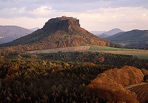
The Elbe Sandstone Mountains, also called the Elbe Sandstone Highlands (German: Elbsandsteingebirge, pronounced [ɛlpˈz̥antʃtaɪnɡəˌbɪʁɡə]; Czech: Děčinská vrchovina, pronounced [ˈɟɛtʃɪnskaː ˈvr̩xovɪna]), are a mountain range straddling the border between the state of Saxony in southeastern Germany and the North Bohemian region of the Czech Republic, with about three-quarters of the area lying on the German side. In both countries, core parts of the mountain range have been declared a national park. The name derives from the sandstone which was carved by erosion.
Ústí nad Labem District
District in Ústí nad Labem, Czech Republic
Distance: Approx. 8393 meters
Latitude and longitude: 50.68333333,14.05
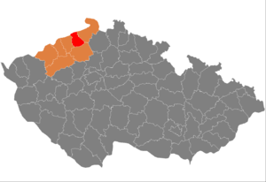
Ústí nad Labem District (Czech: okres Ústí nad Labem) is a district in the Ústí nad Labem Region of the Czech Republic. Its capital is the city of Ústí nad Labem.

Jílové
Town in Ústí nad Labem, Czech Republic
Distance: Approx. 4550 meters
Latitude and longitude: 50.7625,14.105
Jílové (until 1945 Jílové u Podmokel; German: Eulau) is a town in Děčín District in the Ústí nad Labem Region of the Czech Republic. It has about 5,000 inhabitants.

Děčínský Sněžník
Mountain in the Czech Republic
Distance: Approx. 6136 meters
Latitude and longitude: 50.79305556,14.10861111
The Děčínský Sněžník (German: Hoher Schneeberg) is a mountain in the Czech Republic. At 723.5 m (2,374 ft) above sea level, it is the highest peak of the Elbe Sandstone Mountains.

Libouchec
Municipality in Ústí nad Labem, Czech Republic
Distance: Approx. 16 meters
Latitude and longitude: 50.75861111,14.04083333
Libouchec (German: Königswald) is a municipality and village in Ústí nad Labem District in the Ústí nad Labem Region of the Czech Republic. It has about 1,900 inhabitants.

Chuderov
Municipality in Ústí nad Labem, Czech Republic
Distance: Approx. 7790 meters
Latitude and longitude: 50.68861111,14.04638889
Chuderov (German: Groß Kaudern) is a municipality and village in Ústí nad Labem District in the Ústí nad Labem Region of the Czech Republic. It has about 1,200 inhabitants. Chuderov lies approximately 4 kilometres (2 mi) north of Ústí nad Labem and 73 km (45 mi) north of Prague.

Petrovice (Ústí nad Labem District)
Municipality in Ústí nad Labem, Czech Republic
Distance: Approx. 5670 meters
Latitude and longitude: 50.78916667,13.97638889
Petrovice (German: Peterswald) is a municipality and village in Ústí nad Labem District in the Ústí nad Labem Region of the Czech Republic. It has about 900 inhabitants. Petrovice lies approximately 15 kilometres (9 mi) north of Ústí nad Labem and 84 km (52 mi) north of Prague.
Telnice (Ústí nad Labem District)
Municipality in Ústí nad Labem, Czech Republic
Distance: Approx. 6491 meters
Latitude and longitude: 50.73305556,13.95777778
Telnice (German: Tellnitz) is a municipality and village in Ústí nad Labem District in the Ústí nad Labem Region of the Czech Republic. It has about 700 inhabitants. Telnice lies approximately 12 kilometres (7 mi) north-west of Ústí nad Labem and 80 km (50 mi) north-west of Prague.

Tisá
Municipality in Ústí nad Labem, Czech Republic
Distance: Approx. 2962 meters
Latitude and longitude: 50.78444444,14.03138889
Tisá (German: Tyssa) is a municipality and village in Ústí nad Labem District in the Ústí nad Labem Region of the Czech Republic. It has about 1,000 inhabitants.

Velké Chvojno
Municipality in Ústí nad Labem, Czech Republic
Distance: Approx. 2999 meters
Latitude and longitude: 50.73166667,14.03694444
Velké Chvojno (until 1948 České Chvojno; German: Böhmisch Kahn, 1940–1945 Kahn über Bodenbach) is a municipality and village in Ústí nad Labem District in the Ústí nad Labem Region of the Czech Republic. It has about 900 inhabitants.
Battle of Peterswalde
1759 battle
Distance: Approx. 5397 meters
Latitude and longitude: 50.78694444,13.97861111
The Prussian Bohemia Incursion was a military campaign led by the Prince Henry of Prussia during the Third Silesian War (part of the Seven Years' War), to disrupt the Austrian military capacity by launching incursions against its military infrastructure in Bohemia.

Tisá Rocks
Distance: Approx. 3364 meters
Latitude and longitude: 50.78777778,14.02888889
The Tisá Rocks or Tisá Walls (Czech: Tiské stěny; German: Tyssaer Wände) are a group of rocks in Tisá in the Czech Republic. It is located in the western Elbe Sandstone Mountains, not far from its topographical boundary with the Ore Mountains. The region, with its rock pillars up to 30 m high, is one of the major tourist attractions of the region.
Weather in this IP's area
clear sky
-2 Celsius
-5 Celsius
-2 Celsius
-2 Celsius
1029 hPa
89 %
1029 hPa
978 hPa
10000 meters
2.12 m/s
2.47 m/s
179 degree
5 %

