Country:
 Netherlands
Region:
City:
Latitude and Longitude:
Time Zone:
Postal Code:
IP information under different IP Channel
ip-api
Country
Region
City
ASN
Time Zone
ISP
Blacklist
Proxy
Latitude
Longitude
Postal
Route
IPinfo
Country
Region
City
ASN
Time Zone
ISP
Blacklist
Proxy
Latitude
Longitude
Postal
Route
MaxMind
Country
Region
City
ASN
Time Zone
ISP
Blacklist
Proxy
Latitude
Longitude
Postal
Route
Luminati
Country
NLASN
Time Zone
Europe/Amsterdam
ISP
iNES GROUP SRL
Latitude
Longitude
Postal
db-ip
Country
Region
City
ASN
Time Zone
ISP
Blacklist
Proxy
Latitude
Longitude
Postal
Route
ipdata
Country
Region
City
ASN
Time Zone
ISP
Blacklist
Proxy
Latitude
Longitude
Postal
Route
Popular places and events near this IP address

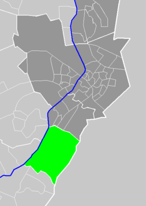
Beesel
Municipality in Limburg, Netherlands
Distance: Approx. 3096 meters
Latitude and longitude: 51.28333333,6.03333333
Beesel (Dutch: [ˈbeːzəl] ; Limburgish: Bezel [ˈbeːzəl]) is a municipality and a town in the province of Limburg in the southeastern Netherlands.

Swalmen
Village in Limburg, Netherlands
Distance: Approx. 6454 meters
Latitude and longitude: 51.23333333,6.03333333
Swalmen (Dutch: [ˈsʋɑlmə(n)] ; Limburgish: Zjwame [ˈʒwaː˦mə]) is a village in the municipality of Roermond, the south-eastern Netherlands. This village is situated between the German border and the river Meuse (Maas in Dutch). Until 1 January 2007, Swalmen was a separate municipality, covering the villages Swalmen, Asselt and Boukoul.

Reuver
Village in Limburg, Netherlands
Distance: Approx. 131 meters
Latitude and longitude: 51.285,6.07916667
Reuver (Limburgish: Oppe Ruiver) is a village in the Dutch province of Limburg. It is located in the municipality of Beesel, about 10 km (6 miles) south of the city of Venlo. The successful metal band Epica comes from Reuver.

Schwalm (Meuse)
River in Germany and the Netherlands
Distance: Approx. 6153 meters
Latitude and longitude: 51.2486,6.0102
The Schwalm (German) or Swalm (Dutch), is a small river in Germany and the Netherlands, tributary to the river Meuse. Its source is near Wegberg, in the district Heinsberg, south-west of Mönchengladbach, in North Rhine-Westphalia (Germany). The Schwalm flows through Wegberg and Brüggen before flowing into the Meuse across the border with the Netherlands, in Swalmen.

Baarlo
Village in Limburg, Netherlands
Distance: Approx. 4953 meters
Latitude and longitude: 51.3275,6.09416667
Baarlo (Dutch: [ˈbaːrloː]; Limburgish: Baolder [ˈbɔːldəʀ]) is a village in southeastern Netherlands. It is located in the municipality of Peel en Maas, Limburg, about 6 km southwest of Venlo.
Belfeld
Place in Limburg, Netherlands
Distance: Approx. 4515 meters
Latitude and longitude: 51.31666667,6.11666667
Belfeld (Limburgish: Belvend) is a village in the Dutch province of Limburg. It is a part of the municipality of Venlo, and lies about 8 km southwest of the city center of Venlo, between the river Meuse and the border with Germany. In 2001, Belfeld had 4856 inhabitants.

Kessel, Limburg
Small city and former municipality in Limburg, Netherlands
Distance: Approx. 1937 meters
Latitude and longitude: 51.28333333,6.05
Kessel (Dutch pronunciation: [ˈkɛsəl] ) is a former municipality and a city in the southeastern province of Limburg, in the Netherlands. It is a small historic municipality with 4,246 residents. It merged with neighbouring municipalities in the new municipality of Peel en Maas (as of 1 January 2010).
Bong, Maasbree
Hamlet in Limburg, Netherlands
Distance: Approx. 5380 meters
Latitude and longitude: 51.3325,6.08055556
Bong (Dutch pronunciation: [bɔŋ]) is a hamlet in the Dutch province of Limburg. It is located in the municipality of Peel en Maas, about 1 km west of Baarlo.

Reuver railway station
Railway station in the Netherlands
Distance: Approx. 172 meters
Latitude and longitude: 51.28305556,6.07944444
Reuver is a railway station located in Reuver, Netherlands. The station originally opened in 1862 and is located on the Maastricht–Venlo railway on the section between Venlo and Roermond. Train services are operated by Arriva.

Swalmen railway station
Railway station in the Netherlands
Distance: Approx. 6240 meters
Latitude and longitude: 51.23583333,6.0325
Swalmen is a railway station in Swalmen, Netherlands. The station was opened in 1862 and is located on the Maastricht–Venlo railway, also known as the Staatslijn E. Train services are operated by Arriva.

Aubergine (Netherlands restaurant)
Restaurant in Steyl, Netherlands
Distance: Approx. 6034 meters
Latitude and longitude: 51.33146944,6.12021389
Aubergine is a restaurant in Steyl in the Netherlands. It is a fine dining restaurant that is awarded one Michelin star in the period 2006–2018. GaultMillau awarded the restaurant 14 out of 20 points.

D'Erp Castle
Castle in Limburg, Netherlands
Distance: Approx. 5266 meters
Latitude and longitude: 51.3295,6.0996
D'Erp Castle, also known as De Borcht, (Dutch: Kasteel d'Erp or De Borcht) is a castle in Baarlo, Limburg, Netherlands. Dating back to the 13th century, it withstood sieges by William the Silent and Frederick Henry, Prince of Orange. The castle is currently privately owned and not open the public.
Weather in this IP's area
light rain
14 Celsius
14 Celsius
13 Celsius
15 Celsius
1013 hPa
96 %
1013 hPa
1010 hPa
6099 meters
0.89 m/s
1.34 m/s
252 degree
100 %
08:06:25
18:34:27