84.245.90.215 - IP Lookup: Free IP Address Lookup, Postal Code Lookup, IP Location Lookup, IP ASN, Public IP
Country:
Region:
City:
Location:
Time Zone:
Postal Code:
ISP:
ASN:
language:
User-Agent:
Proxy IP:
Blacklist:
IP information under different IP Channel
ip-api
Country
Region
City
ASN
Time Zone
ISP
Blacklist
Proxy
Latitude
Longitude
Postal
Route
db-ip
Country
Region
City
ASN
Time Zone
ISP
Blacklist
Proxy
Latitude
Longitude
Postal
Route
IPinfo
Country
Region
City
ASN
Time Zone
ISP
Blacklist
Proxy
Latitude
Longitude
Postal
Route
IP2Location
84.245.90.215Country
Region
presovsky kraj
City
snina
Time Zone
Europe/Bratislava
ISP
Language
User-Agent
Latitude
Longitude
Postal
ipdata
Country
Region
City
ASN
Time Zone
ISP
Blacklist
Proxy
Latitude
Longitude
Postal
Route
Popular places and events near this IP address
Snina
Town in Slovakia
Distance: Approx. 418 meters
Latitude and longitude: 48.98805556,22.15666667
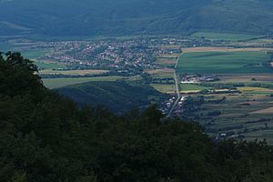
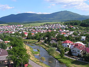
Snina (Hungarian: Szinna, Rusyn: Снина) is a town in Slovakia located at the confluence of the Cirocha river and the small river Pčolinka in the valley between the Bukovec Mountains foothills and the Vihorlat Mountains. It is the closest town with rail and bus connections to Poloniny National Park.
Snina District
District in Prešov Region, Slovakia
Distance: Approx. 141 meters
Latitude and longitude: 48.9875,22.15194444
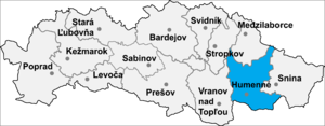
Snina District (okres Snina) is a district in the Prešov Region of eastern Slovakia. Until 1918, the district was part of the county of Kingdom of Hungary of Zemplín. It's the easternmost district in Slovakia, and includes the easternmost point of the whole country, Kremenec.
Pichne
Municipality in Slovakia
Distance: Approx. 5144 meters
Latitude and longitude: 49.03333333,22.13333333
Pichne (Hungarian: Tüskés, Rusyn: Пыхнї) is a village and municipality in Snina District in the Prešov Region of north-eastern Slovakia.
Adidovce
Municipality in Slovakia
Distance: Approx. 8010 meters
Latitude and longitude: 49.01666667,22.05
Adidovce (Rusyn: Адїдовцї) is a village and municipality in the Humenné District in the Prešov Region of north-east Slovakia. The mayor is Lenka Hudáková (Voice – Social Democracy).

Belá nad Cirochou
Municipality in Slovakia
Distance: Approx. 4455 meters
Latitude and longitude: 48.96666667,22.1
Belá nad Cirochou (Rusyn: Бела над Цірохов, Hungarian: Cirókabéla) is a large village and municipality in Snina District in the Prešov Region of north-eastern Slovakia.

Valaškovce
Distance: Approx. 7193 meters
Latitude and longitude: 48.93333333,22.1
Valaškovce is a municipality and former village and in Humenné District in the Prešov Region of north-east Slovakia.

Dlhé nad Cirochou
Municipality in Slovakia
Distance: Approx. 6628 meters
Latitude and longitude: 48.96666667,22.06666667
Dlhé nad Cirochou (Hungarian: Cirókahosszúmező) is a village and municipality in Snina District in the Prešov Region of north-eastern Slovakia.

Zemplínske Hámre
Municipality in Slovakia
Distance: Approx. 4082 meters
Latitude and longitude: 48.95194444,22.1525
Zemplínske Hámre (Hungarian: Jozsefhámor) is a village and municipality in Snina District in the Prešov Region of north-eastern Slovakia.

Stakčín
Municipality in Slovakia
Distance: Approx. 6808 meters
Latitude and longitude: 49.00277778,22.24166667
Stakčín (Hungarian: Takcsány, Rusyn: Стащін) is a larger village and a municipality in Snina District in the Prešov Region of north-eastern Slovakia.

Vihorlat Mountains
Mountain range in Slovakia and Ukraine
Distance: Approx. 8089 meters
Latitude and longitude: 48.91666667,22.16666667
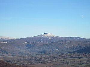
Vihorlat Mountains (Slovak: Vihorlatské vrchy; Ukrainian: Вигорлат, Vyhorliat, Hungarian: Vihorlát) or colloquially Vihorlat is a volcanic mountain range in eastern Slovakia and western Ukraine. A part of the range is listed as a World Heritage Site.
Vihorlat Protected Landscape Area
Protected landscape area of Slovakia
Distance: Approx. 8089 meters
Latitude and longitude: 48.91666667,22.16666667
Vihorlat Protected Landscape Area (Slovak: Chránená krajinná oblasť Vihorlat) is one of 14 protected landscape areas in Slovakia. The Landscape Area is in the middle part of the Vihorlatské vrchy mountains, in eastern Slovakia. It is in the Humenné, Sobrance and Snina districts.
Chapel of Virgin Mary
Chapel in Snina, Slovakia
Distance: Approx. 993 meters
Latitude and longitude: 48.99163889,22.13822222
The Chapel of Virgin Mary is a neoclassical building situated in the only cemetery in Snina in Slovakia. The chapel was built by Štefan Rholl in 1842. Because his family had roots in Snina, he built a tomb with a chapel for his deceased relatives.
Weather in this IP's area
overcast clouds
-1 Celsius
-1 Celsius
-1 Celsius
-1 Celsius
1030 hPa
94 %
1030 hPa
983 hPa
7648 meters
1.3 m/s
2.25 m/s
139 degree
95 %


