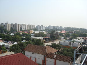
Country:
 Romania
Region:
City:
Latitude and Longitude:
Time Zone:
Postal Code:
IP information under different IP Channel
ip-api
Country
Region
City
ASN
Time Zone
ISP
Blacklist
Proxy
Latitude
Longitude
Postal
Route
IPinfo
Country
Region
City
ASN
Time Zone
ISP
Blacklist
Proxy
Latitude
Longitude
Postal
Route
MaxMind
Country
Region
City
ASN
Time Zone
ISP
Blacklist
Proxy
Latitude
Longitude
Postal
Route
Luminati
Country
ROASN
Time Zone
Europe/Bucharest
ISP
Orange Romania S.A.
Latitude
Longitude
Postal
db-ip
Country
Region
City
ASN
Time Zone
ISP
Blacklist
Proxy
Latitude
Longitude
Postal
Route
ipdata
Country
Region
City
ASN
Time Zone
ISP
Blacklist
Proxy
Latitude
Longitude
Postal
Route
Popular places and events near this IP address

Bellu Cemetery
Largest cemetery in Bucharest, Romania
Distance: Approx. 3269 meters
Latitude and longitude: 44.40388889,26.1
Șerban Vodă Cemetery (commonly known as Bellu Cemetery) is the largest and most famous cemetery in Bucharest, Romania. It is located on a plot of land donated to the local administration by Baron Barbu Bellu. It has been in use since 1858.

Ferentari
Neighborhood in Bucharest, Romania
Distance: Approx. 1306 meters
Latitude and longitude: 44.392564,26.081017
Ferentari [fe.renˈtarʲ] is a neighbourhood located in the 5th Sector of Bucharest, Romania.

Eroii Revoluției metro station
Bucharest metro station
Distance: Approx. 3100 meters
Latitude and longitude: 44.40423611,26.09655833
Eroii Revoluției (English: Heroes of the Revolution) is a metro station in Bucharest, on Bucharest Metro Line M2. It was initially named Pieptănari, but the name was changed to commemorate those people who died during the Romanian Revolution of 1989.

Rahova
Distance: Approx. 1976 meters
Latitude and longitude: 44.39861111,26.055
Rahova is a neighbourhood of southwest Bucharest, Romania, situated in Sector 5, west of Dâmbovița River. It is named after the Bulgarian town Rahovo (today Oryahovo), site of a battle in the Romanian War of Independence. The neighborhood stretches from between Antiaeriană and Drumul Sării Avenues to Panduri Square (in the west), Panduri and 13 Septembrie Streets in the north, George Cosbuc Avenue, Viilor and Sălaj Streets in the east and Bucharest City Limits in the South.
City Mall (Bucharest)
Shopping mall in Bucharest, Romania
Distance: Approx. 2973 meters
Latitude and longitude: 44.40166667,26.09777778
City Mall was a shopping mall located in Eroii Revolutiei square, Bucharest, Romania. Opened in 2005, the construction was based on an incomplete hunger circus abandoned after the fall of the Communist system. The mall became insolvent in 2012, and was bought by real estate investor Ioannis Papalekas.

Progresu Power Station
Distance: Approx. 3260 meters
Latitude and longitude: 44.37277778,26.10722222
The Progresu Power Station is a large thermal power plant located in Bucharest, having 4 generation groups of 50 MW each having a total electricity generation capacity of 200 MW. Its chimney is the tallest structure in Bucharest with a height of 240 metres.
Progresul
Distance: Approx. 2588 meters
Latitude and longitude: 44.373,26.098
Progresul is a district in southern Bucharest's Sectorul 4, Romania.
Stadionul ANEFS
Distance: Approx. 2784 meters
Latitude and longitude: 44.39029,26.10344
ANEFS Stadium is a multi-purpose stadium in Bucharest, Romania. It is currently used mostly for football matches and is the home ground of Comprest GIM București and Electrica București. The stadium holds 6,000 people.

Giurgiului
Neighborhood of Bucharest
Distance: Approx. 1869 meters
Latitude and longitude: 44.38916667,26.09194444
Giurgiului (Romanian pronunciation: [ˈdʒjurdʒjuluj]) is a neighborhood in the southern part of the Romanian capital Bucharest, in Sector 5, near Berceni and Ferentari. Like Berceni, Giurgiului has plenty of 10-storey blocks of flats that were built under Communist rule, starting with 1959–1964. The estimated population is between 30,000 and 40,000.
Odăi
District in Bucharest, Romania
Distance: Approx. 2719 meters
Latitude and longitude: 44.392733,26.037469
Odăi is a district in the Southwest side of Bucharest, Romania in Sector 5. In the north it is bounded by Alexandria Road, in the east it borders the Rahova neighborhood, and in the southwest it borders Ilfov County.

Headquarters Multinational Division Southeast
Military unit
Distance: Approx. 2693 meters
Latitude and longitude: 44.40477778,26.05169444
Headquarters Multinational Division Southeast (HQ MND-SE) is NATO's command and control military body in the South-East region under the Multinational Corps Southeast. The operational control is handled by the Supreme Allied Commander Europe (SACEUR). The headquarters are located in Bucharest, Romania.

Bucharest Sephardic Jewish Cemetery
Jewish cemetery in Bucharest, Romania
Distance: Approx. 2916 meters
Latitude and longitude: 44.40222222,26.09611111
The Bucharest Sephardic Jewish Cemetery (Romanian: Cimitirul evreiesc Sefard din București) is one of three active Jewish cemeteries that still exist in Bucharest. The cemetery is located on 2 Olteniței Street, across the street from Bellu Cemetery, and was opened in 1865. It has an area between 4 and 5 hectares large, and contains 10,300 graves.
Weather in this IP's area
scattered clouds
17 Celsius
18 Celsius
16 Celsius
19 Celsius
1010 hPa
86 %
1010 hPa
1001 hPa
8000 meters
2.57 m/s
240 degree
40 %
07:18:24
18:49:29