Country:
 Romania
Region:
City:
Latitude and Longitude:
Time Zone:
Postal Code:
IP information under different IP Channel
ip-api
Country
Region
City
ASN
Time Zone
ISP
Blacklist
Proxy
Latitude
Longitude
Postal
Route
IPinfo
Country
Region
City
ASN
Time Zone
ISP
Blacklist
Proxy
Latitude
Longitude
Postal
Route
MaxMind
Country
Region
City
ASN
Time Zone
ISP
Blacklist
Proxy
Latitude
Longitude
Postal
Route
Luminati
Country
ROASN
Time Zone
Europe/Bucharest
ISP
Orange Romania S.A.
Latitude
Longitude
Postal
db-ip
Country
Region
City
ASN
Time Zone
ISP
Blacklist
Proxy
Latitude
Longitude
Postal
Route
ipdata
Country
Region
City
ASN
Time Zone
ISP
Blacklist
Proxy
Latitude
Longitude
Postal
Route
Popular places and events near this IP address
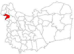
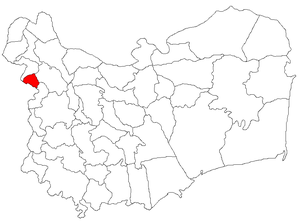
Măcin
Town in Tulcea, Romania
Distance: Approx. 1444 meters
Latitude and longitude: 45.24555556,28.12305556
Măcin (Romanian pronunciation: [məˈt͡ʃin]) is a town in Tulcea County, in the Northern Dobruja region of Romania.

Battle of Măcin
1791 battle of the Russo-Turkish War
Distance: Approx. 1444 meters
Latitude and longitude: 45.24555556,28.12305556
The Battle of Măcin took place during the Russo-Turkish War (1787–1792), fought on 9 July 1791 between the Ottoman Empire and the Russian Empire. The Russian army of 30,000 was commanded by Prince Nicholas Repnin, whereas the Turks, numbering about 80,000 men, were led by Koca Yusuf Pasha.
Jijila
Commune in Tulcea, Romania
Distance: Approx. 5960 meters
Latitude and longitude: 45.3,28.15
Jijila is a commune in Tulcea County, Northern Dobruja, Romania. It is composed of two villages, Garvăn and Jijila.
Carcaliu
Commune in Tulcea, Romania
Distance: Approx. 7097 meters
Latitude and longitude: 45.18333333,28.15
Carcaliu is a commune in Tulcea County, Northern Dobruja, Romania. It is composed of a single village, Carcaliu. At the 2011 census, 91% of inhabitants were Lipovans and 8.9% Romanians.

Văcăreni
Commune in Tulcea, Romania
Distance: Approx. 9031 meters
Latitude and longitude: 45.31666667,28.2
Văcăreni is a commune in Tulcea County, Northern Dobruja, Romania. It is composed of a single village, Văcăreni. This belonged to Luncavița Commune until 2003, when it was split off.
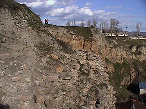
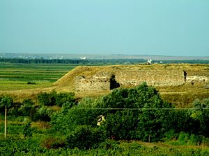
Arrubium
Distance: Approx. 1395 meters
Latitude and longitude: 45.2388,28.1277
Arrubium was a fort in the Roman province of Moesia (today's Măcin, Romania), (later Scythia Minor) and was part of the defensive frontier system of the Moesian Limes along the Danube.
Battle of Galați
Distance: Approx. 9857 meters
Latitude and longitude: 45.27,28.02
The Battle of Galați was a military engagement between the formerly allied Romanian and Russian troops at the end of World War I, as the former sought to prevent the latter from retreating from the armistice line along with their equipment.
Weather in this IP's area
clear sky
14 Celsius
14 Celsius
14 Celsius
14 Celsius
1018 hPa
78 %
1018 hPa
1014 hPa
10000 meters
2.99 m/s
4.6 m/s
199 degree
07:13:08
18:36:58