Country:
 Romania
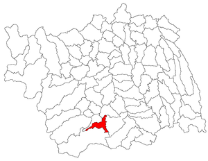
Region:
City:
Latitude and Longitude:
Time Zone:
Postal Code:
IP information under different IP Channel
ip-api
Country
Region
City
ASN
Time Zone
ISP
Blacklist
Proxy
Latitude
Longitude
Postal
Route
IPinfo
Country
Region
City
ASN
Time Zone
ISP
Blacklist
Proxy
Latitude
Longitude
Postal
Route
MaxMind
Country
Region
City
ASN
Time Zone
ISP
Blacklist
Proxy
Latitude
Longitude
Postal
Route
Luminati
Country
ROASN
Time Zone
Europe/Bucharest
ISP
Orange Romania S.A.
Latitude
Longitude
Postal
db-ip
Country
Region
City
ASN
Time Zone
ISP
Blacklist
Proxy
Latitude
Longitude
Postal
Route
ipdata
Country
Region
City
ASN
Time Zone
ISP
Blacklist
Proxy
Latitude
Longitude
Postal
Route
Popular places and events near this IP address

Onești
City in Bacău County, Romania
Distance: Approx. 1810 meters
Latitude and longitude: 46.25861111,26.76916667
Onești (Romanian pronunciation: [oˈneʃtʲ]; Hungarian: Ónfalva), formerly known as Gheorghe Gheorghiu-Dej, is a city in Bacău County, Romania, with a population of 34,005 inhabitants as of 2021. It is situated in the historical region of Moldavia. Administratively, the villages of Slobozia and Borzești form part of Onești.

Borzești Church
Distance: Approx. 5328 meters
Latitude and longitude: 46.24123,26.81774
The Borzeşti church is located in Onești, Bacău County, Romania and it was ordered by Ştefan cel Mare to be built in 1493, with construction lasting from July 9, 1493, to October 12, 1494. Legend has it that the church was dedicated to a child killed during the invasions of the Tatars. The church is designed in a Moldavian style, just as the Războieni Church and the Piatra Neamţ Church (1497–1498).
Oituz (river)
River in Bacău, Romania
Distance: Approx. 716 meters
Latitude and longitude: 46.2534,26.7571
The Oituz (Hungarian: Ojtoz) is a right tributary of the river Trotuș in Romania. It discharges into the Trotuș in Onești. The following towns and villages are situated along the river Oituz, from source to mouth: Oituz (CV), Poiana Sărată, Oituz (BC), Bogdănești and Onești.
Tazlău (river)
River in Romania
Distance: Approx. 5223 meters
Latitude and longitude: 46.2775,26.80416667
The Tazlău is a left tributary of the river Trotuș in Romania. Its source is in the Tarcău Mountains. It discharges into the Trotuș in Slobozia, near the city Onești.
Caraclău
River in Bacău County, Romania
Distance: Approx. 2179 meters
Latitude and longitude: 46.262,26.7277
The Caraclău is a left tributary of the river Trotuș in Romania. It discharges into the Trotuș near Onești. Its length is 15 km (9.3 mi) and its basin size is 26 km2 (10 sq mi).
Buciumi (river)
River in Bacău County, Romania
Distance: Approx. 2851 meters
Latitude and longitude: 46.2289,26.7714
The Buciumi is a right tributary of the river Cașin in Romania. It flows into the Cașin near Răcăuți. Its length is 11 km (6.8 mi) and its basin size is 18 km2 (6.9 sq mi).
Cașin (Trotuș)
River in Bacău County, Romania
Distance: Approx. 1593 meters
Latitude and longitude: 46.259,26.7652
The Cașin is a right tributary of the river Trotuș in Romania. It discharges into the Trotuș in Onești. Its length is 54 km (34 mi) and its basin size is 308 km2 (119 sq mi).
Curița
River in Bacău County, Romania
Distance: Approx. 6145 meters
Latitude and longitude: 46.1945,26.7447
The Curița is a left tributary of the river Cașin in Romania. It discharges into the Cașin in the village Cașin. Its length is 17 km (11 mi) and its basin size is 31 km2 (12 sq mi).

Bogdănești, Bacău
Commune in Bacău, Romania
Distance: Approx. 6283 meters
Latitude and longitude: 46.21666667,26.68333333
Bogdănești is a commune in Bacău County, Western Moldavia, Romania located on the Oituz River valley. It is composed of two villages, Bogdănești and Filipești.
Cașin
Commune in Bacău, Romania
Distance: Approx. 5522 meters
Latitude and longitude: 46.2,26.75
Cașin is a commune in Bacău County, Western Moldavia, Romania. It is composed of two villages, Cașin and Curița.

Borzești Power Station
Thermal power plant in Borzeşti, Romania
Distance: Approx. 1811 meters
Latitude and longitude: 46.25833333,26.76944444
The Borzeşti Power Station is a large thermal power plant in Borzeşti, Romania, containing seven generation groups, three of 25 MW, two of 50 MW, one of 60 MW and one of 210 MW, having a total electricity generation capacity of 655 MW.

Buciumi, Bacău
Commune in Bacău, Romania
Distance: Approx. 6102 meters
Latitude and longitude: 46.2,26.78333333
Buciumi is a commune in Bacău County, Western Moldavia, Romania. It is composed of two villages, Buciumi and Răcăuți. The villages were part of Ștefan cel Mare Commune until 2005, when they were split off.
Weather in this IP's area
overcast clouds
16 Celsius
16 Celsius
16 Celsius
16 Celsius
1011 hPa
81 %
1011 hPa
987 hPa
10000 meters
1.49 m/s
1.5 m/s
307 degree
95 %
07:16:48
18:45:38