84.19.41.251 - IP Lookup: Free IP Address Lookup, Postal Code Lookup, IP Location Lookup, IP ASN, Public IP
Country:
Region:
City:
Location:
Time Zone:
Postal Code:
IP information under different IP Channel
ip-api
Country
Region
City
ASN
Time Zone
ISP
Blacklist
Proxy
Latitude
Longitude
Postal
Route
Luminati
Country
Region
eng
City
london
ASN
Time Zone
Europe/London
ISP
Vaioni Group Ltd
Latitude
Longitude
Postal
IPinfo
Country
Region
City
ASN
Time Zone
ISP
Blacklist
Proxy
Latitude
Longitude
Postal
Route
IP2Location
84.19.41.251Country
Region
england
City
swanmore
Time Zone
Europe/London
ISP
Language
User-Agent
Latitude
Longitude
Postal
db-ip
Country
Region
City
ASN
Time Zone
ISP
Blacklist
Proxy
Latitude
Longitude
Postal
Route
ipdata
Country
Region
City
ASN
Time Zone
ISP
Blacklist
Proxy
Latitude
Longitude
Postal
Route
Popular places and events near this IP address

Bishop's Waltham
Town in Hampshire, England
Distance: Approx. 2460 meters
Latitude and longitude: 50.9536,-1.2118
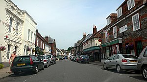
Bishop's Waltham (or Bishops Waltham) is a medieval market town situated at the source of the River Hamble in Hampshire, England. It has a foot in the South Downs National Park and is located at the midpoint of a long-established route between Winchester and Portsmouth. It is home to the ruins of Bishop's Waltham Palace, a Scheduled Ancient Monument under English Heritage management, and a well-preserved high street with many listed buildings which now house independent shops.

Bishop's Waltham Palace
Palace ruins in England
Distance: Approx. 2701 meters
Latitude and longitude: 50.95361111,-1.21555556
Bishop's Waltham Palace is a moated Bishop's Palace ruin in Bishop's Waltham, Hampshire, England.
Waltham Chase
Village in the Winchester district of Hampshire, England
Distance: Approx. 1369 meters
Latitude and longitude: 50.936071,-1.195118
Waltham Chase is a village in Hampshire, England, neighbouring the town of Bishop's Waltham. It is in the civil parish of Shedfield, comprising about two square kilometres of land to the south-east of Bishop's Waltham.
Swanmore
Village and parish in Hampshire, England
Distance: Approx. 203 meters
Latitude and longitude: 50.942257,-1.179353
Swanmore is a rural village and civil parish situated in the Meon Valley, Hampshire, England. It is very near to Bishop's Waltham. Swanmore was originally set up to provide homes for workers in local brickworks.

Swanmore College
Community school in Swanmore, Hampshire, England
Distance: Approx. 801 meters
Latitude and longitude: 50.9403,-1.19
Swanmore College is an 11–16 mixed secondary community school in Swanmore, Hampshire, England. The school has achieved Sports-mark, Investors in People and an Enhanced Healthy School award.

Galley Down Wood
Geological site in England
Distance: Approx. 2693 meters
Latitude and longitude: 50.968,-1.185
Galley Down Wood is a 16.6-hectare (41-acre) biological Site of Special Scientific Interest north-east of Bishop's Waltham in Hampshire. This wood, which was planted with beech trees in around 1930, has a well developed beech flora. Flowering plants include bird's-nest orchid, white helleborine, greater butterfly-orchid, common spotted orchid and the nationally rare long-leaved helleborine.
Meon Valley Trail (cycle trail)
Distance: Approx. 2796 meters
Latitude and longitude: 50.919,-1.184
The Meon Valley Trail is a 16 kilometres (9.9 mi) trail for cyclists in Hampshire, England. The trail passes through Butser Hill, Clanfield, West Meon and East Meon. Full details of the route can be found on the Hampshire County Council website.
Shirrell Heath
Village in Hampshire, England
Distance: Approx. 2113 meters
Latitude and longitude: 50.9254,-1.1862
Shirrell Heath is a village and top of a modest escarpment of the South Downs National Park in south Hampshire, England. Shirrell Heath, and its neighbouring village, Waltham Chase are part of Shedfield parish. It is in the civil parish of Shedfield.

Church of Saint Barnabas, Swanmore
Distance: Approx. 67 meters
Latitude and longitude: 50.94416667,-1.18111111
The Church of St Barnabas is the Church of England parish church of Swanmore near Southampton in Hampshire, England. It was constructed in 1844 and is a grade II listed building. The church is under the ecclesiastic jurisdiction of the Diocese of Portsmouth and the Deanery of Bishop's Waltham.

Mislingford
Hamlet in Hampshire, England
Distance: Approx. 2413 meters
Latitude and longitude: 50.924628,-1.164775
Mislingford is a small area around the River Meon between the village of Swanmore and the small hamlet of Kingsmead on the A32 road in the City of Winchester district of Hampshire, England. Its nearest town is Fareham, which lies approximately 5 miles (8.0 km) south-east from the village.

The Moors, Bishop's Waltham
Nature reserve in Hampshire, England
Distance: Approx. 1693 meters
Latitude and longitude: 50.949,-1.203
The Moors, Bishop's Waltham is a 28-hectare (69-acre) biological Site of Special Scientific Interest in Bishop's Waltham in Hampshire. It is a Nature Conservation Review and an area of 14.5 hectares (36 acres) is a Local Nature Reserve, which is owned and managed by Hampshire County Council. These unimproved wet meadows and alder carr drain into Mill Pond at the centre of the site.

Dundridge Meadows
Nature reserve in Hampshire, England
Distance: Approx. 2258 meters
Latitude and longitude: 50.96,-1.2
Dundridge Meadows is a 7.5-hectare (19-acre) Local Nature Reserve near Bishop's Waltham in Hampshire. It is owned by Hampshire County Council and managed by Hampshire County Council Countryside Service. These meadows are chalk grassland managed for hay.
Weather in this IP's area
broken clouds
9 Celsius
9 Celsius
8 Celsius
10 Celsius
1025 hPa
98 %
1025 hPa
1017 hPa
8000 meters
0.51 m/s
270 degree
75 %