Country:
Region:
City:
Latitude and Longitude:
Time Zone:
Postal Code:
IP information under different IP Channel
ip-api
Country
Region
City
ASN
Time Zone
ISP
Blacklist
Proxy
Latitude
Longitude
Postal
Route
Luminati
Country
ASN
Time Zone
Europe/Amsterdam
ISP
Signet B.V.
Latitude
Longitude
Postal
IPinfo
Country
Region
City
ASN
Time Zone
ISP
Blacklist
Proxy
Latitude
Longitude
Postal
Route
db-ip
Country
Region
City
ASN
Time Zone
ISP
Blacklist
Proxy
Latitude
Longitude
Postal
Route
ipdata
Country
Region
City
ASN
Time Zone
ISP
Blacklist
Proxy
Latitude
Longitude
Postal
Route
Popular places and events near this IP address

Erasmus University Rotterdam
Public university in the Netherlands
Distance: Approx. 739 meters
Latitude and longitude: 51.91805556,4.52583333
Erasmus University Rotterdam (Dutch: Erasmus Universiteit Rotterdam [eːˈrɑsmʏs ynivɛrsiˈtɛit rɔtərˈdɑm]; abbreviated as EUR) is a public research university located in Rotterdam, Netherlands. The university is named after Desiderius Erasmus Roterodamus, a 15th-century Christian humanist and theologian. Erasmus MC is the largest and one of the foremost academic medical centers and trauma centers in the Netherlands, whereas its economics and business school, Erasmus School of Economics and Rotterdam School of Management are well known in Europe.

Van Donge & De Roo Stadion
Dutch Football Stadium
Distance: Approx. 391 meters
Latitude and longitude: 51.91694444,4.52055556
The Stadion Woudestein (Dutch pronunciation: [ˌstaːdijɔɱ ˈʋʌudəstɛin]; known as the Van Donge & De Roo Stadion for sponsorship reasons), is a multi-use stadium in Rotterdam, Netherlands. It is currently used mainly for football matches and is the home stadium of the Excelsior men's the women's teams. The stadium is able to hold 4,500 people and was built in 1902.

Rotterdam Business School
Distance: Approx. 891 meters
Latitude and longitude: 51.91570297,4.52755877
Rotterdam Business School (RBS; distinct from Rotterdam School of Management, Erasmus University) was founded in Rotterdam, Netherlands in 1990 as the International School of Economics Rotterdam, which developed study programmes in English. Rotterdam Business School is part of Rotterdam University of Applied Sciences and offers three types of study programmes: Bachelor, Master, and Special.

Kralingen
Place in South Holland, Netherlands
Distance: Approx. 957 meters
Latitude and longitude: 51.925,4.50722222
Kralingen (Dutch pronunciation: [ˈkraːlɪŋə(n)]) is a former village in the Dutch province of South Holland, now a neighbourhood of Rotterdam. It is located about 3 kilometres east of the city centre, in the borough Kralingen-Crooswijk. Kralingen was a separate municipality until 1895, when it merged with Rotterdam.

Arboretum Trompenburg
Distance: Approx. 282 meters
Latitude and longitude: 51.91944444,4.51833333
Arboretum Trompenburg is a botanical garden in Rotterdam, Netherlands, which hosts a large collection of woody as well as herbaceous plants. It occupies an area of 7 ha and is situated 4 m below sea level, so a system of canals is used to drain the land. The history of the garden dates back to the 19th century.
Institute for Housing and Urban Development Studies
Distance: Approx. 795 meters
Latitude and longitude: 51.9159,4.5262
The Institute for Housing and Urban Development Studies (IHS) is an international institute on urban management and housing at the Erasmus University Rotterdam, based in the Netherlands. IHS was founded in 1958 and has more than 60 years of history behind its back. It offers post graduate education (master's degree and PhD) and training, advisory services and applied research in the field of urban management, housing and urban planning.

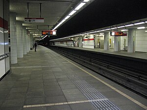
Voorschoterlaan metro station
Subway station in Rotterdam, the Netherlands
Distance: Approx. 802 meters
Latitude and longitude: 51.925,4.51305556
Voorschoterlaan is an underground subway station in the city of Rotterdam, located on the Rotterdam Metro lines A, B, and C. The station opened on 10 May 1982, the same date that the East-West Line (also formerly called the Caland line), of which it is a part, was opened. The station is located to the east of the city center, in the borough of Kralingen-Crooswijk. Overground people can get on at RET-Rotterdam tram line 7.
Admiraliteitsbrug
Distance: Approx. 748 meters
Latitude and longitude: 51.92083333,4.50527778
The Admiraliteitsbrug is a drawbridge over the Buizengat in Rotterdam. The bridge is located on Willem Ruyslaan and connects Oostzeedijk to the Maasboulevard. The bridge has a passage width of 9.20 m (30.2 ft) and a vertical clearance of 2.75 m (9 ft 0 in).
Struisenburg
Neighborhood of Rotterdam in South Holland, Netherlands
Distance: Approx. 235 meters
Latitude and longitude: 51.91777778,4.51166667
Struisenburg is a neighborhood of Rotterdam, Netherlands.

's-Gravenweg 168, Kralingen
Dutch National Historical Site
Distance: Approx. 873 meters
Latitude and longitude: 51.92375,4.52354
's-Gravenweg 168, Kralingen, Rotterdam is a Louis XIV-XV façade house ca. 1850 that is classified as a Dutch National Heritage Site (number: 32911).
Fred (restaurant)
Restaurant in Rotterdam, Netherlands
Distance: Approx. 203 meters
Latitude and longitude: 51.91698611,4.51763611
Fred is a restaurant in Rotterdam, Netherlands. It is a fine dining restaurant that was awarded one Michelin star for the period 2010–2013, and two stars since 2014. GaultMillau awarded the restaurant 16 out of 20 points.

BlueCity
Distance: Approx. 954 meters
Latitude and longitude: 51.919799,4.501538
BlueCity is a platform for the circular economy located in former Center Parcs site Tropicana, Rotterdam. It is home to a collective of small businesses operating within a zero waste circular economy, influenced by the Blue Economy. BlueCity was founded in 2015, when the old Tropicana swimming pool was bought at public auction for €1.7 m in 2015.
Weather in this IP's area
overcast clouds
9 Celsius
8 Celsius
8 Celsius
11 Celsius
1024 hPa
91 %
1024 hPa
1023 hPa
7000 meters
2.57 m/s
200 degree
100 %
08:02:07
16:51:18

