83.243.90.144 - IP Lookup: Free IP Address Lookup, Postal Code Lookup, IP Location Lookup, IP ASN, Public IP
Country:
Region:
City:
Location:
Time Zone:
Postal Code:
IP information under different IP Channel
ip-api
Country
Region
City
ASN
Time Zone
ISP
Blacklist
Proxy
Latitude
Longitude
Postal
Route
Luminati
Country
Region
rix
City
riga
ASN
Time Zone
Europe/Riga
ISP
Telenet SIA
Latitude
Longitude
Postal
IPinfo
Country
Region
City
ASN
Time Zone
ISP
Blacklist
Proxy
Latitude
Longitude
Postal
Route
IP2Location
83.243.90.144Country
Region
ropazu novads
City
ulbroka
Time Zone
Europe/Riga
ISP
Language
User-Agent
Latitude
Longitude
Postal
db-ip
Country
Region
City
ASN
Time Zone
ISP
Blacklist
Proxy
Latitude
Longitude
Postal
Route
ipdata
Country
Region
City
ASN
Time Zone
ISP
Blacklist
Proxy
Latitude
Longitude
Postal
Route
Popular places and events near this IP address

Riga LVRTC Transmitter
Communication tower near Riga, Latvia
Distance: Approx. 580 meters
Latitude and longitude: 56.938,24.28241667
The Riga LVRTC Transmitter was a mediumwave transmitter in Ulbroka near Riga, Latvia, which broadcast on 945 kHz a music program in DRM-simulcast mode, which was receivable at night time in wide parts of Europe. It used as an antenna two guyed mast radiators. One of them was a 125 m-tall (410 ft) guyed lattice mast.

Ulbroka
Village in Stopiņi Municipality, Latvia
Distance: Approx. 970 meters
Latitude and longitude: 56.93333333,24.28333333
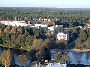
Ulbroka is a village in Stopiņi Parish, Ropaži Municipality in the Vidzeme region of Latvia. It is the administrative center of Stopiņi Parish and municipality. The village is crossed by two first category roads Rīga-Ērgļi (P4) and Rīga-Ogre (P5).

Riga offensive (1944)
Soviet offensive against Nazi Germany during World War II
Distance: Approx. 3261 meters
Latitude and longitude: 56.96666667,24.31666667
The Riga offensive (Russian: Рижская наступательная операция, lit. 'Riga offensive operation') was part of the larger Baltic offensive on the Eastern Front during World War II. It took place late in 1944, and drove German forces from the city of Riga.

Stopiņi Municipality
Municipality of Latvia
Distance: Approx. 970 meters
Latitude and longitude: 56.93333333,24.28333333
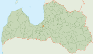
Stopiņi Municipality (Latvian: Stopiņu novads) is a former municipality in the historical region of Vidzeme, and the Riga Planning Region in Latvia. The municipality was formed in 2005 through the reorganization of Stopiņi Parish, the administrative centre being Ulbroka. The municipality consisted of the following villages and settlements: Ulbroka, Saurieši, Upeslejas, Dreiliņi, Vālodzes, Līči, Dzidriņas, Rumbula and Cekule.
St. Catherine's Lutheran Church, Riga
Church in Riga, Latvia
Distance: Approx. 3073 meters
Latitude and longitude: 56.95791389,24.24936667
St. Catherine's Lutheran Church (Latvian: Svētās Katrīnas Evaņģēliski luteriskā baznīca), also known as Biķeri or Biķernieki church for its location, is a Lutheran church in Riga, the capital of Latvia. It is a parish church of the Evangelical Lutheran Church of Latvia.

Mazā Jugla
River in Latvia
Distance: Approx. 3736 meters
Latitude and longitude: 56.96944444,24.32333333
Mazā Jugla (previously German: Kleine Jägel) is a river in Latvia. It flows for 119 kilometres through the municipalities of Ogre, Salaspils, Ikšķile and Stopiņi. The source of the river is located in Taurupe parish, Ogre Municipality 130 m above sea level, whereas the mouth is 0.1 m asl.

Brekši
Neighbourhood of Riga, Latvia
Distance: Approx. 2920 meters
Latitude and longitude: 56.966363,24.303979
Brekši is a neighbourhood of Riga, the capital of Latvia. The main touristic and historical sights of this neighbourhood include Juglas muiža and Brekšu muiža.

Dreiliņi, Stopiņi Municipality
Village in Latvia
Distance: Approx. 2615 meters
Latitude and longitude: 56.9433,24.2469
Dreiliņi is a village in Stopiņi Parish, Ropaži Municipality in the Vidzeme region and the Riga Planning Region of Latvia. From 2009 until 2021, it was part of the former Stopiņi Municipality. Artist Burkards Dzenis was born in Dreiliņi.
Vālodzes
Village in Latvia
Distance: Approx. 231 meters
Latitude and longitude: 56.9408,24.2861
Vālodzes is a village in Stopiņi Parish, Ropaži Municipality in the Vidzeme region and the Riga Planning Region of Latvia.
Dzidriņas
Village in Latvia
Distance: Approx. 2070 meters
Latitude and longitude: 56.94166667,24.32388889
Dzidriņas is a village in Stopiņi Parish, Ropaži Municipality in the Vidzeme region and the Riga Planning Region of Latvia.

Riga offensive (1917)
WWI battle over Riga, Latvia
Distance: Approx. 3736 meters
Latitude and longitude: 56.96944444,24.32333333
The Riga offensive (Russian: Рижская операция), also called the Jugla Offensive or the Battle of Riga (German: Schlacht um Riga), took place in early September 1917 and was the last major campaign on the Eastern Front of World War I before the Russian Provisional Government and its army began disintegrating. The battle was fought between Oskar von Hutier's German Eighth Army and Dmitri Parsky's Russian Twelfth Army. The Russian forces in Latvia were under the command of Vladislav Klembovsky's Northern Front, tasked with guarding the approaches to the Russian capital Petrograd.

Lielā Jugla
River in Latvia
Distance: Approx. 3736 meters
Latitude and longitude: 56.96944444,24.32333333
Lielā Jugla is a river in Latvia. It flows for 63 kilometres (the length would reach 118 km if the Mergupe river were counted as part of the Lielā Jugla), through the municipalities of Sigulda and Ropaži. The source of the river is located in Mālpils parish, Sigulda Municipality 71 m above sea level, whereas the mouth is 0.1 m asl.
Weather in this IP's area
overcast clouds
6 Celsius
4 Celsius
5 Celsius
6 Celsius
1030 hPa
94 %
1030 hPa
1028 hPa
10000 meters
3.09 m/s
220 degree
100 %
