Country:
Region:
City:
Latitude and Longitude:
Time Zone:
Postal Code:
IP information under different IP Channel
ip-api
Country
Region
City
ASN
Time Zone
ISP
Blacklist
Proxy
Latitude
Longitude
Postal
Route
Luminati
Country
Region
11
City
lisbon
ASN
Time Zone
Europe/Lisbon
ISP
Servicos De Comunicacoes E Multimedia S.A.
Latitude
Longitude
Postal
IPinfo
Country
Region
City
ASN
Time Zone
ISP
Blacklist
Proxy
Latitude
Longitude
Postal
Route
db-ip
Country
Region
City
ASN
Time Zone
ISP
Blacklist
Proxy
Latitude
Longitude
Postal
Route
ipdata
Country
Region
City
ASN
Time Zone
ISP
Blacklist
Proxy
Latitude
Longitude
Postal
Route
Popular places and events near this IP address

Cambeses (Barcelos)
Civil parish in Norte, Portugal
Distance: Approx. 2935 meters
Latitude and longitude: 41.483,-8.532
Cambeses is a Portuguese freguesia ("civil parish"), located in the municipality of Barcelos. The population in 2011 was 1,300, in an area of 3.31 km².
Carreira e Fonte Coberta
Civil parish in Norte, Portugal
Distance: Approx. 2324 meters
Latitude and longitude: 41.479,-8.553
Carreira e Fonte Coberta is a civil parish in the municipality of Barcelos, Portugal. It was formed in 2013 by the merger of the former parishes Carreira and Fonte Coberta. The population in 2011 was 2,033, in an area of 5.29 km².
Carvalhas
Civil parish in Norte, Portugal
Distance: Approx. 3878 meters
Latitude and longitude: 41.47,-8.59
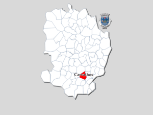
Carvalhas is a Portuguese freguesia ("civil parish"), located in the municipality of Barcelos. The population as of 2011 was 691, in an area of 3.49 square kilometres (1.35 sq mi).
Chorente, Góios, Courel, Pedra Furada e Gueral
Civil parish in Norte, Portugal
Distance: Approx. 5595 meters
Latitude and longitude: 41.457,-8.613
Chorente, Góios, Courel, Pedra Furada e Gueral is a civil parish in the municipality of Barcelos, Portugal. It was formed in 2013 by the merger of the former parishes Chorente, Góios, Courel, Pedra Furada and Gueral. The population in 2011 was 2,568, in an area of 16.09 km².
Monte de Fralães
Civil parish in Norte, Portugal
Distance: Approx. 1756 meters
Latitude and longitude: 41.458,-8.567
Monte de Fralães is a former civil parish, located in the municipality of Barcelos, Portugal. In 2013, the parish merged into the new parish Viatodos, Grimancelos, Minhotães e Monte de Fralães. The population in 2011 was 408, in an area of 1.58 km².

Moure (Barcelos)
Civil parish in Norte, Portugal
Distance: Approx. 4771 meters
Latitude and longitude: 41.501,-8.556
Moure is a Portuguese parish, located in the municipality of Barcelos. The population in 2011 was 925, in an area of 2.54 km².

Sequeade e Bastuço (São João e Santo Estêvão)
Civil parish in Norte, Portugal
Distance: Approx. 4815 meters
Latitude and longitude: 41.502,-8.543
Sequeade e Bastuço (São João e Santo Estêvão) is a civil parish in the municipality of Barcelos, Portugal. It was formed in 2013 by the merger of the former parishes Sequeade, Bastuço (São João) and Bastuço (Santo Estêvão). The population in 2011 was 1,916, in an area of 6.34 km².
Silveiros e Rio Covo (Santa Eulália)
Civil parish in Norte, Portugal
Distance: Approx. 2599 meters
Latitude and longitude: 41.469,-8.574
Silveiros e Rio Covo (Santa Eulália) is a civil parish in the municipality of Barcelos, Portugal. It was formed in 2013 by the merger of the former parishes Silveiros and Rio Covo (Santa Eulália). The population in 2011 was 2,151, in an area of 8.23 km².
Viatodos, Grimancelos, Minhotães e Monte de Fralães
Civil parish in Norte, Portugal
Distance: Approx. 1427 meters
Latitude and longitude: 41.449,-8.557
Viatodos, Grimancelos, Minhotães e Monte de Fralães is a civil parish in the municipality of Barcelos, Portugal. It was formed in 2013 by the merger of the former parishes Viatodos, Grimancelos, Minhotães and Monte de Fralães. The population in 2011 was 3,814, in an area of 12.40 km².

Arentim e Cunha
Civil parish in Norte, Portugal
Distance: Approx. 4814 meters
Latitude and longitude: 41.492,-8.509
Arentim e Cunha is a civil parish in the municipality of Braga, Portugal. It was formed in 2013 by the merger of the former parishes Arentim and Cunha. The population in 2011 was 1,530, in an area of 5.72 km².

Ruilhe
Civil parish in Norte, Portugal
Distance: Approx. 5893 meters
Latitude and longitude: 41.499,-8.5
Ruilhe is a Portuguese parish, located in the municipality of Braga. The population in 2011 was 1,142, in an area of 2.20 km².
Igreja de Santa Eulália do Mosteiro de Arnoso
Church building in Vila Nova de Famalicão, Braga District, Portugal
Distance: Approx. 2164 meters
Latitude and longitude: 41.4670984,-8.5225274
Church of Santa Eulalia of the Monastery of Arnoso (Portuguese: Igreja de Santa Eulália do Mosteiro de Arnoso) is a church in Vila Nova de Famalicão, Portugal. It was classified as a National Monument in 1938.
Weather in this IP's area
broken clouds
15 Celsius
14 Celsius
11 Celsius
15 Celsius
1018 hPa
71 %
1018 hPa
1008 hPa
10000 meters
2.39 m/s
3.83 m/s
84 degree
57 %
07:25:40
17:13:03

